Alamos (copy)
Project
Alamos
Commodity
Primary: Silver
Secondary: Gold, Copper, Lead, Zinc
Location
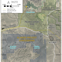
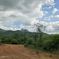
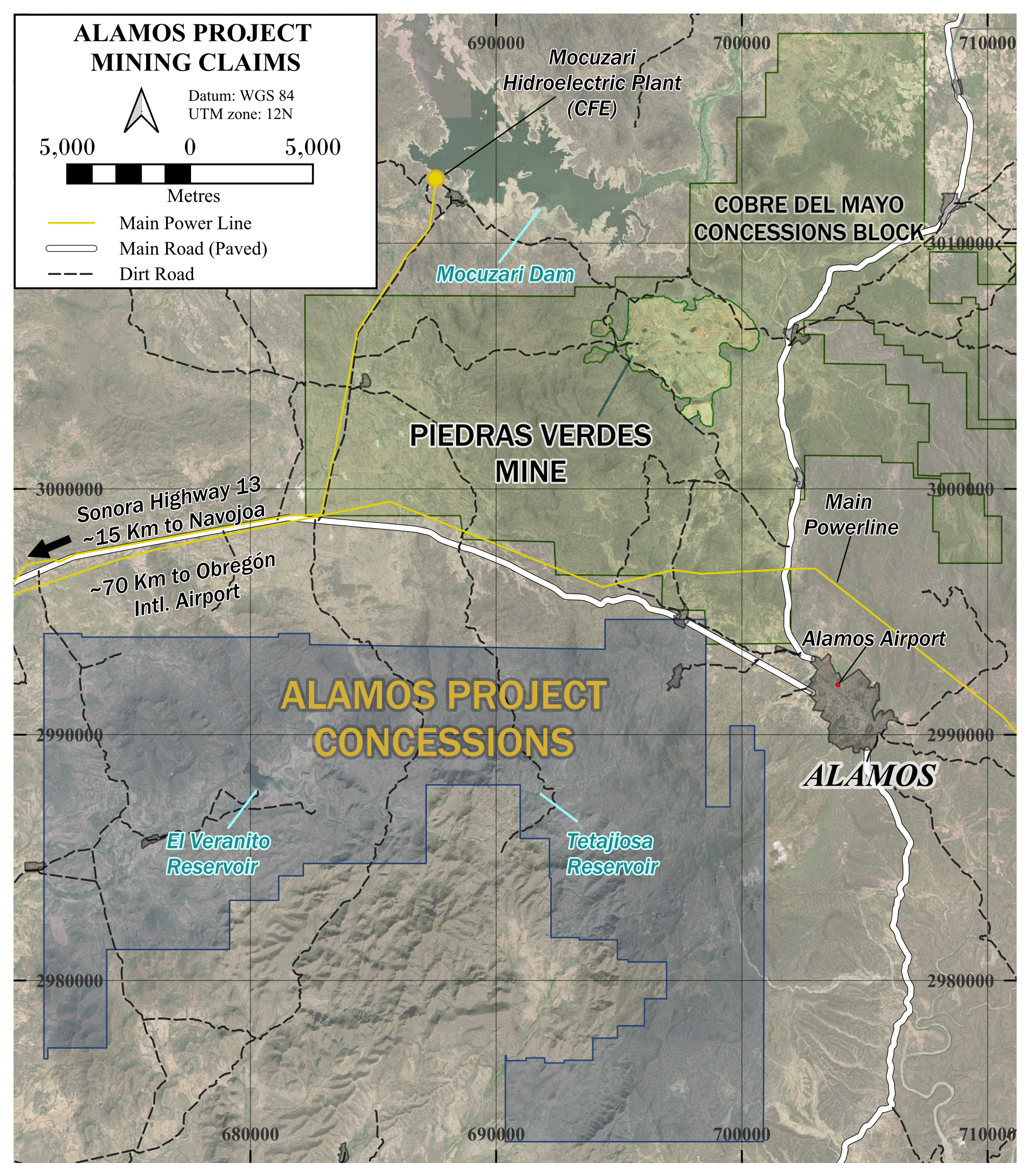
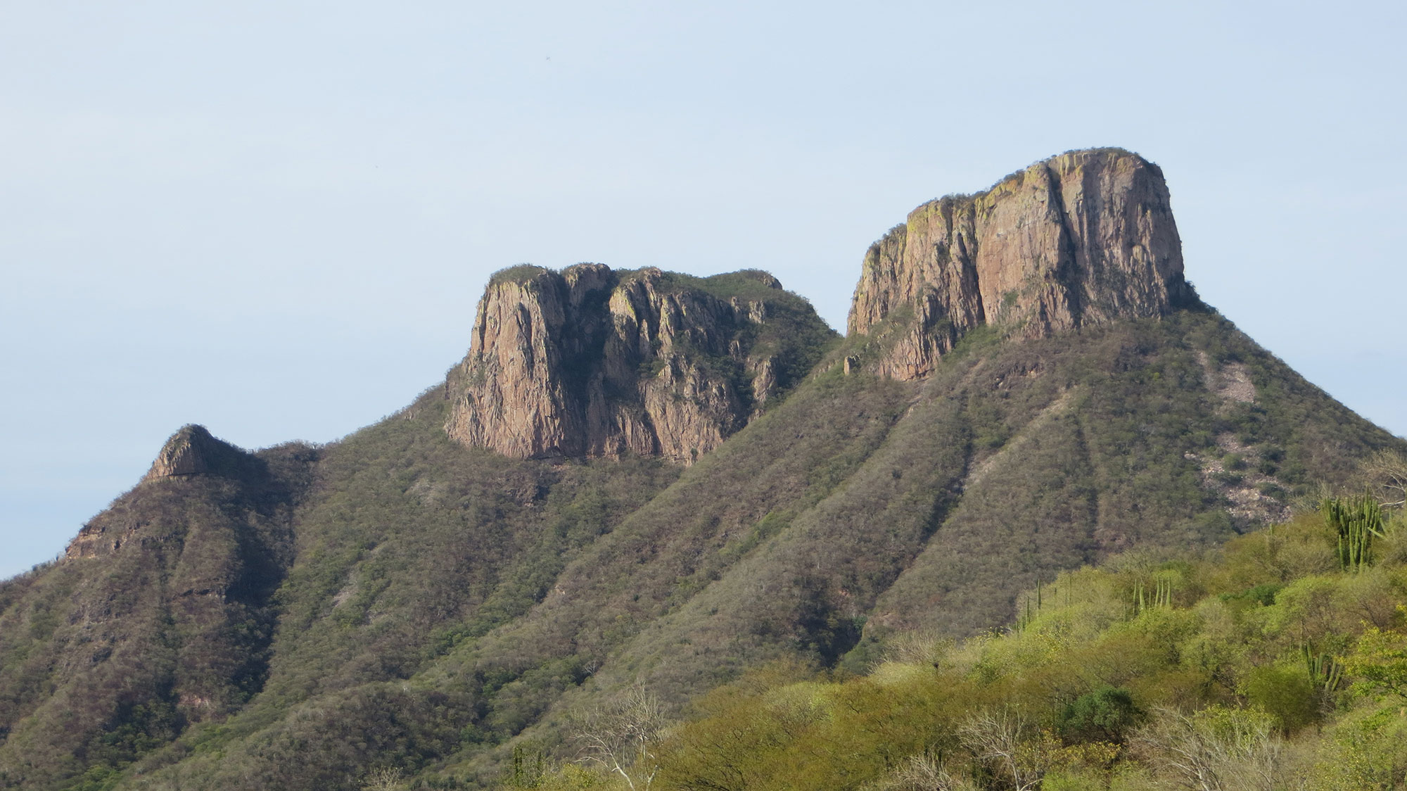
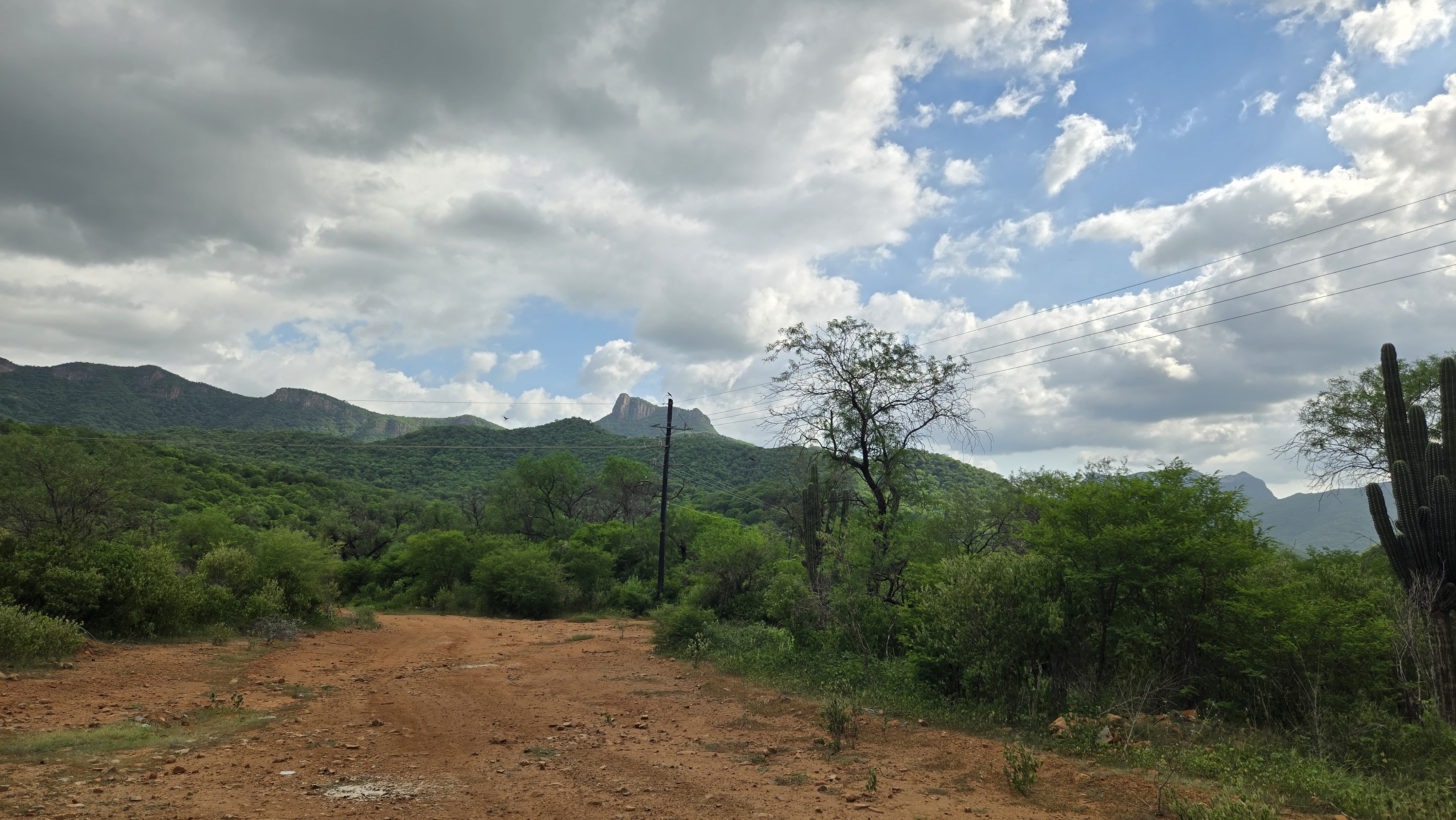
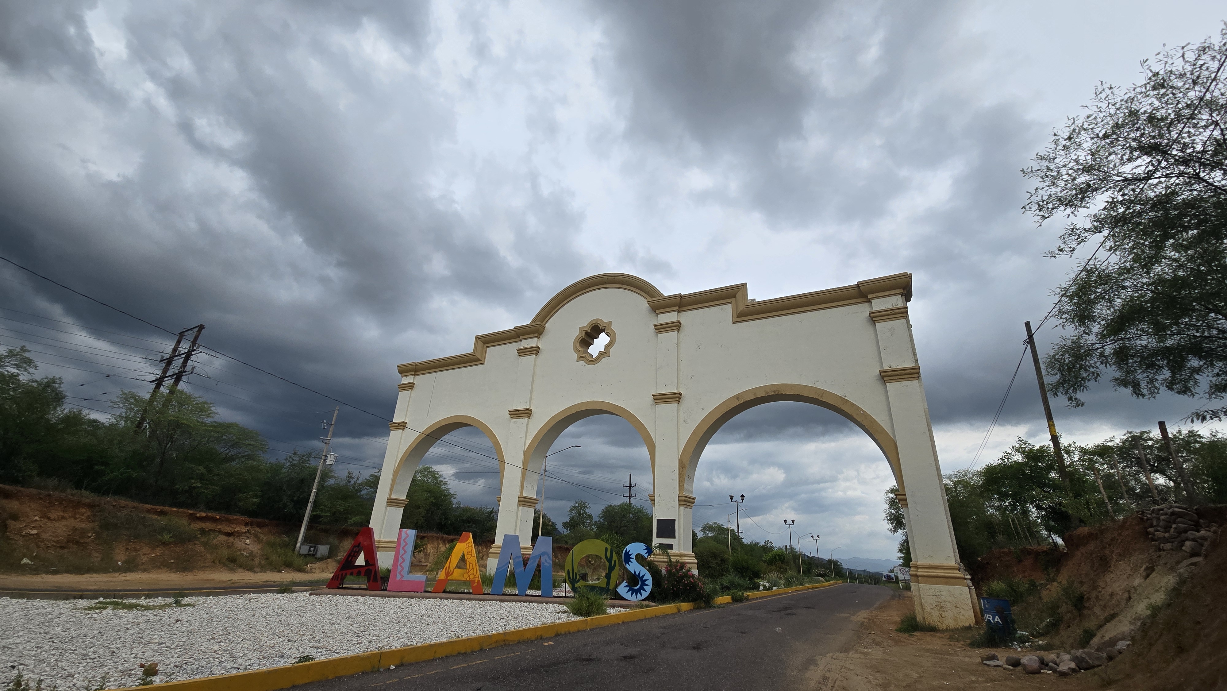
Southern Sonora
Nearest City
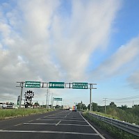
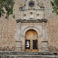
8 km west of city of Alamos
Nearest Major Mining Projects
45 km northwest of Pan American's Alamo Dorado silver mine
15 km south of Cobre Del Mayo's Piedras Verdes copper mine
Drilling
Initial Inferred Resource Estimate: 55 Moz AgEq grading 320 g/t AgEq
Phase II - 50,000 m resource expansion drill program planned for updated resource in second half of 2026
Geology
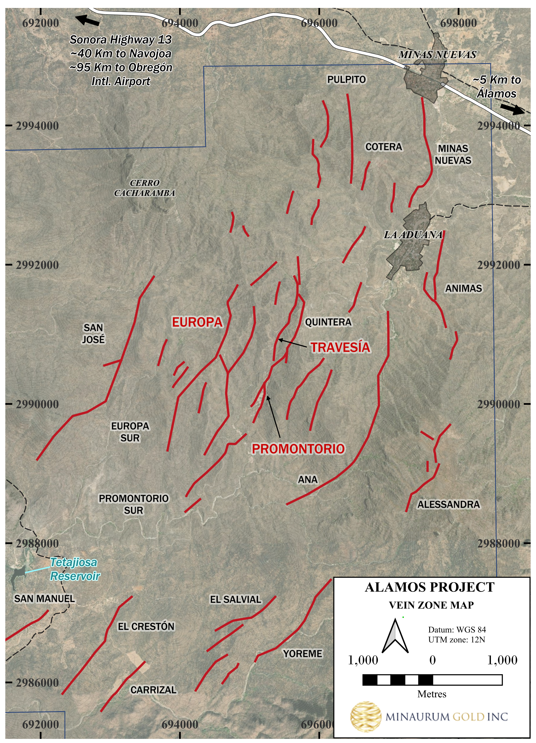
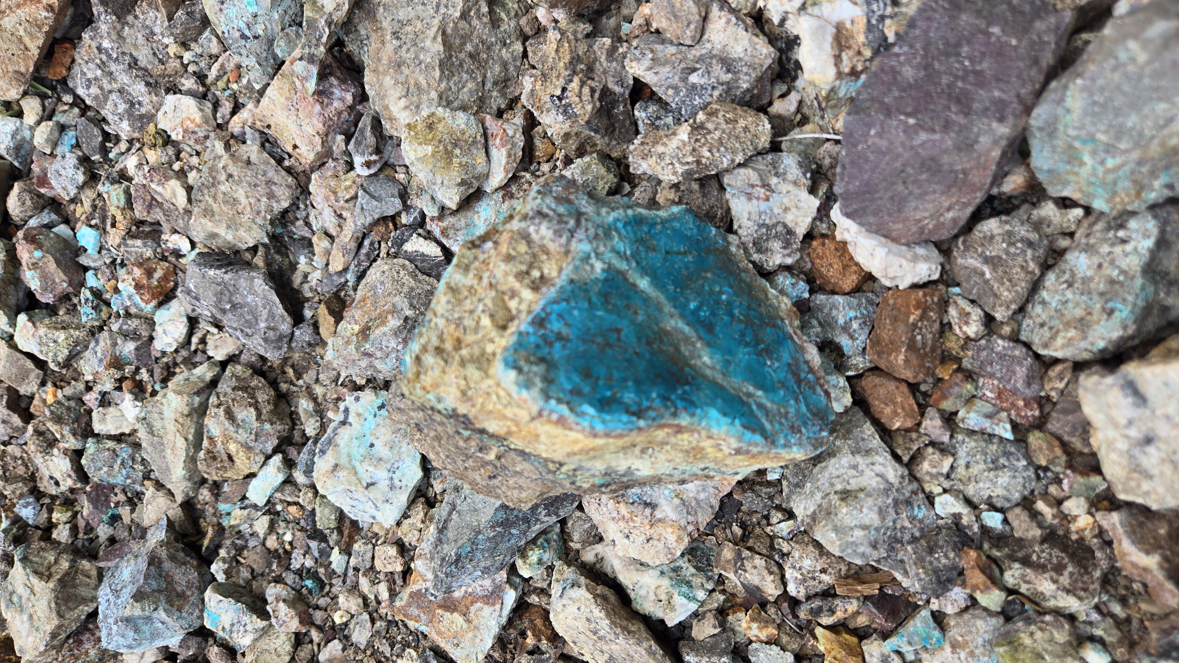
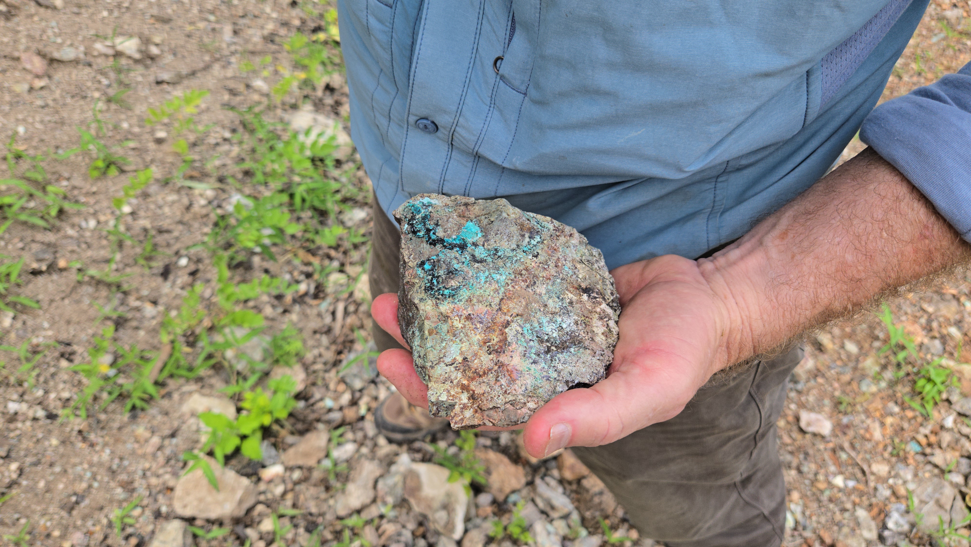
Epithermal vein system
Land Package
37,928 has
Exploration Highlights
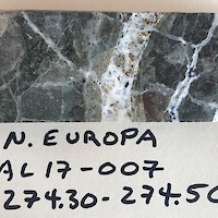
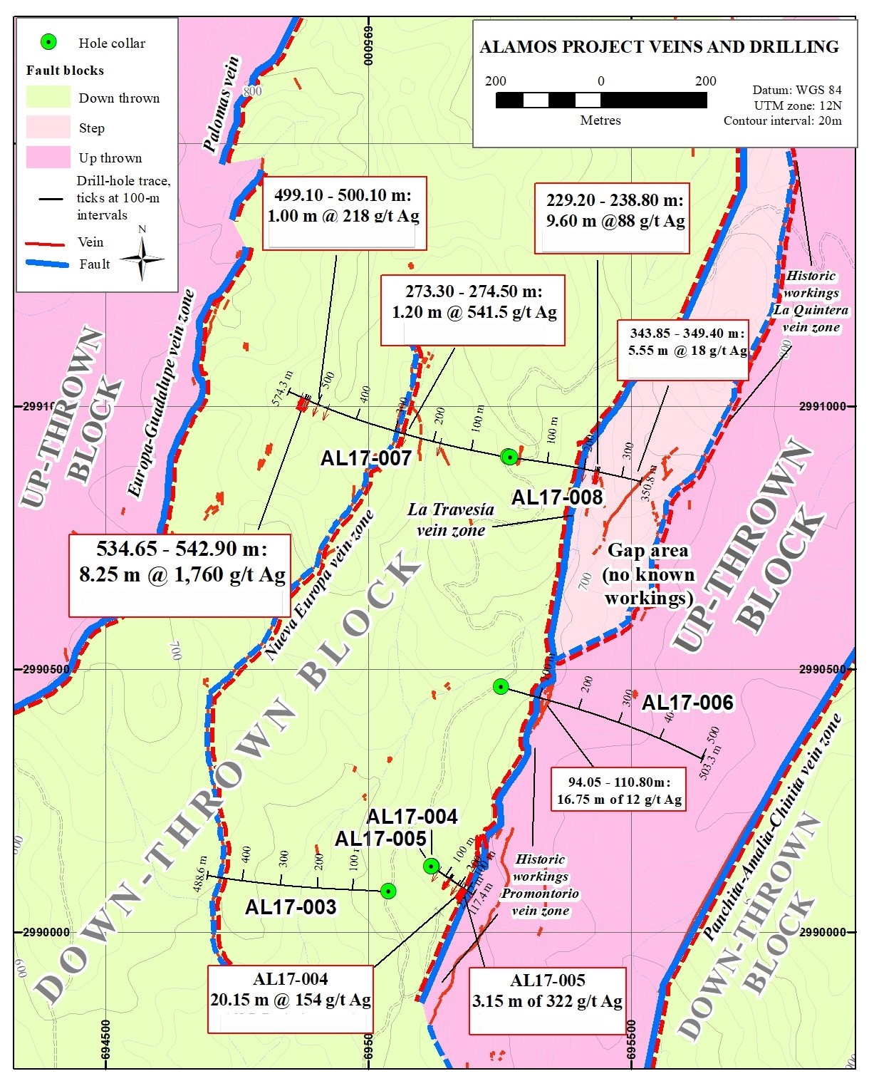
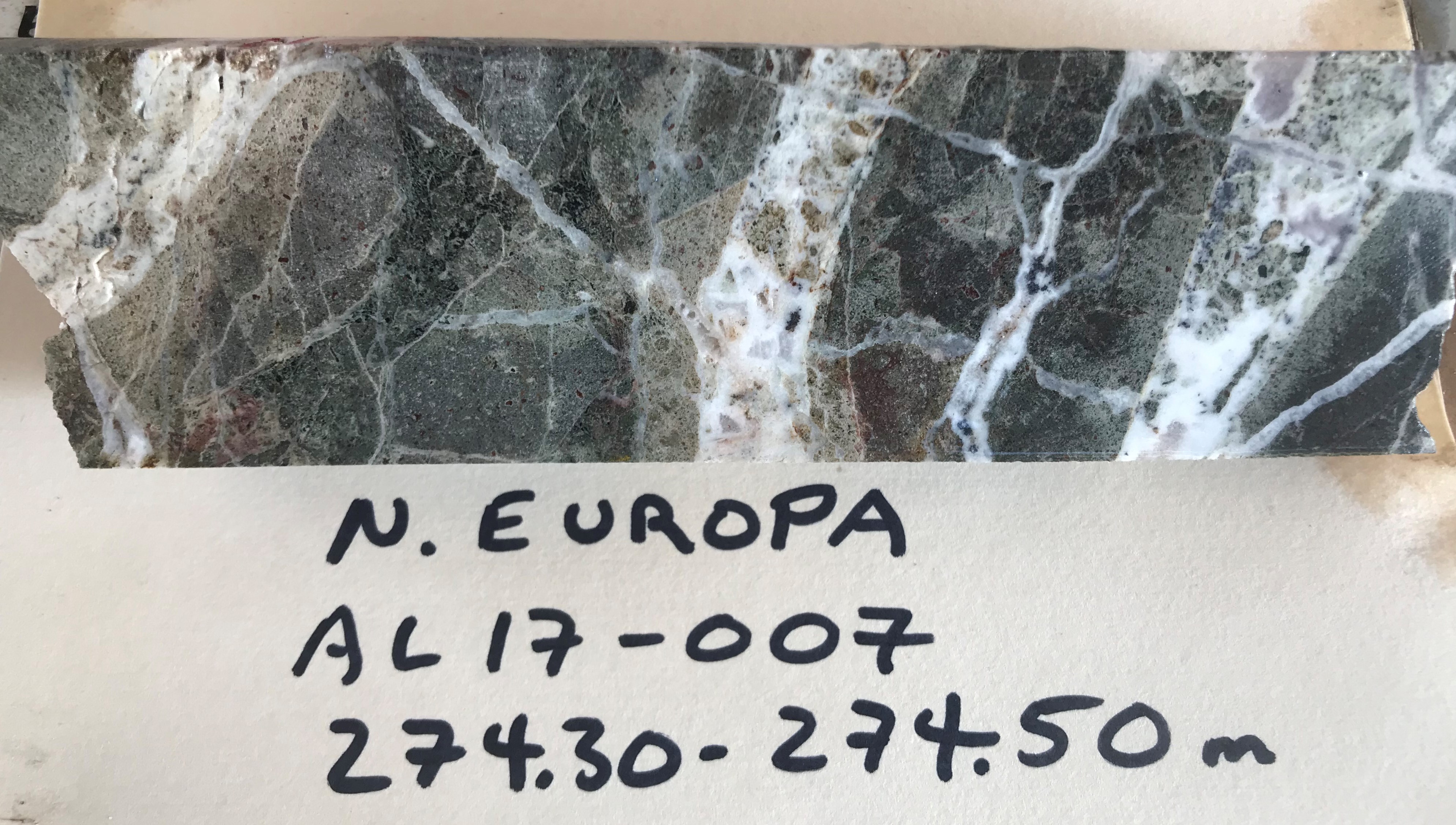
Hole AL 17-007
8.25 m of 1,760 g/t Ag, 1.6% Cu, 1.5% Pb, and 2.6% Zn incl. 2.2 m of 5,098 g/t Ag, 2.76% Cu, 0.5% Pb, and 1.18% Zn
Hole AL 24-117
36.65 m of 328 g/t AgEq, 152 g/t Ag, 0.29 g/t Au, 0.48% Cu, 1.09% Pb, 2.21% Zn incl. 3.85 m of 1,022 g/t AgEq, 409 g/t Ag, 0.82 g/t Au, 1.82% Cu, 2.82% Pb, 8.48% Zn
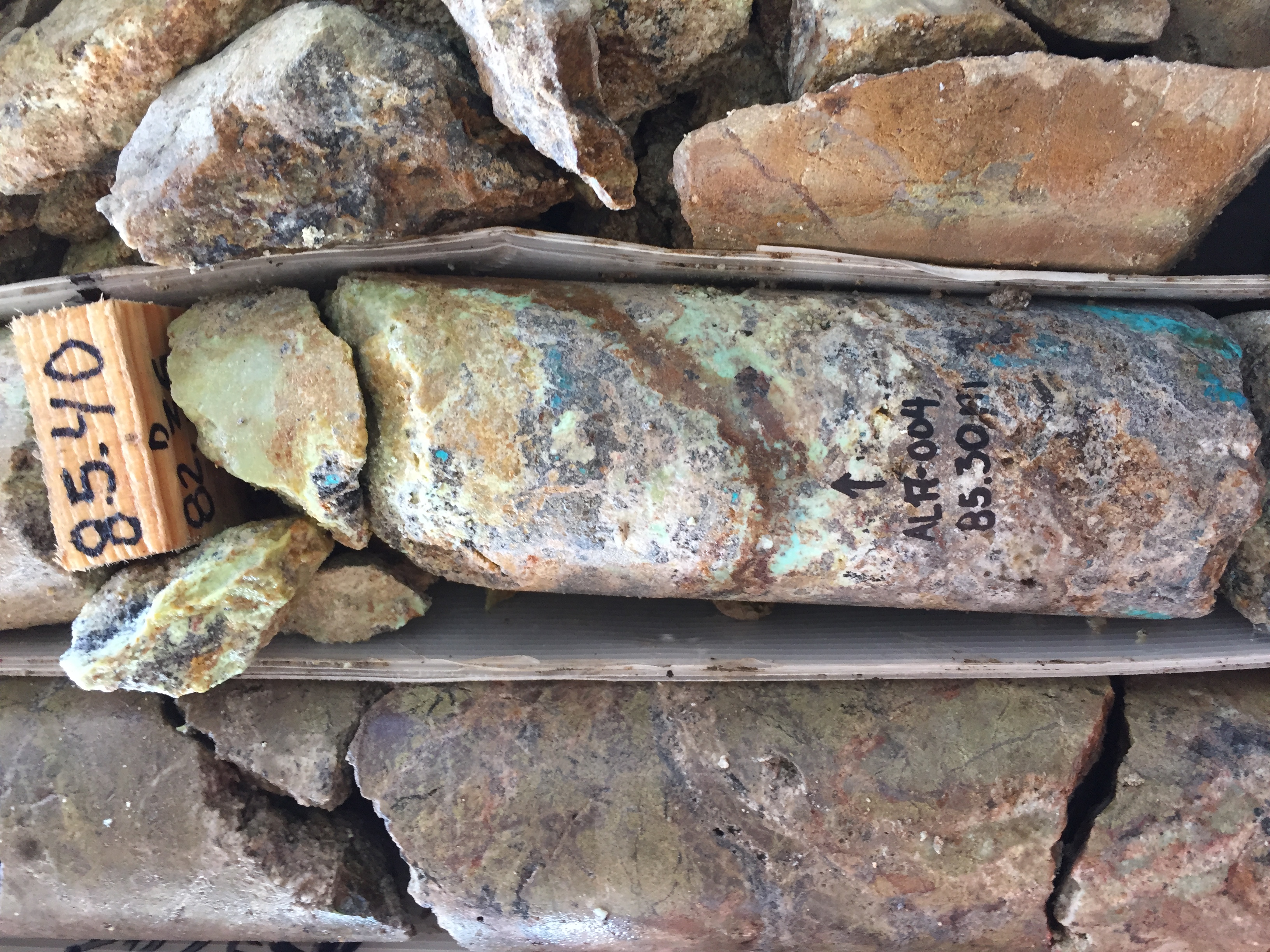
Hole AL 17-004
20.15 m of 154 g/t Ag, 0.5% Cu, 2.3% Pb, 6.8% Zn
Hole AL24-107
5.60 m of 368 g/t AqEq, 200 g/t Ag, 0.48 g/t Au, 0.35% Cu, 1.46% Pb, 1.64% Zn
Hole AL24-111
3.00 m of 4,173 g/t AgEq, 3,152 g/t Ag, 3.78 gt Au, 1.11% Cu, 9.02% Pb, 10.62% Zn incl. 1.55 m of 7,780 g/t AgEq, 6,020 g/t Ag, 7.17 g/t Au, 1.84% Cu, 16.28% Pb, 16.36% Zn
which includes 0.50 m of 13,955 g/t AgEq
Hole AL 20-042
3.50 m of 404 g/t Ag, 0.54% Cu, 1.30% Pb, 1.81% Zn incl. 1.15 m of 999 g/t Ag, 1.29% Cu, 2.98% Pb, 2.98% Zn
Hole AL 20-046
5.10 m of 769 g/t Ag, 0.76% Cu incl. 3.10 m of 1,197 g/t Ag, 1.04% Cu
Hole AL 20-047
6.35 m of 356 g/t Ag, 0.39% Cu, 0.42% Pb, 0.57% Zn incl. 0.70 m of 2090 g/t Ag, 1.98% Cu, 2.51% Pb, 2.43% Zn
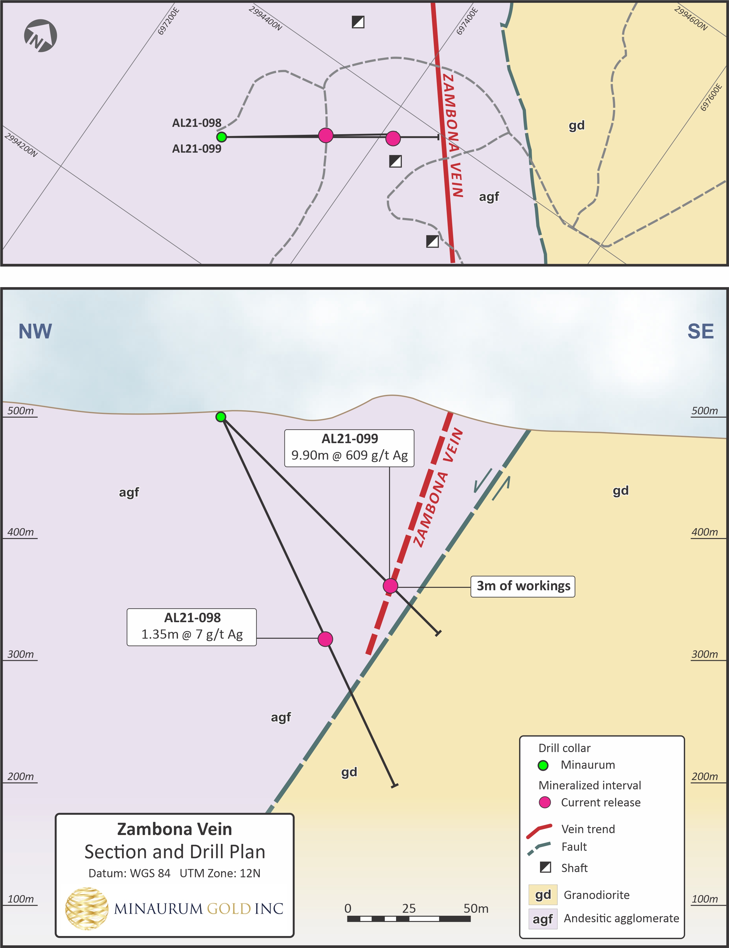
Hole AL21-099
9.90 m @ 609 g/t Ag; incl. 0.90 m @ 1,145 g/t Ag, 0.50 m @ 2,260 g/t Ag, and 0.50 m @ 2,360 g/t Ag
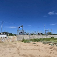
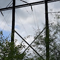
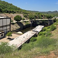
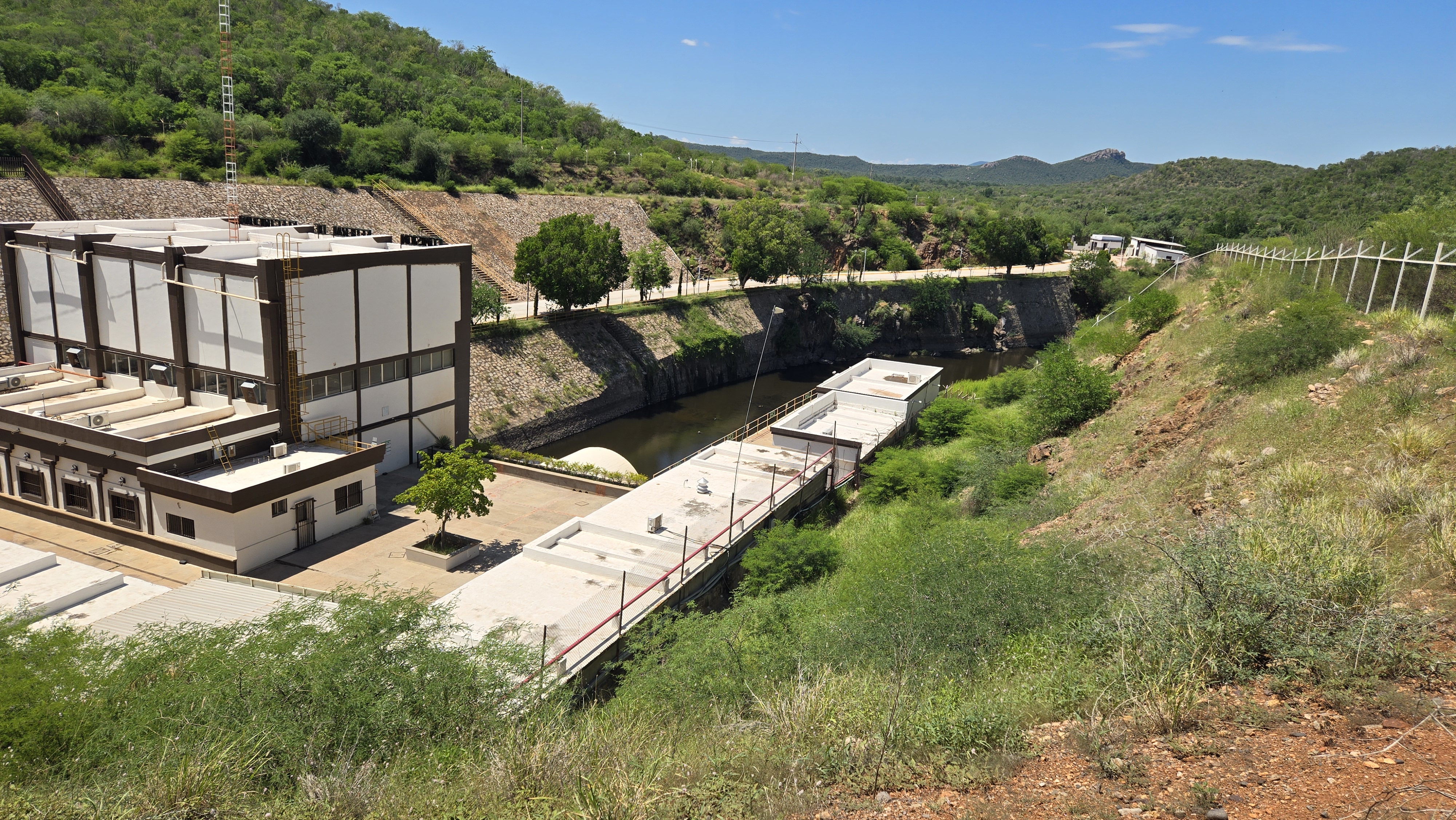
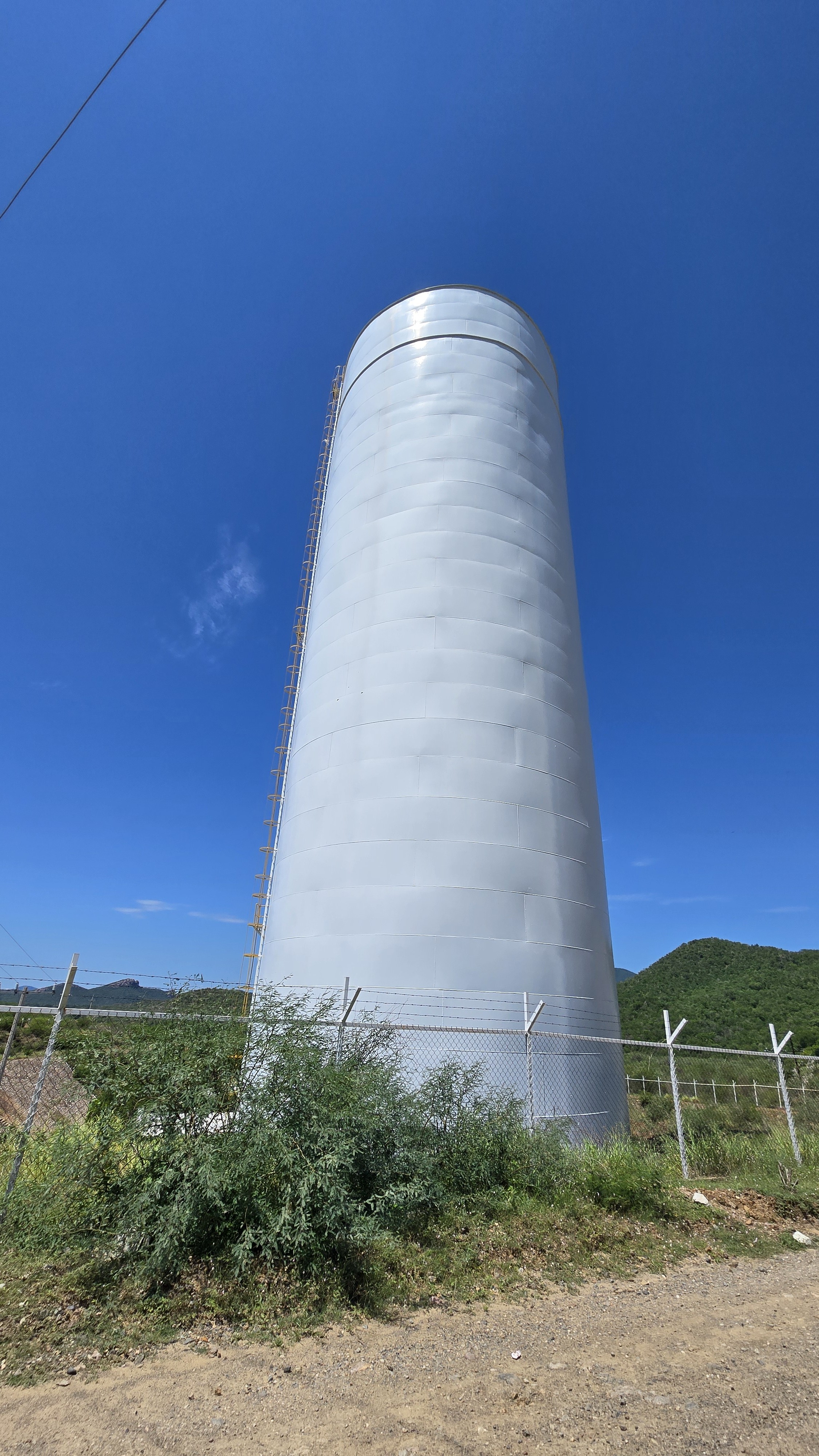
Access & Infrastructure
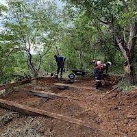
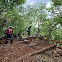
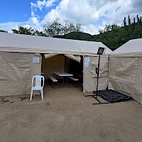
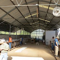
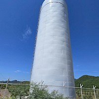
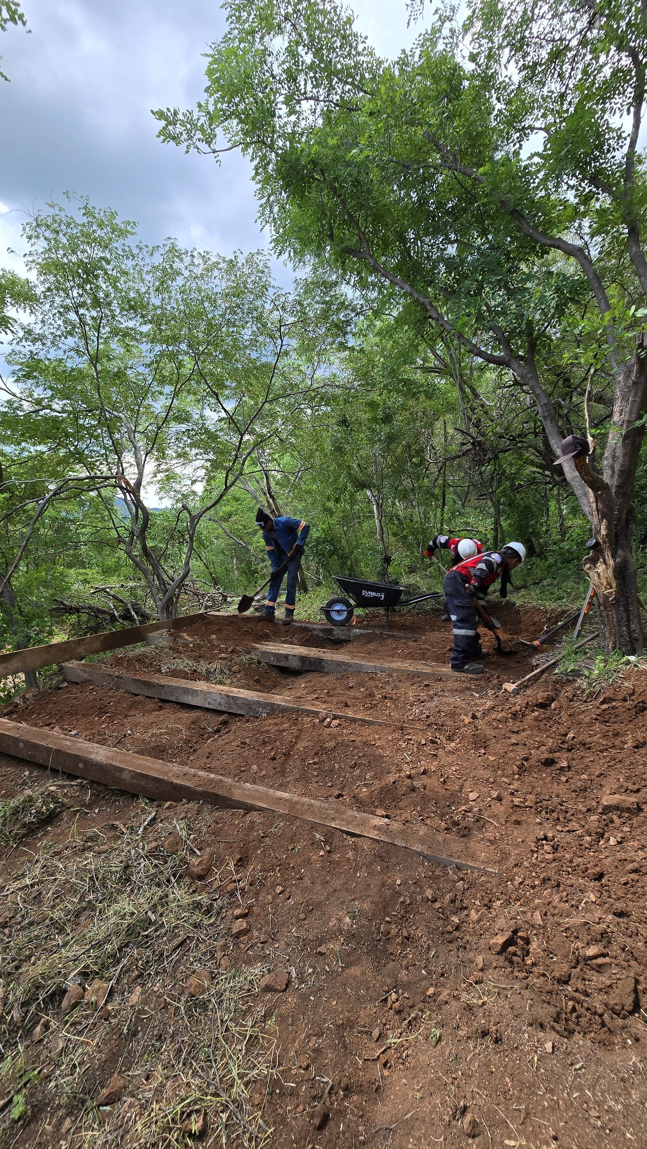
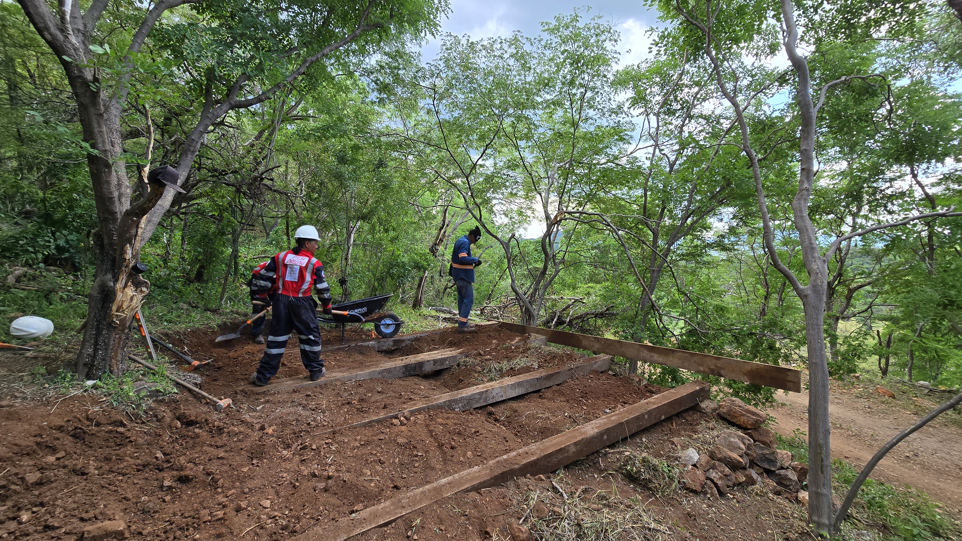
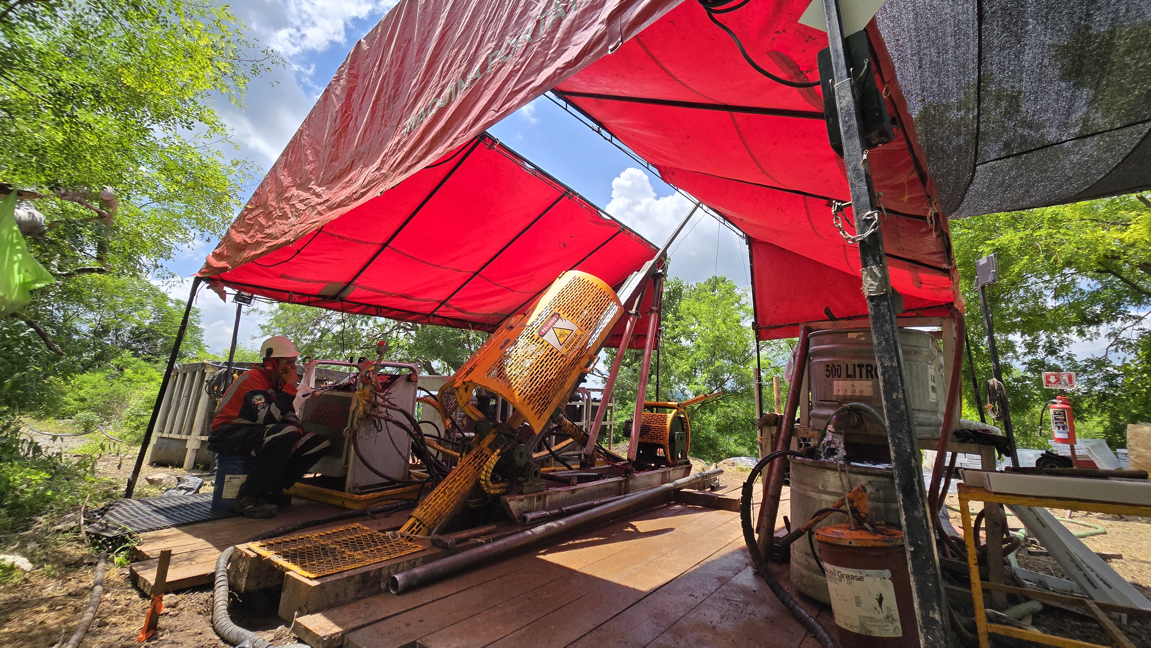
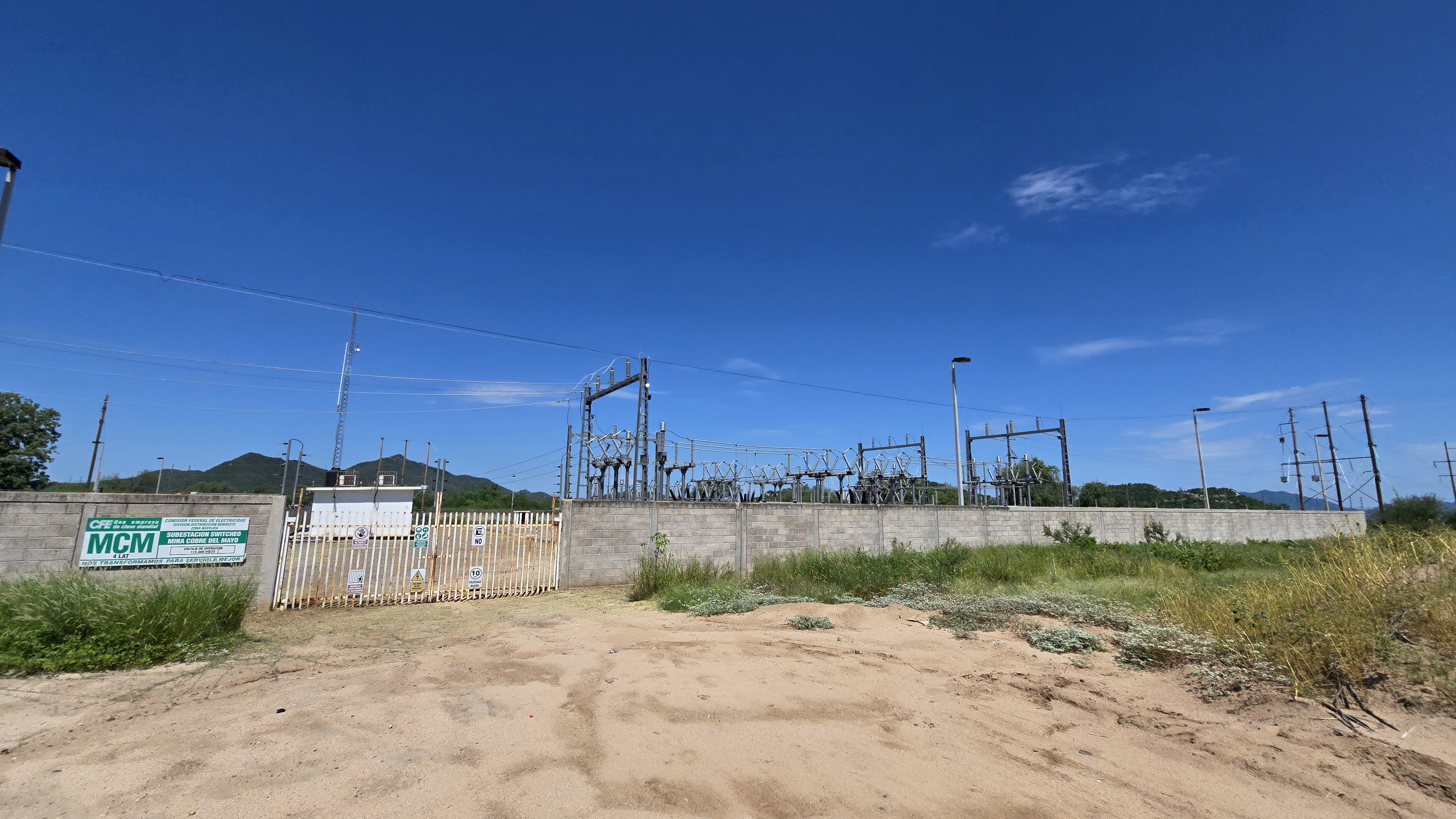
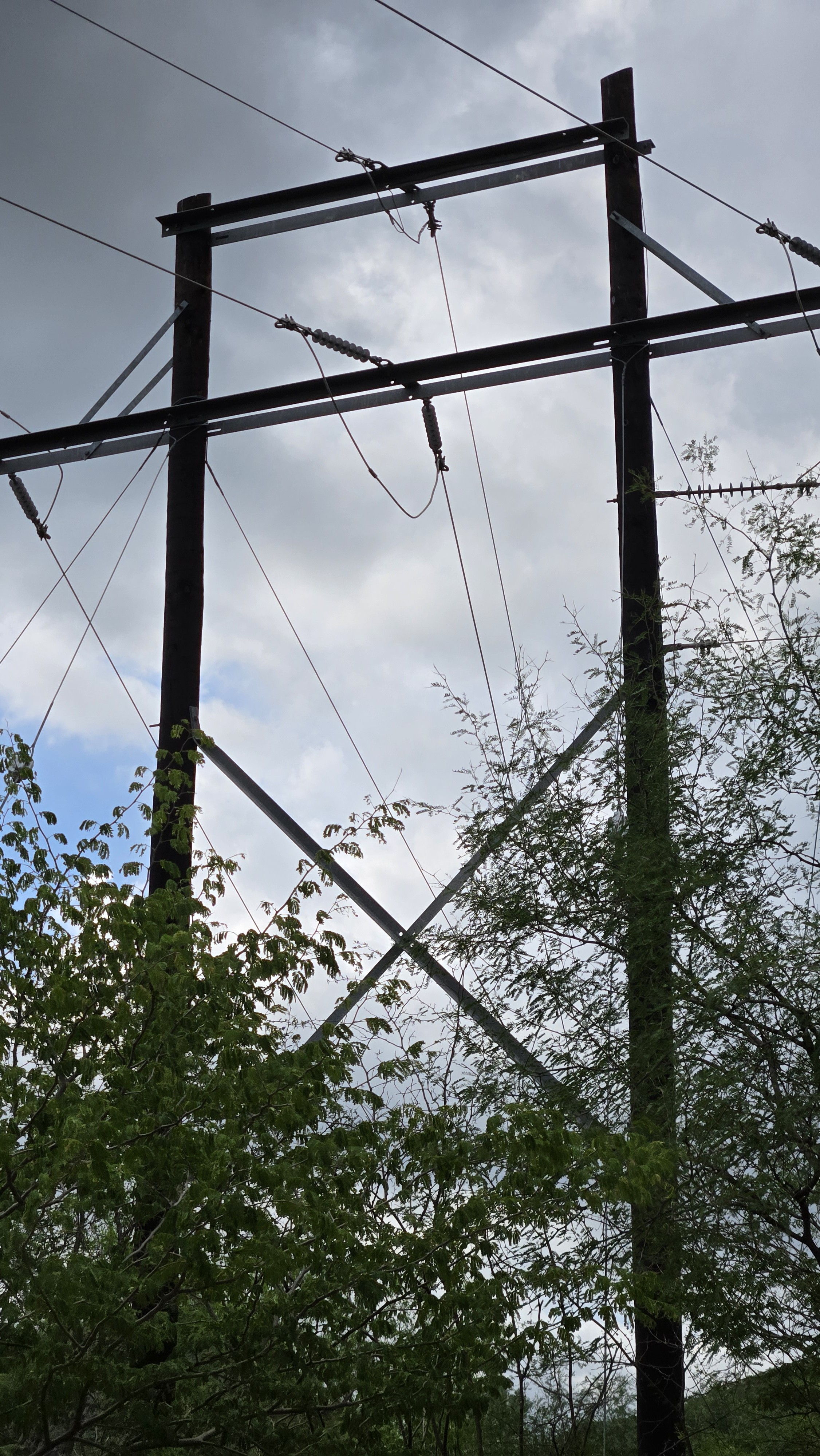
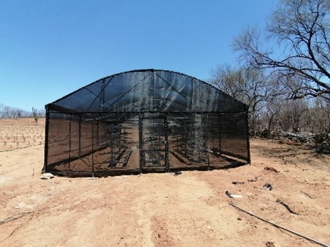
Paved and gravel roads, mining labour force, power and water. Permitted through to construction allowing surface exploration and mining production activities.
Project Interest
100% Owned
Project
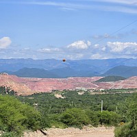
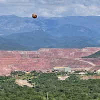
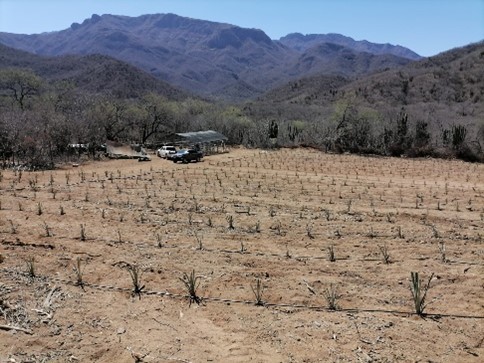
The 100% owned Alamos silver project has a unique advantage as the only recent permitted silver discovery in Mexico an Environmental Impact Statement ("MIA”) for the development allowing for surface exploration and mining production activities, including the construction of drill pads, clean-up of preexisting roads, and the rehabilitation and reactivation of historical underground mine workings. Alamos hosts excellent infrastructure with the central area (Quintera-Promontorio vein zones) permitted from exploration through to production. The project lies 8 km west of the city of Alamos, 45km northwest of Pan American's Alamo Dorado silver mine, and 15 km south of Cobre Del Mayo's Piedras Verdes copper mine. The project is 37,928 hectares.
Alamos hosts an initial inferred resource estimate of 55 million ounces silver equivalent grading 320 g/t silver equivalent (see Minaurum news release dated January 28, 2026 and Resource section above).
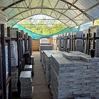
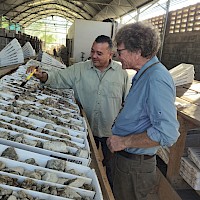
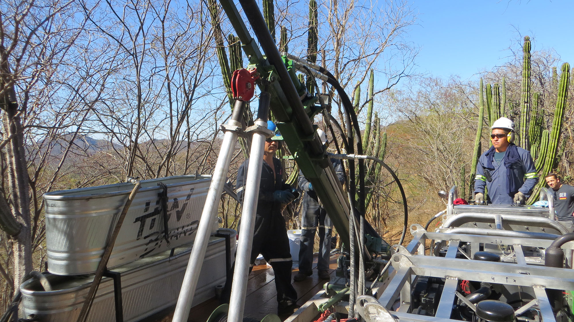
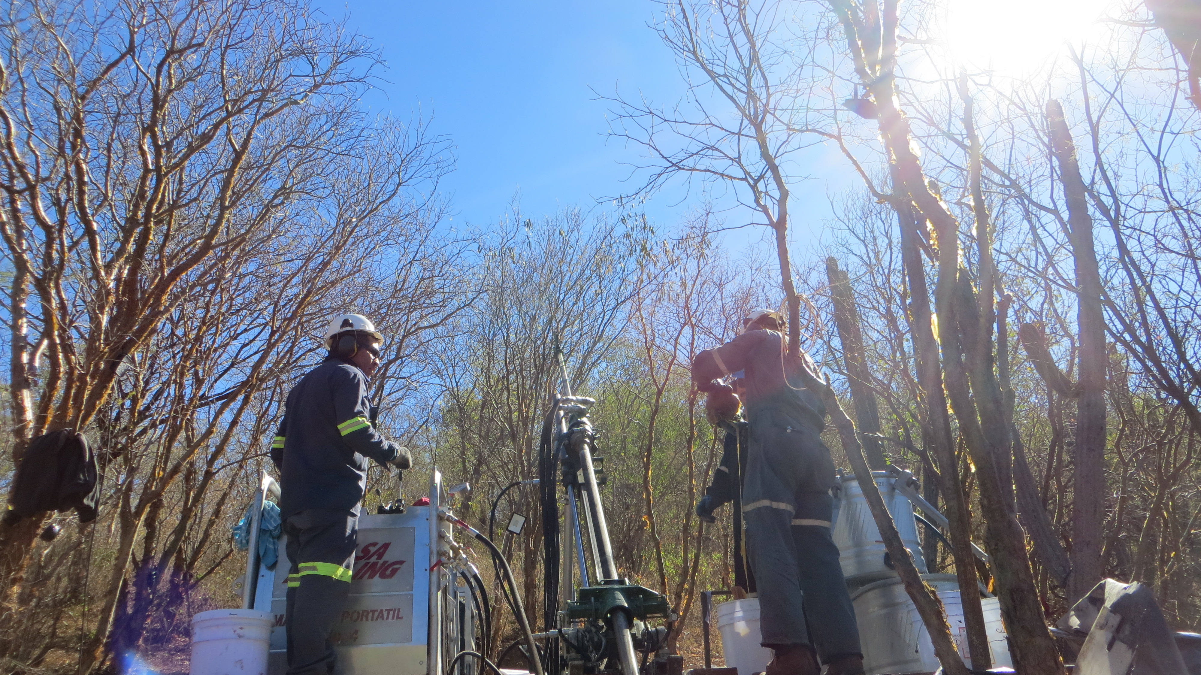
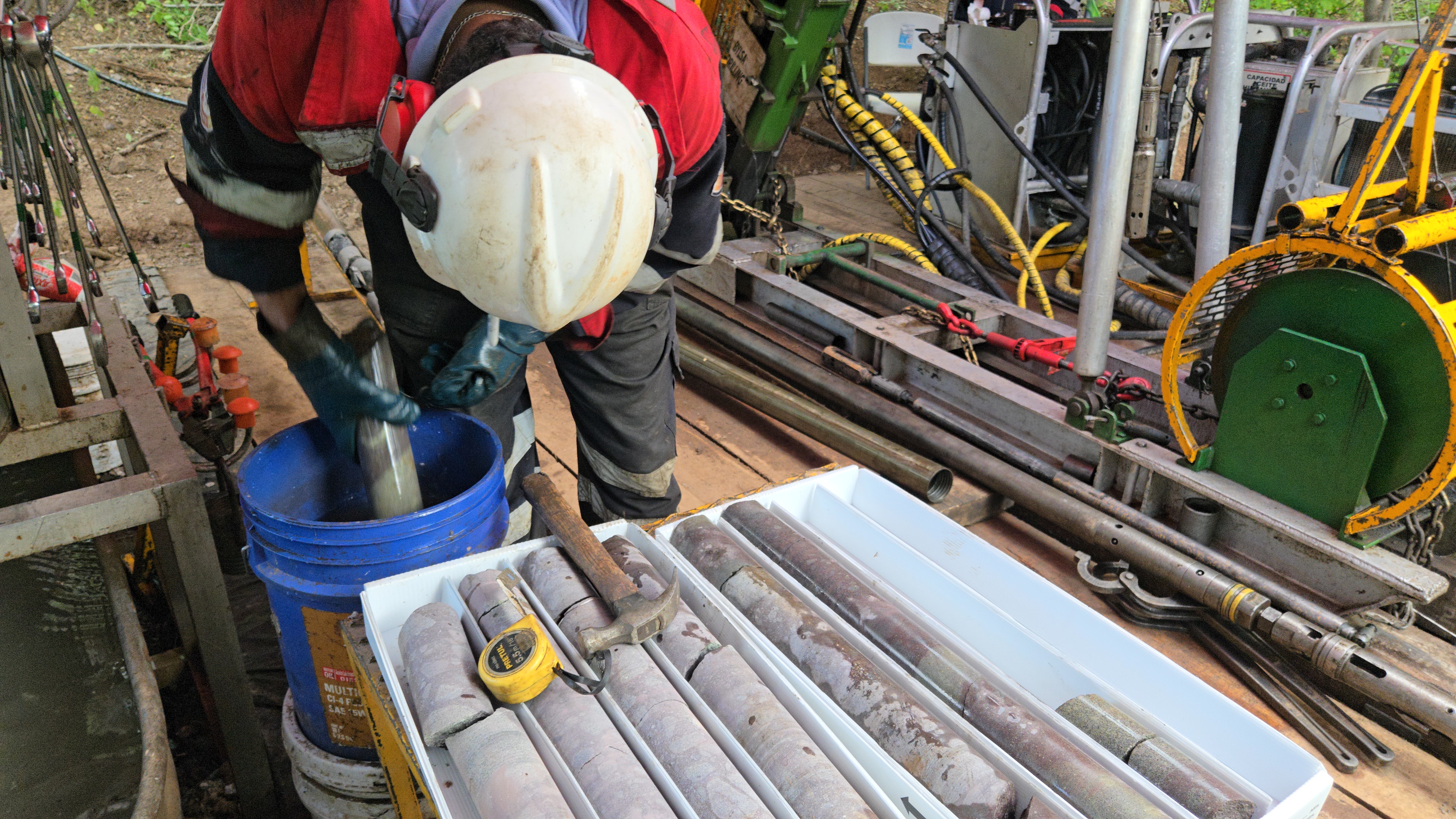
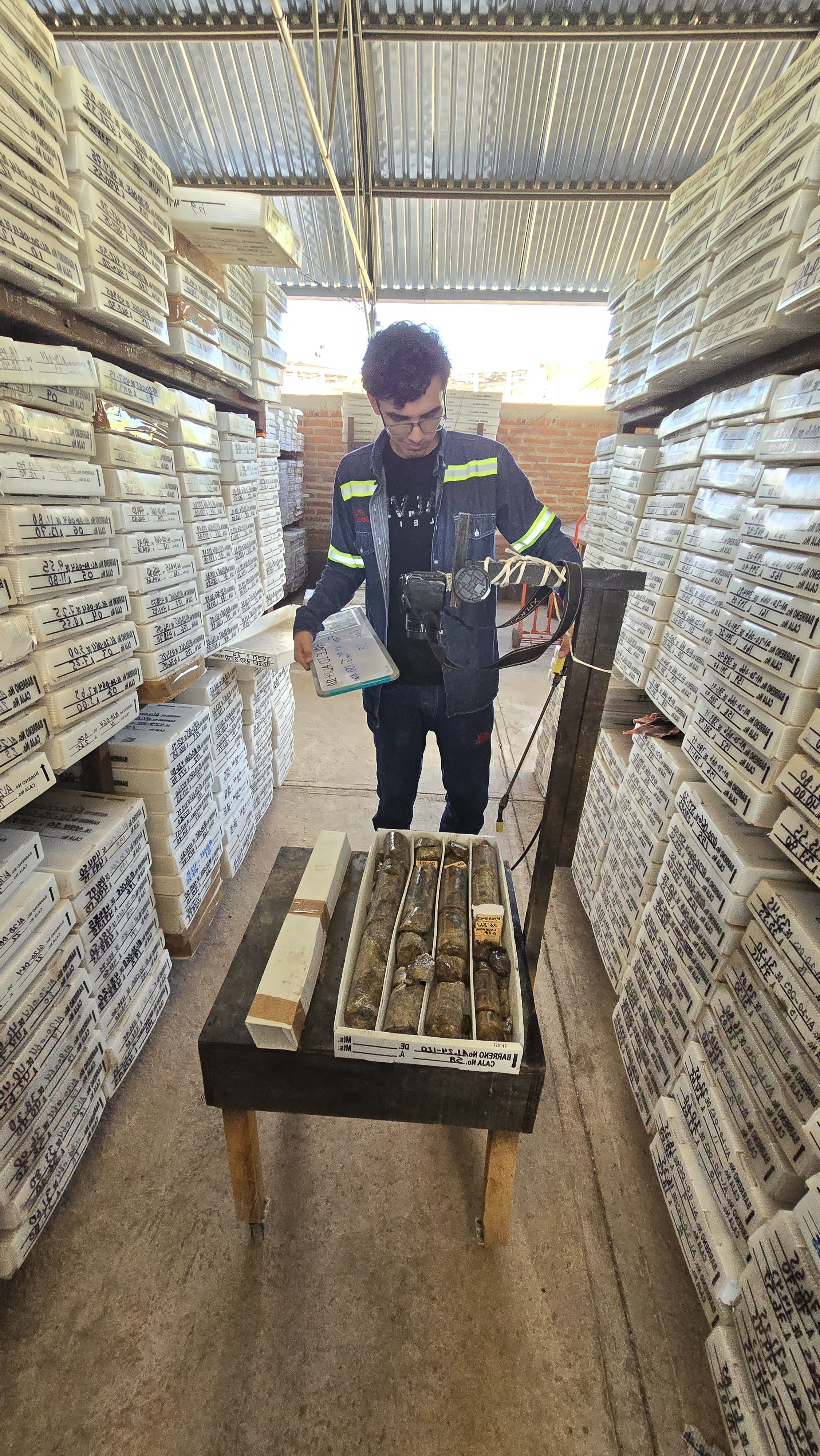
Minaurum has drilled 149 diamond core holes totaling 55,000 m on 19 of the 26 vein zones discovered at the Alamos silver project from 2017 - 2025.
A Phase II - 50,000 m resource expansion drill program is currently underway and targeting an updated resource in second half of 2026.
Opportunity
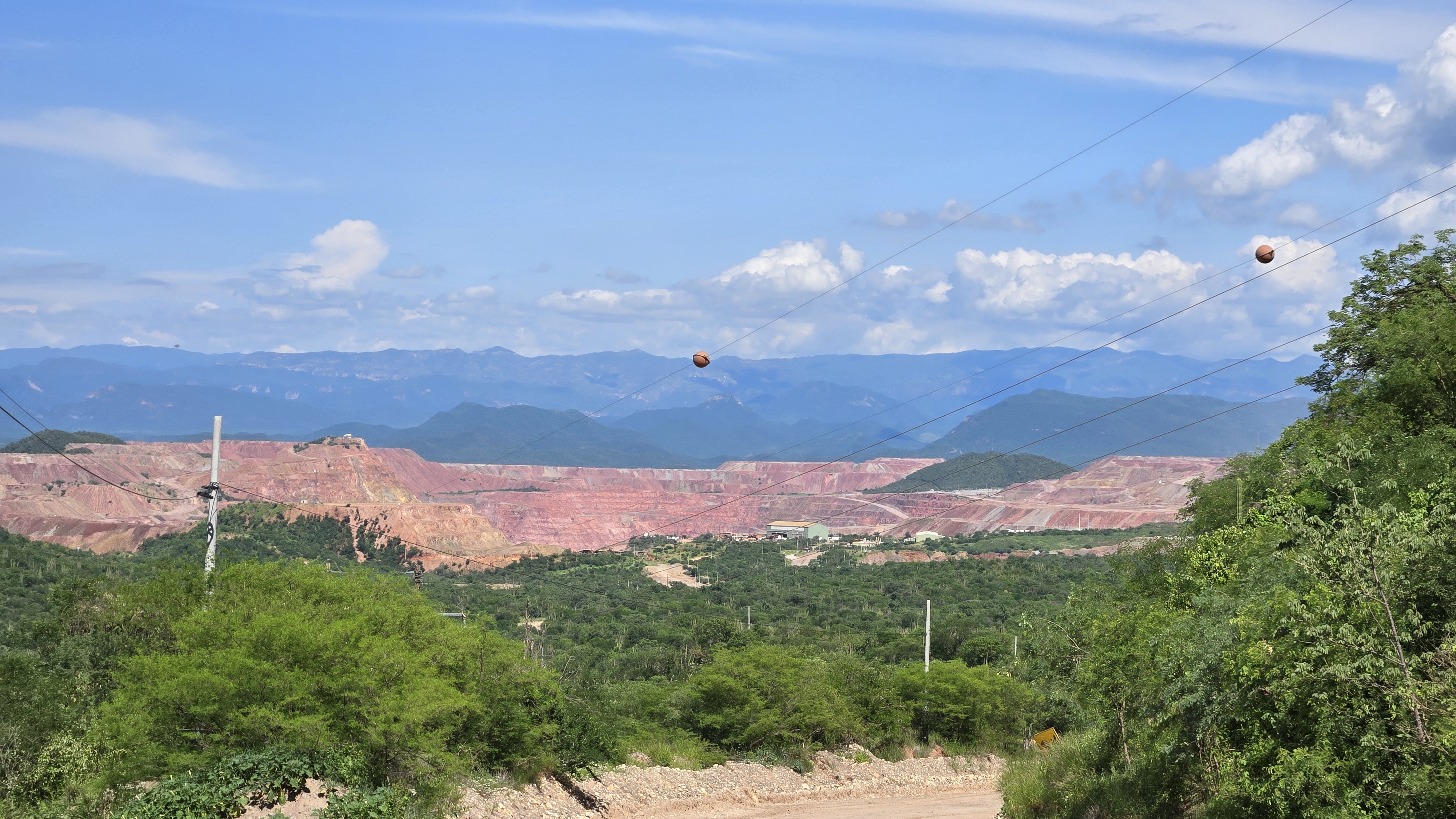
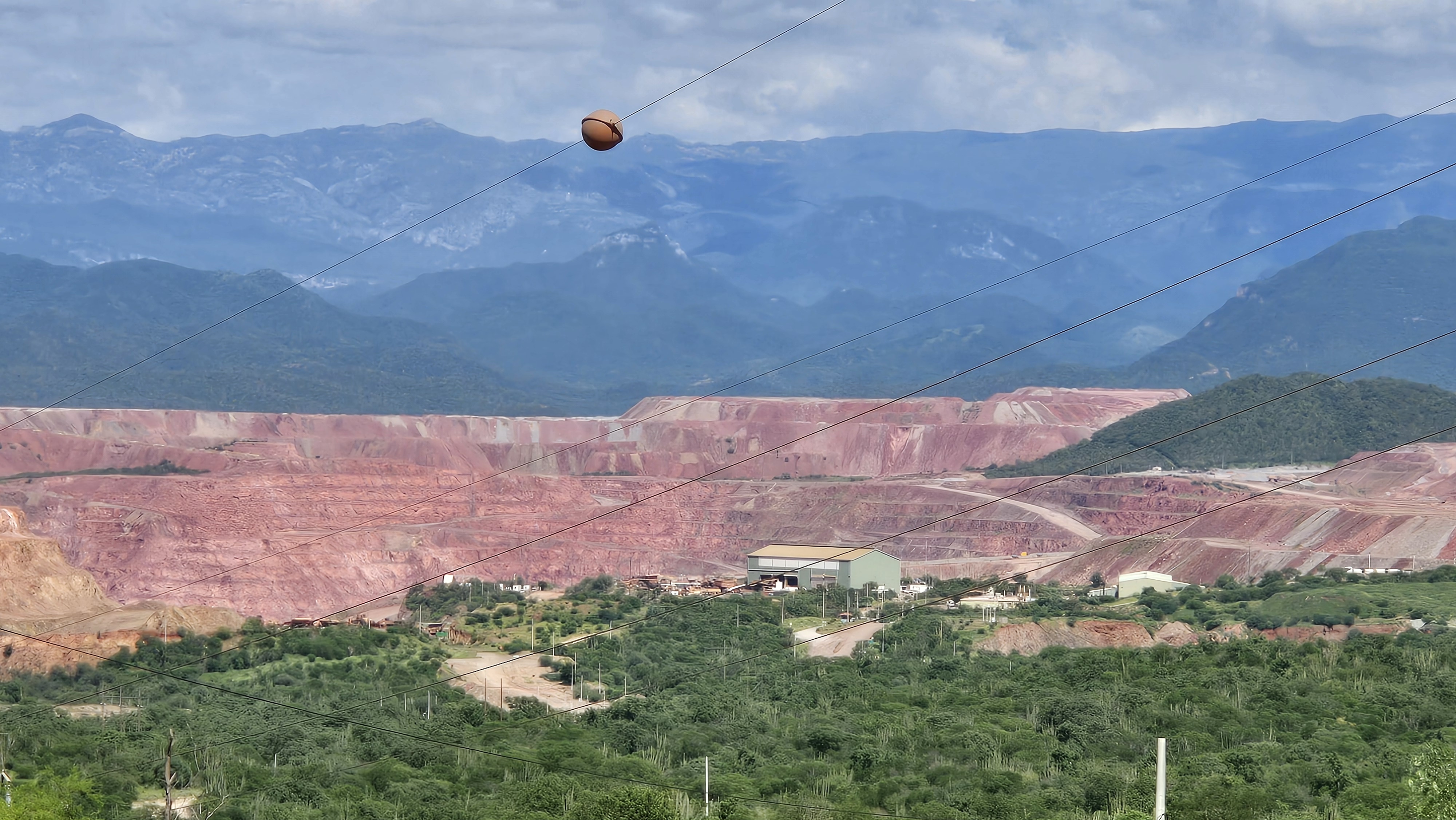
The 100% owned Alamos Silver Project controlling over 37,000 hectares is located in Sonora, Mexico and presents a unique opportunity in that it is permitted for production with an initial inferred resource estimate of 55 million ounces AgEq grading 320 g/t AgEq (see Minaurum news release dated January 28, 2026 and Resource section above). Cobre del Mayo’s Piedras Verdes porphyry copper mine lies about 16 km to the NNE of the central part of the Alamos district, along the projection of the main fault trend.
The project is permitted for production with an Environmental Impact Statement ("MIA”) permit granted by the Mexican Federal Environmental Authority ("SEMARNAT"). The permit allows for surface exploration and mining production activities, including the construction of drill pads, clean-up of preexisting roads, and the rehabilitation and reactivation of historical underground mine workings. Please see news release dated June, 26, 2023. Alamos’ mining permit was granted on December 13, 2013 and is valid for a period of 30 years starting on the date of the notice of commencement of Minaurum’s exploration activities to SEMARNAT, the National Commission for Protection of Natural Areas (CONANP), and the Federal Attorney for Environmental Protection (PROFEPA), which occurred on October 18, 2016.
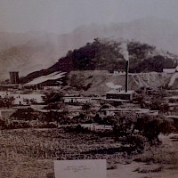
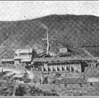
Geology & History
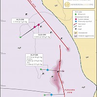
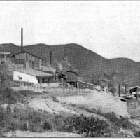
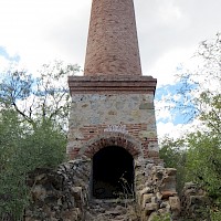
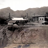
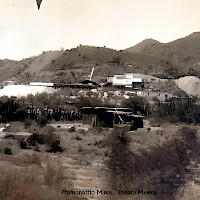
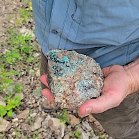
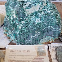
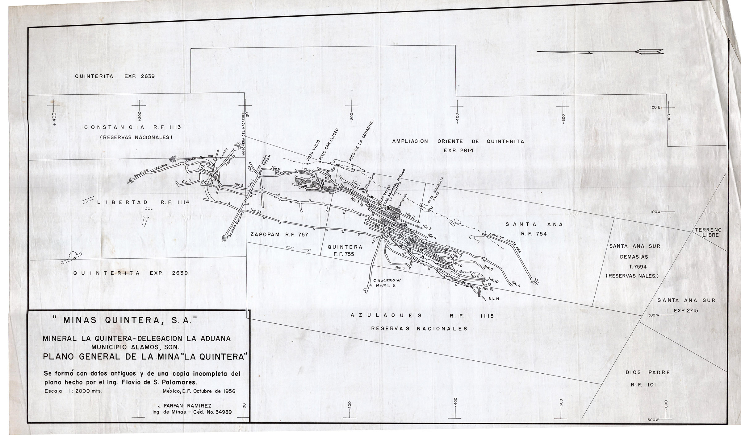
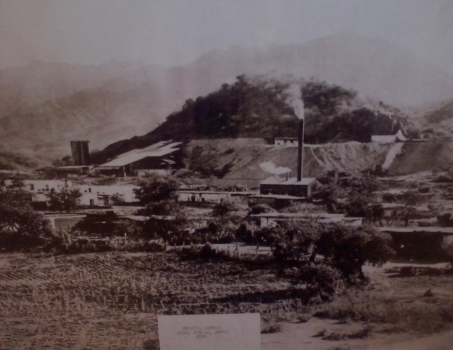
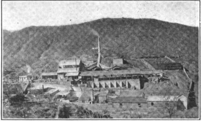
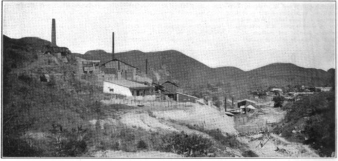
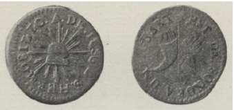
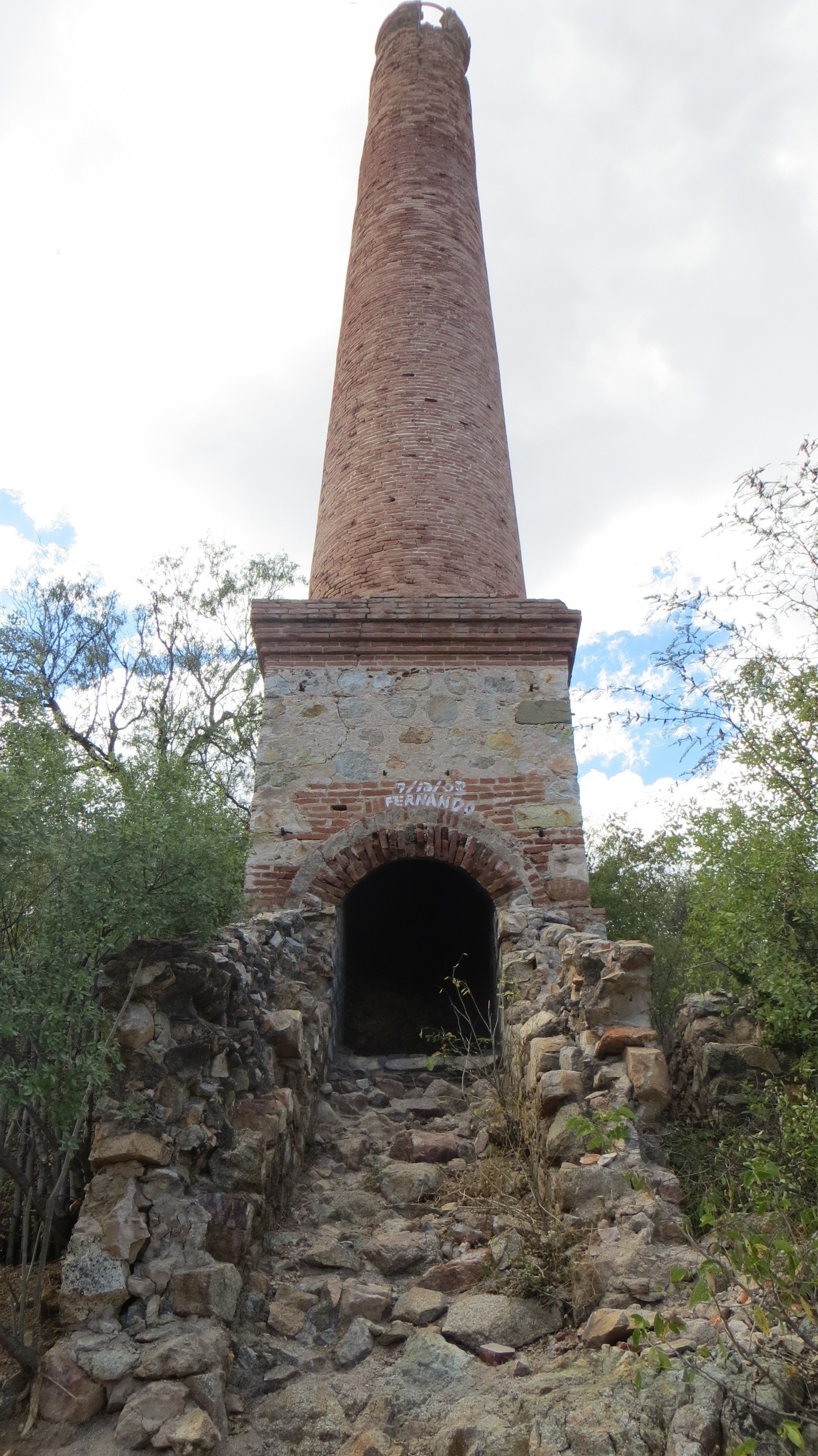
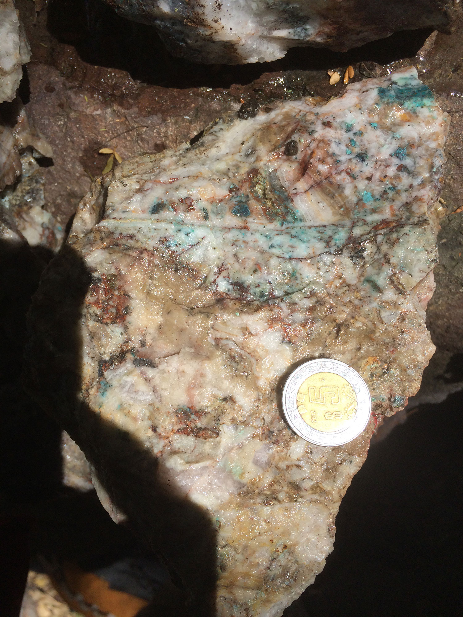
It contains a wide, high-grade epithermal vein system that produced approximately 200 Moz of silver from the time of the first Spanish discovery around 1682 to the 1910-1920 Mexican Revolution from three separate mines. Historical reports indicate mine widths of up to 20m grading in excess of 2,000 g/t silver and 3-4% copper. In the latter part of the 19th century, silver production from the district supported a mint in the nearby town of Alamos. Mining activities diminished just before and during the 1910-1920 Mexican Revolution, with the Zambona mine shutting down by 1925. Various operators attempted to revive the mines during the 20th century, but with only minor production, mostly from the re-working of mine dumps (see 43-101 Technical Report titled Alamos Project - June 8, 2021 on SEDAR).
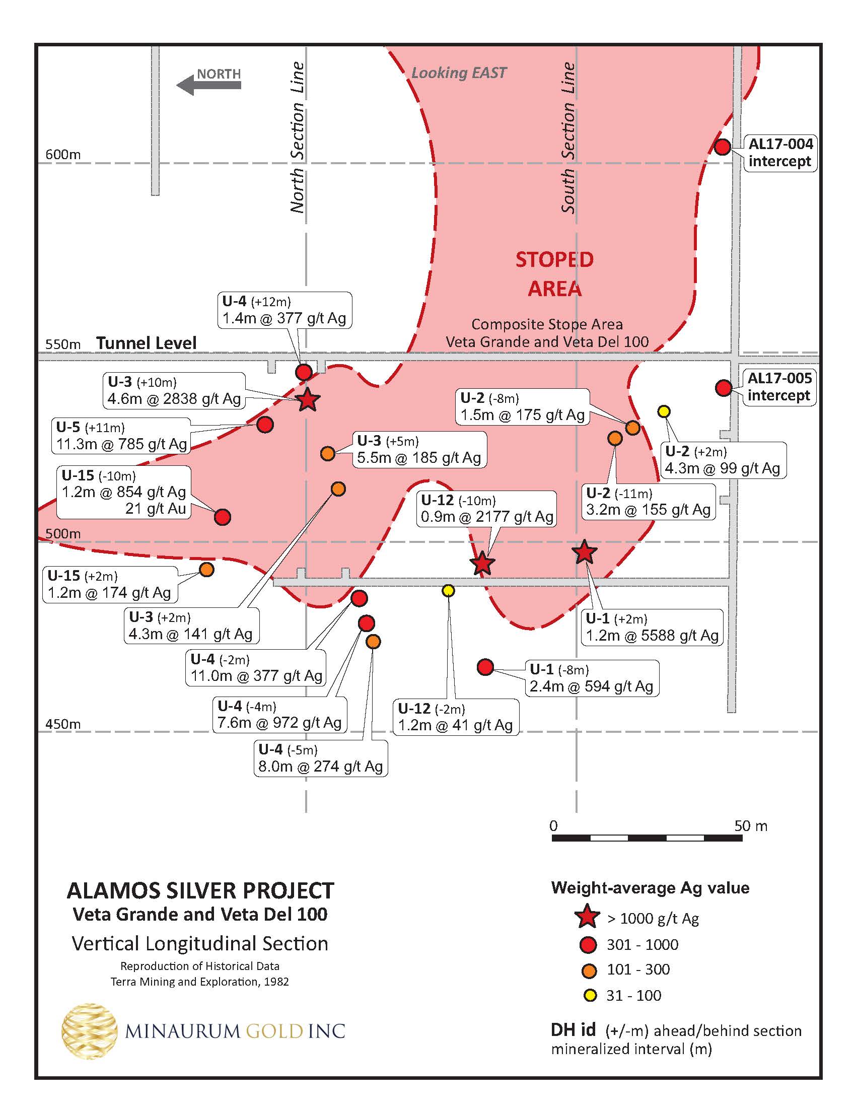
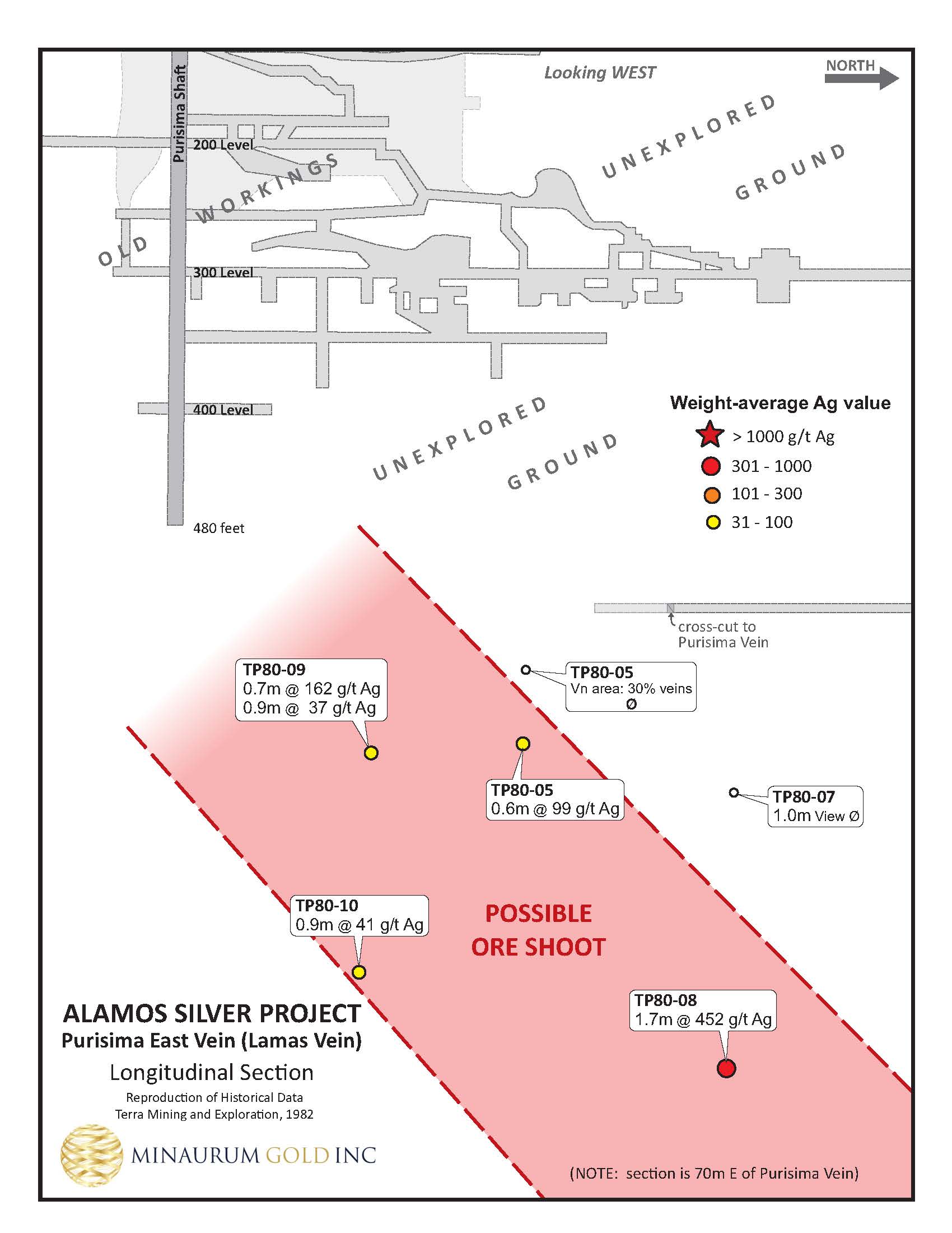
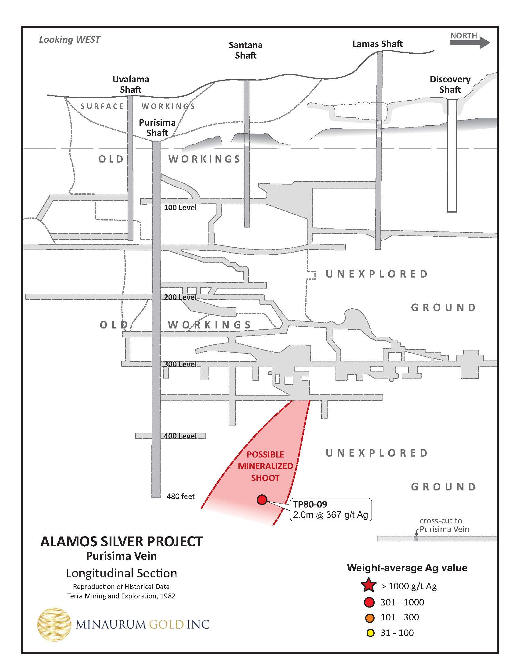
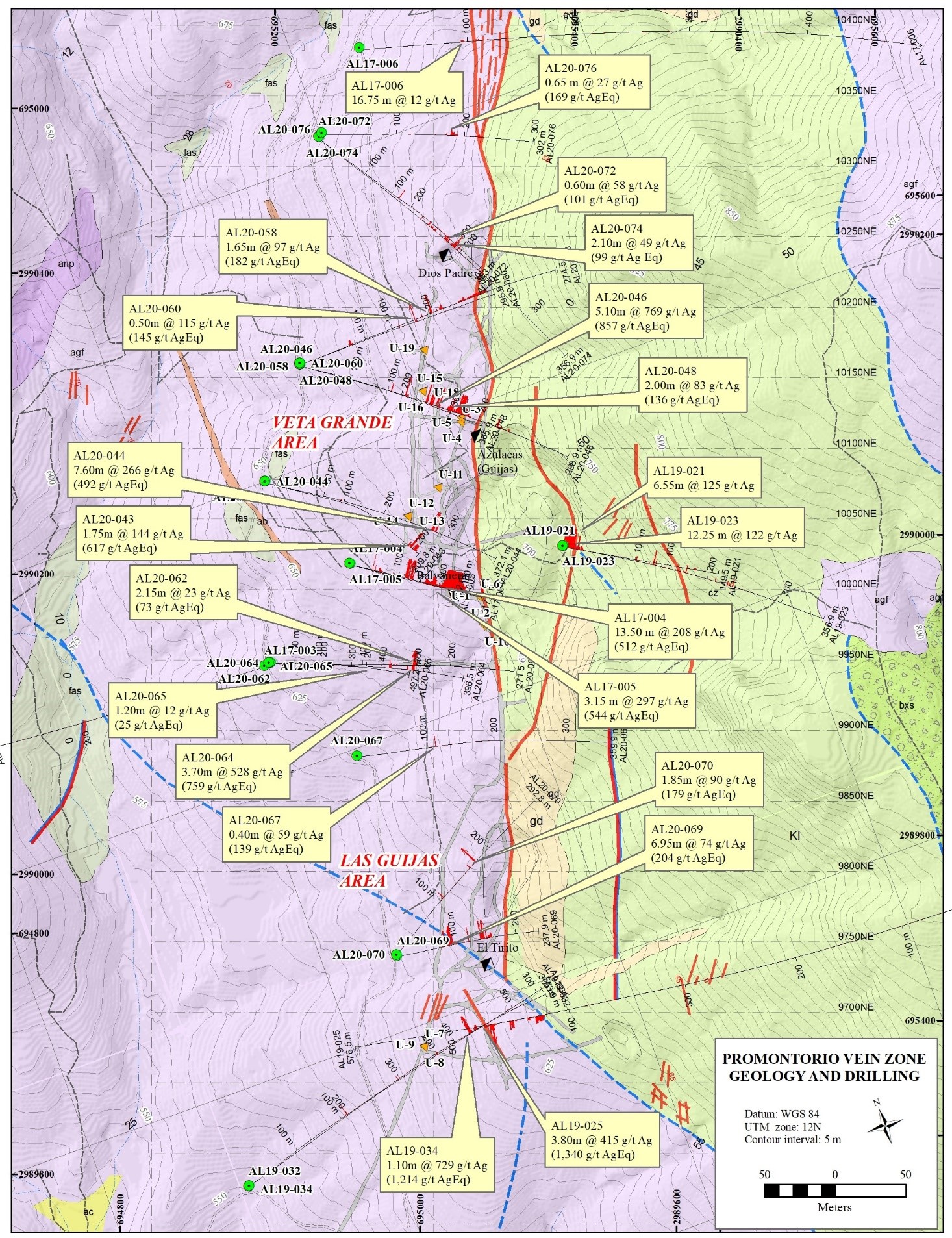
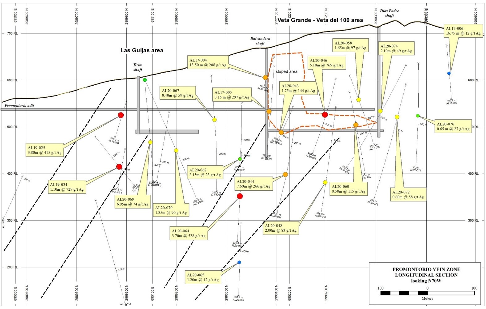
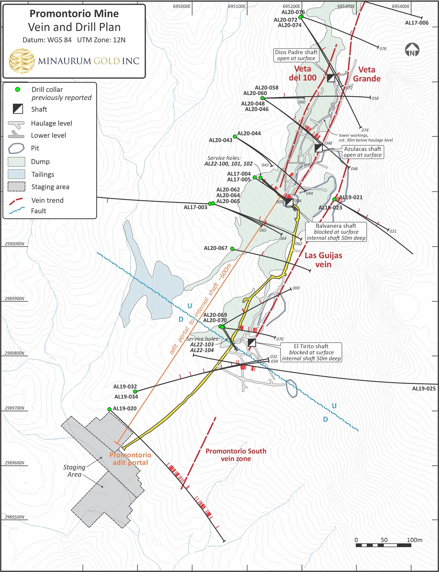
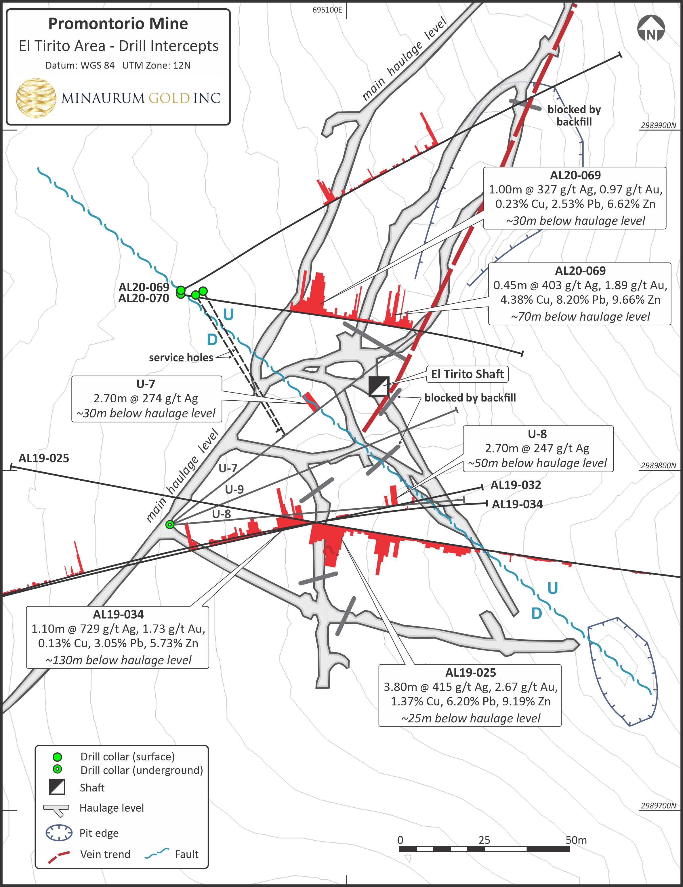
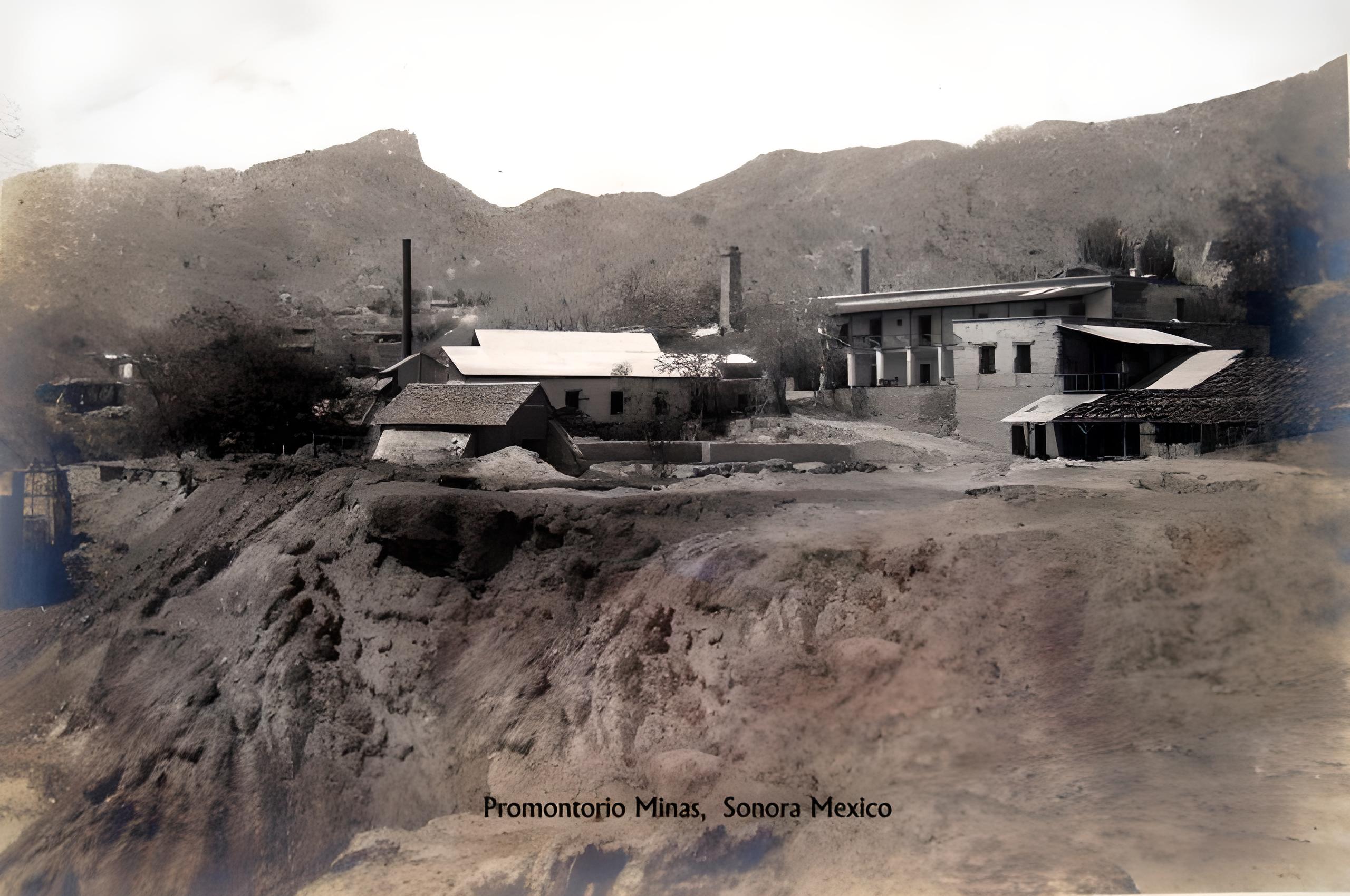
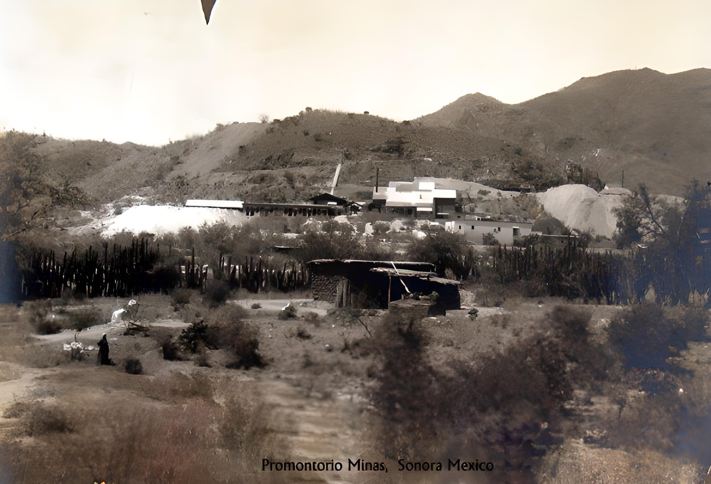
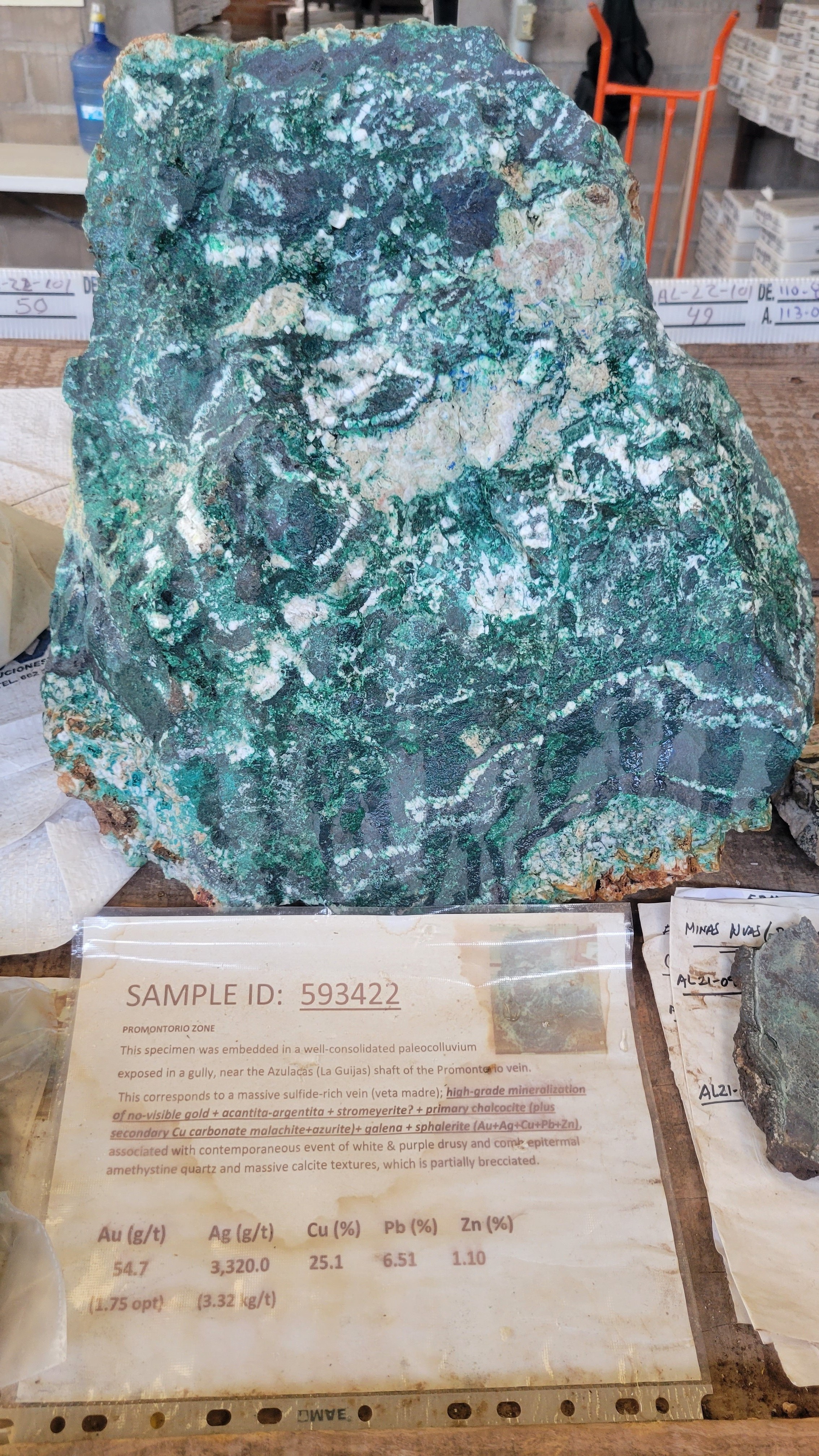
Minaurum acquired historical data including mine maps, sections and assay results of 40 holes (6,099 m) drilled in multiple surface and underground exploration campaigns that occurred from the 1960s through the early 1980s. The exploration programs were focused on the historic Promontorio and Minas Nuevas underground mines that closed in 1898 and 1912, respectively. The majority of these historical holes cut broad widths of high-grade silver, the best include: Hole U-3 that cut 4.6 m grading 2,838 g/t silver and Hole U-5 that cut 11.3 m of 785 g/t silver. The drill results indicate that the historically mined deposits included multiple veins that continue both down plunge and along-strike. At Promontorio, drill holes intersected mineralization over 50 m below the historic mining level and indicate an aggregate 735 m strike length of mineralization. (please see News Release February 6, 2020).
Drill highlights from the Historical Drilling Data at the Promontorio mine include: (only silver and gold were assayed – widths are reported drill thickness)
- 1.2 m of 5,588 g/t Ag (Hole U-1)
- 1.2 m of 1,008 g/t Ag (Hole U -1)
- 4.6 m of 2,838 g/t Ag (Hole U-3)
- 4.6 m of 305 g/t Ag (Hole U-4)
- 1.4 m of 377 g/t Ag (Hole U-4)
- 12.2 m of 710 g/t Ag (Hole U-4)
- 7.6 m of 747 g/t Ag (Hole U-5)
- 11.3 m of 785 g/t Ag (Hole U-5)
- 1 m of 2,177 g/t Ag (Hole U-12)
- 1.2 m of 854 g/t Ag (Hole U-15)
Drill highlights from the historical drilling data at the Minas Nuevas mine include: (only silver was assayed – widths are reported drill thickness)
- 1.7 m of 452 g/t Ag (Hole TP-80-08)
- 2 m of 367 g/t Ag (Hole TP-80-09)
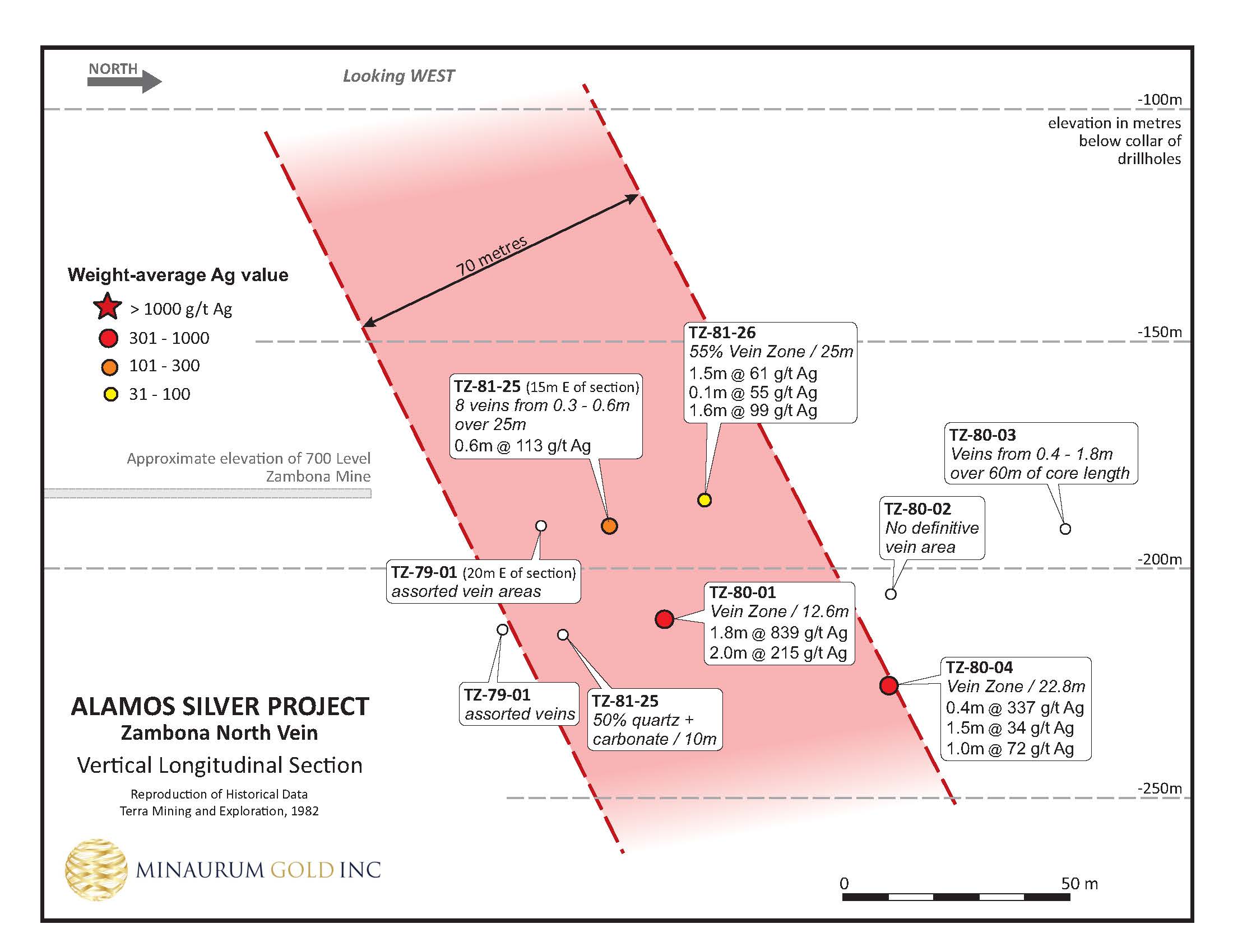
- 1.8 m of 839 g/t Ag (Hole TZ-80-01)
Exploration
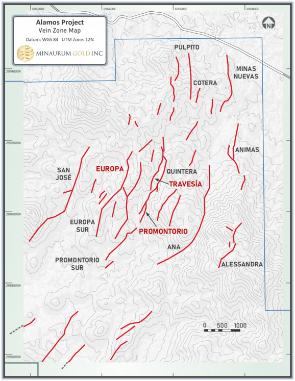
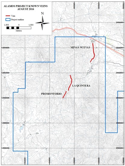
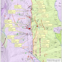
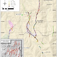
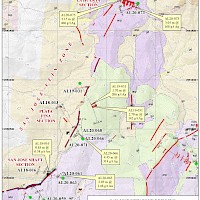
Minaurum geologists have covered more than 75 sq km with detailed geological mapping, and the geochemical database has more than 1500 rock samples with over 60,000 m of core drilling in 178 holes resulting in the identification of 26 vein zones in the Alamos district.
The 26 vein zones are spread across a mineral footprint measuring 11 km by 6 km with drilling so far testing 19 of the vein zones. Thirteen of the nineteen vein zones drilled returned high-grade silver intercepts demonstrating that mineralization occurs throughout the vein system. Only 15% of the total concession package has been explored so far with 85% with signficiant potential.
Minaurum currently has a 50,000 m resource expansion drill program to expand the initial inferred resource estimate.
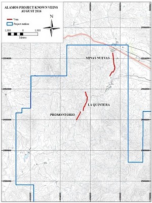
August 2016: 3 Vein Zones Now: 26+ Vein Zones
Drill Results Highlights
Drill Results
Vein System
Known Strike Length (m)
Best Drill Intercept
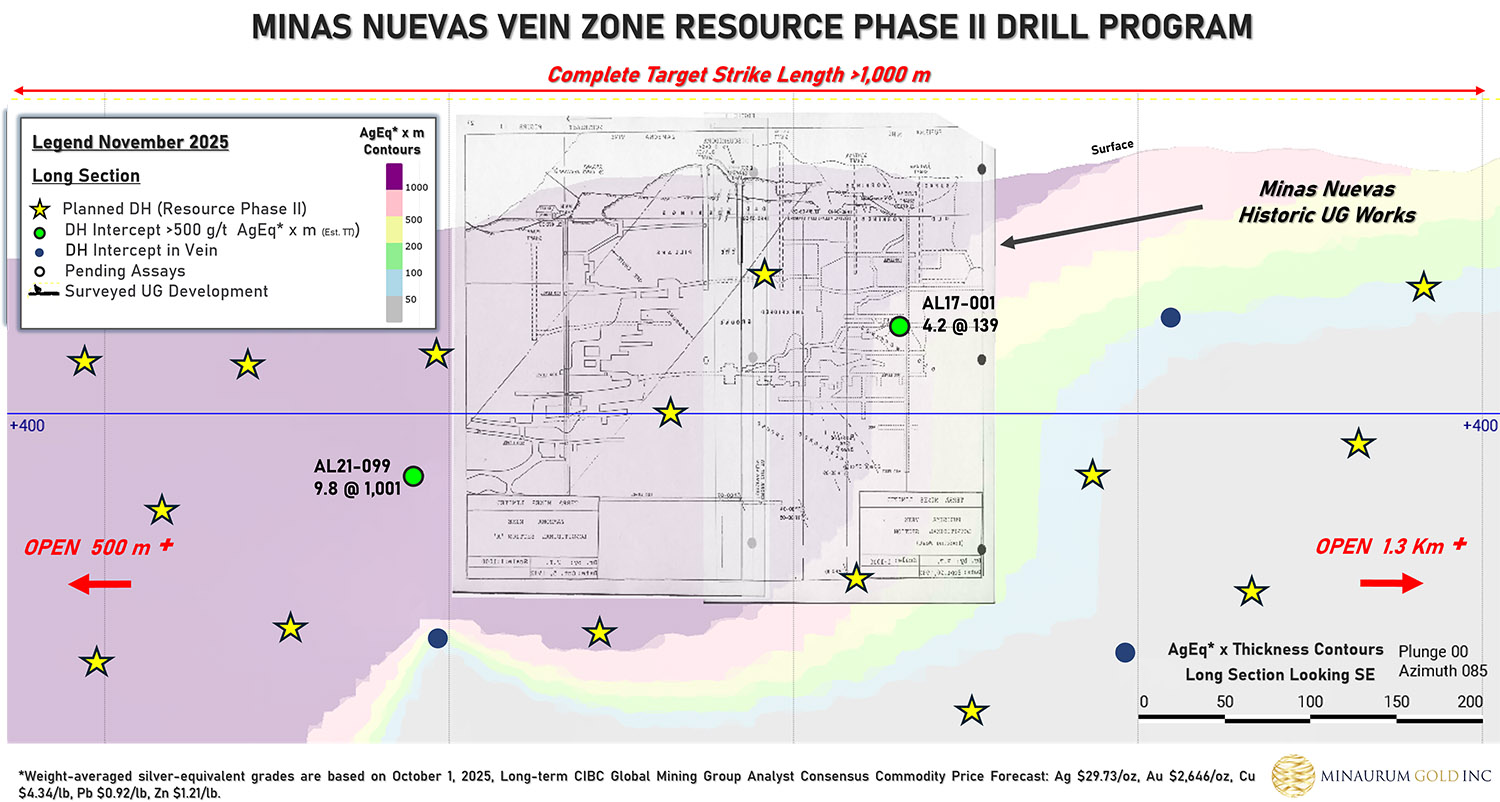
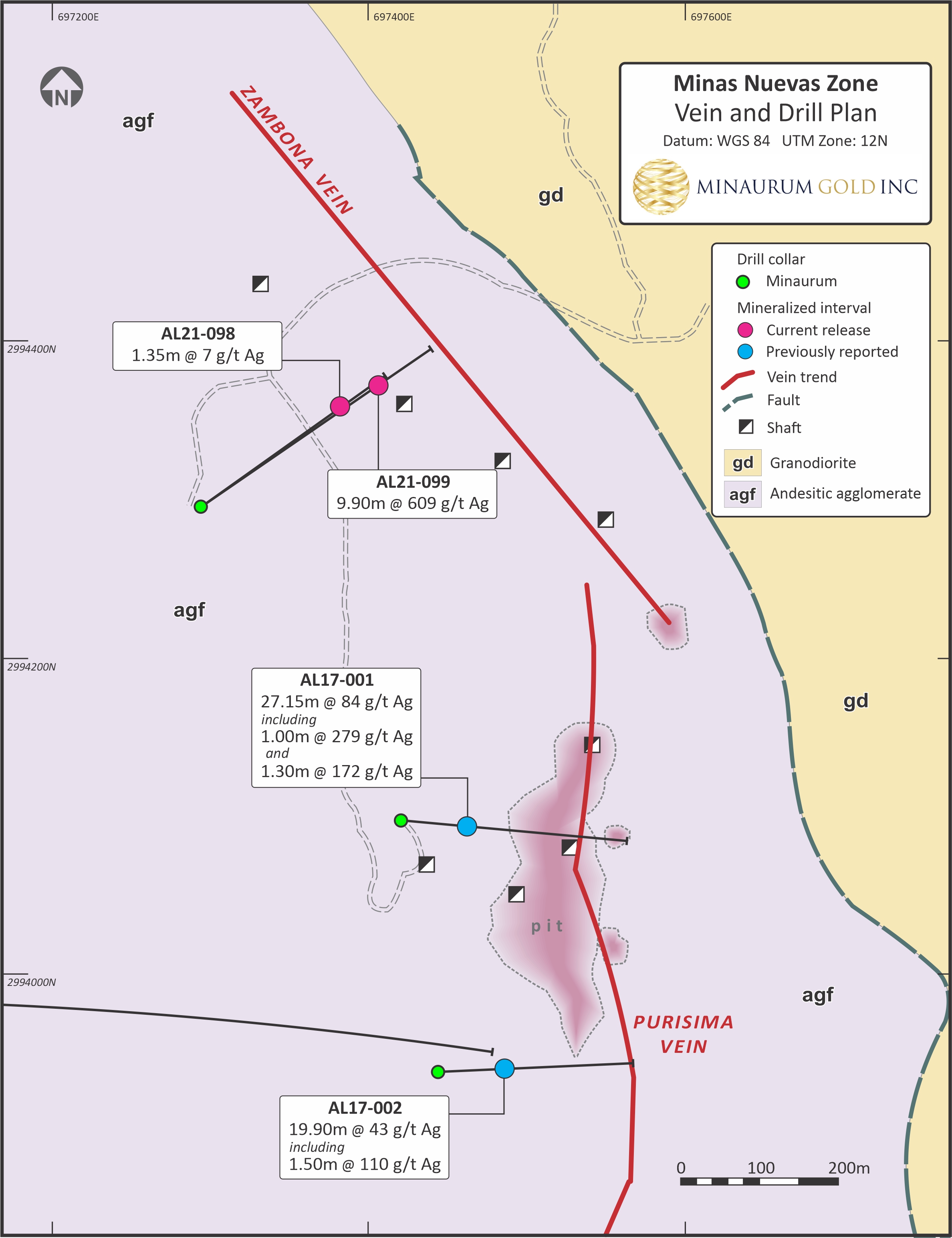
Minas Nuevas
1500
9.90 m @ 609 g/t Ag; incl. 0.90 m @ 1,145 g/t Ag, 0.50 m @ 2,260 g/t Ag, and 0.50 m @ 2,360 g/t Ag (Hole AL21-099)
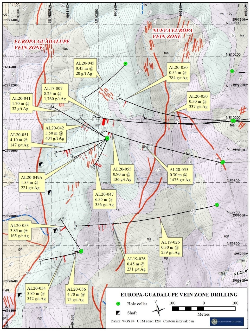
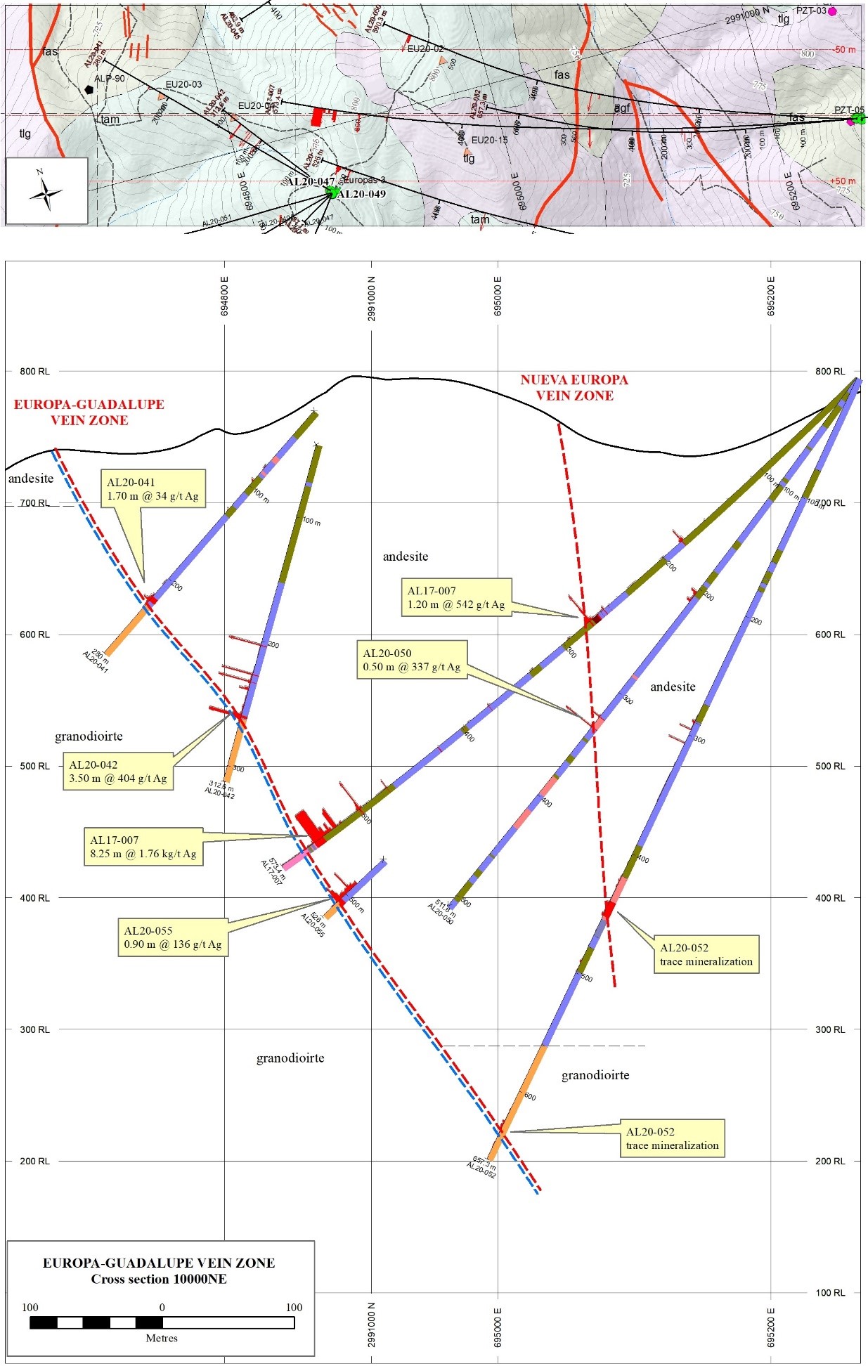
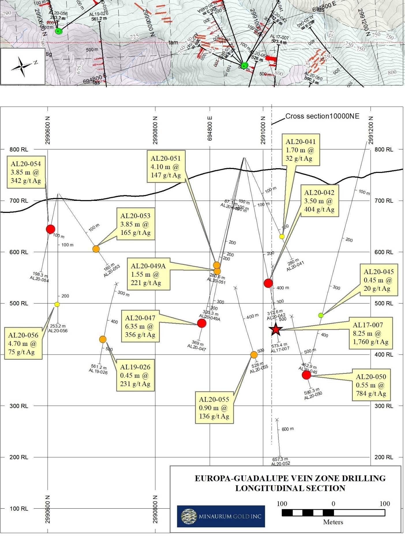
Europa-Guadalupe
2500
6.35 m of 356 g/t Ag, 0.39% Cu, 0.42% Pb, 0.57% Zn incl. 0.70 m of 2090 g/t Ag, 1.98% Cu, 2.51% Pb, 2.43% Zn (AL20-047)
3.50 m of 404 g/t Ag, 0.54% Cu, 1.30% Pb, 1.81% Zn incl. 1.15 m of 999 g/t Ag, 1.29% Cu, 2.98% Pb, 4.15% Zn (AL20-042)
3.85 m @ 342 g/t Ag, 0.76% Cu, 1.03% Zn; including 0.80 m @ 1,185 g/t Ag, 2.19% Cu, 1.2% Zn (AL20-054)
3.25 m @ 196 g/t Ag, 178 ppb Au, 0.26% Cu, 0.35% Pb, 1.10% Zn including 0.55 m @ 784 g/t Ag, 552 ppb Au, 1.05% Cu, and 2.49% Zn (AL20-050)
Promontorio
1200
5.1 m of 769 g/t Ag, 0.76% Cu; incl. 3.1 m of 1,197 g/t Ag, 1.04% Cu (AL20-046)
2.9 m of 636 g/t Ag, 495 ppb Au, 1.36% Cu, 3.85% Pb, 7.18% Zn (AL20-044)
1.75 m of 144 g/t Ag, 610 ppb Au, 4.15% Pb, 9.10% Zn (AL20-043)
3.70 m @ 528 g/t Ag, 819 ppb Au, 0.83% Cu, 2.43% Pb, 1.47% Zn, including 1.05 m @ 1,203 g/t Ag, 2.45 g/t Au, 1.42% Cu, 5.08% Pb, 2.80% Zn (AL20-064)
4.00 m @ 161 g/t Ag, 0.5 g/t Au, 0.24% Cu, 2.15% Pb, 5.92% Zn, including 1.00 m @ 327 g/t Ag, 0.9 g/t Au, 0.23% Cu, 2.53% Pb, 6.62% Zn (AL20-069)
Nueva Europa
2100
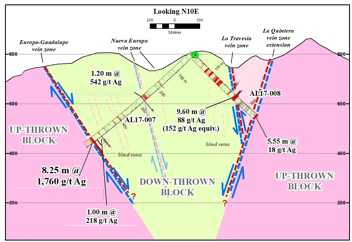
1.20 m @ 542 g/t Ag, 0.28% Cu, 0.44% Pb, 0.88% Zn (AL17-007)
Amalia
980
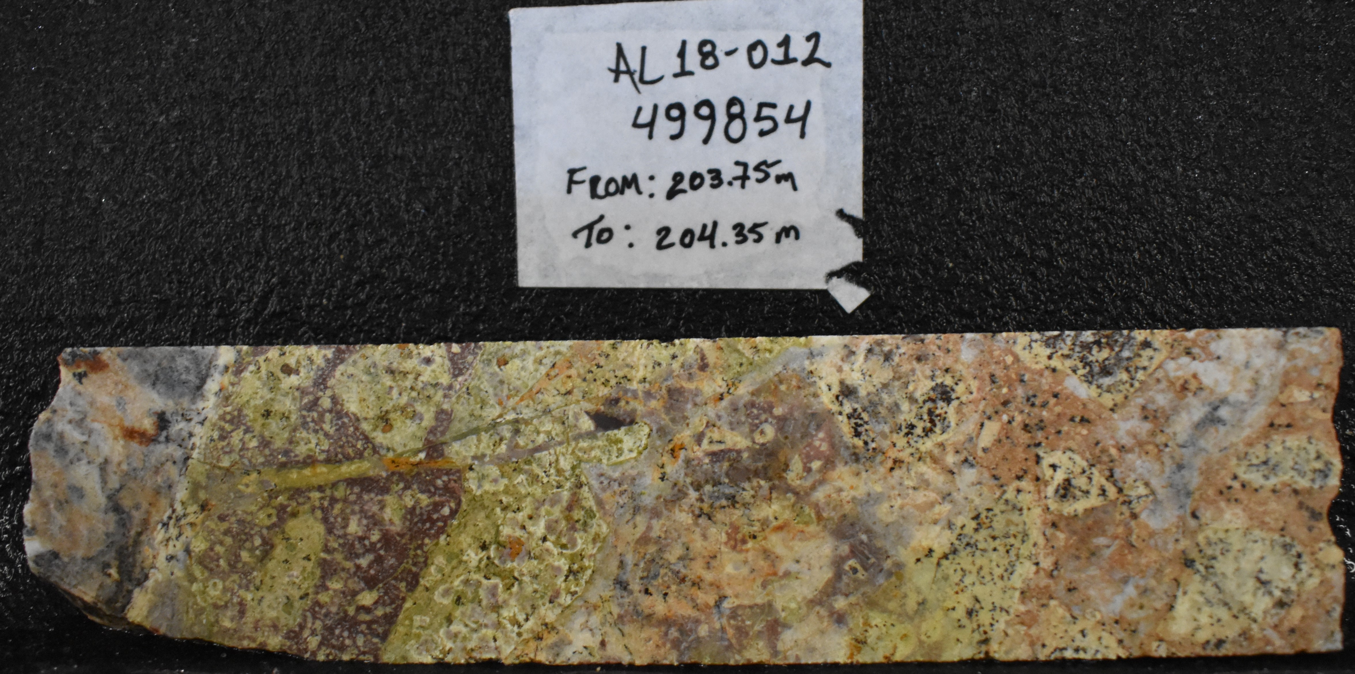
1.30 m @ 1.73% Pb, 1.99% Zn (AL18-012)
0.25 m of 113 g/t Ag, 150 ppb Au, 0.29% Cu, 2.60% Pb, and 5.74% Zn (AL19-019)
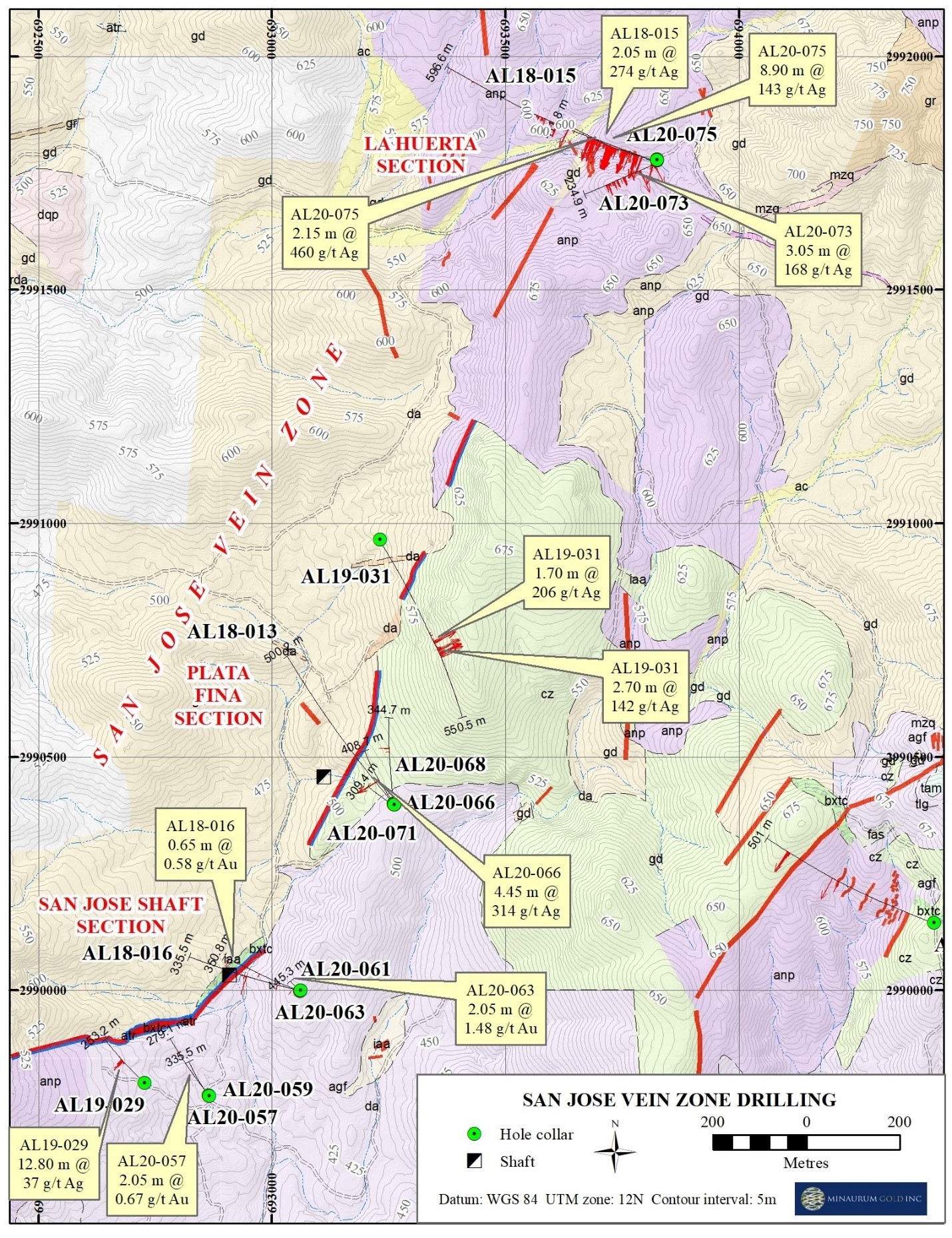
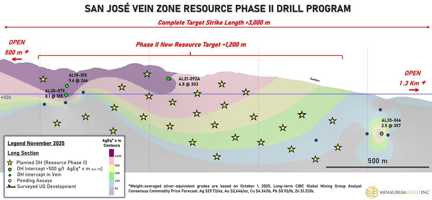
San Jose
2500
9.60 m @ 198 g/t Ag, 0.22% Pb, 0.88 % Zn (AL18-015)
4.45 m @ 314 g/t Ag, 0.27% Cu, 0.19% Pb, 0.20% Zn (AL20-066)
2.15 m @ 460 g/t Ag, 0.15% Cu, 0.47% Pb, 0.85% Zn (AL20-075)
Tigre
1000
0.90 m @ 391 g/t Ag, 0.42% Pb, 0.29% Zn (AL18-012)
Ana
3400
2.85 m @ 25 g/t Ag, 2.29% Pb, 10.58% Zn (AL18-011)
Travesia
880
9.60 m @ 88 g/t Ag, 0.24% Cu, 0.37% Pb, 0.33% Zn (AL17-008)
El Creston
1900
0.20 m @ 20 g/t Ag, 0.85% Cu (AL18-014)
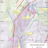
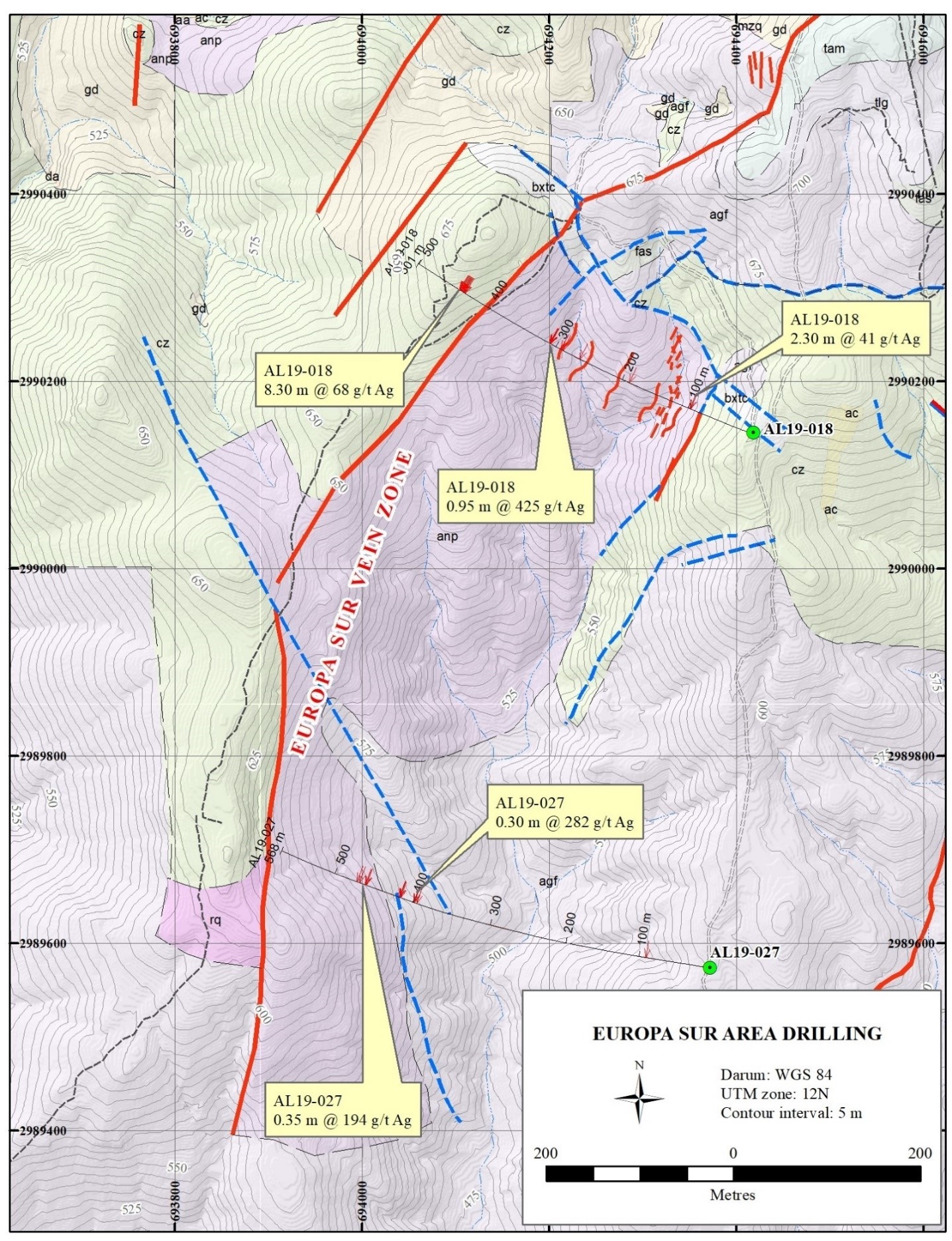
Europa Sur
1000
0.95 m @ 425 g/t Ag, 0.32% Cu, 3.17% Pb 1.31% Zn, including 0.50-m @ 719 g/t Ag, 172 ppb Au, 0.57% Cu, 5.91% Pb, and 2.37% Zn (AL19-018)
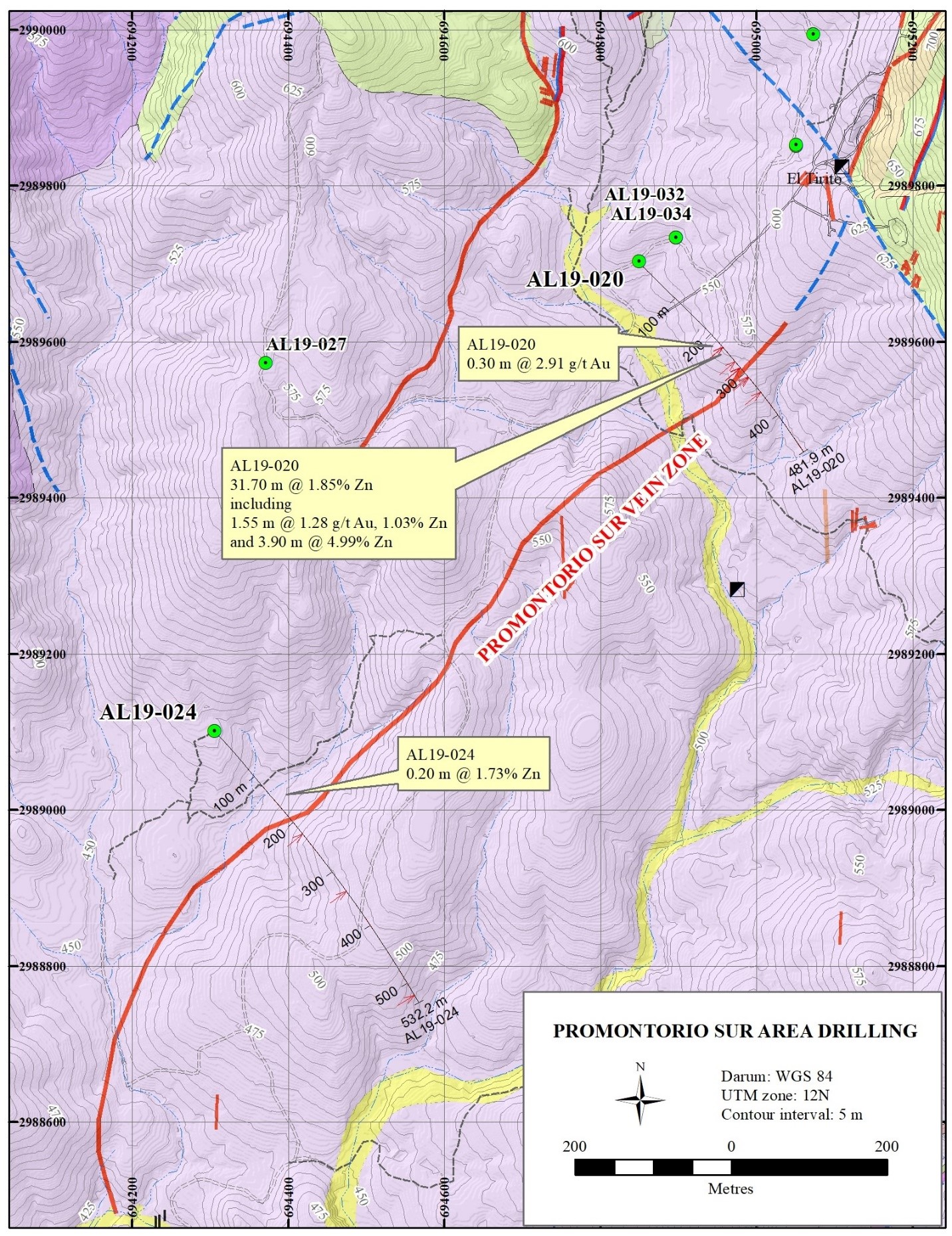
Promontorio Sur
1300
31.70 m mineralized zone containing 0.20m interval assaying 304 g/t Ag, 352 ppb Au, 1.41% Cu, 2.5% Pb, 3.36% Zn (AL19-020)
Azulacas
400
12.25 m averaging 122 g/t Ag, 0.21% Cu and 1.37% Zn (AL19-023)
La Quintera
1400
0.50 m of 124 g/t Ag, 0.26% Cu (AL19-017)
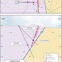
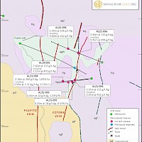
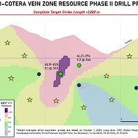
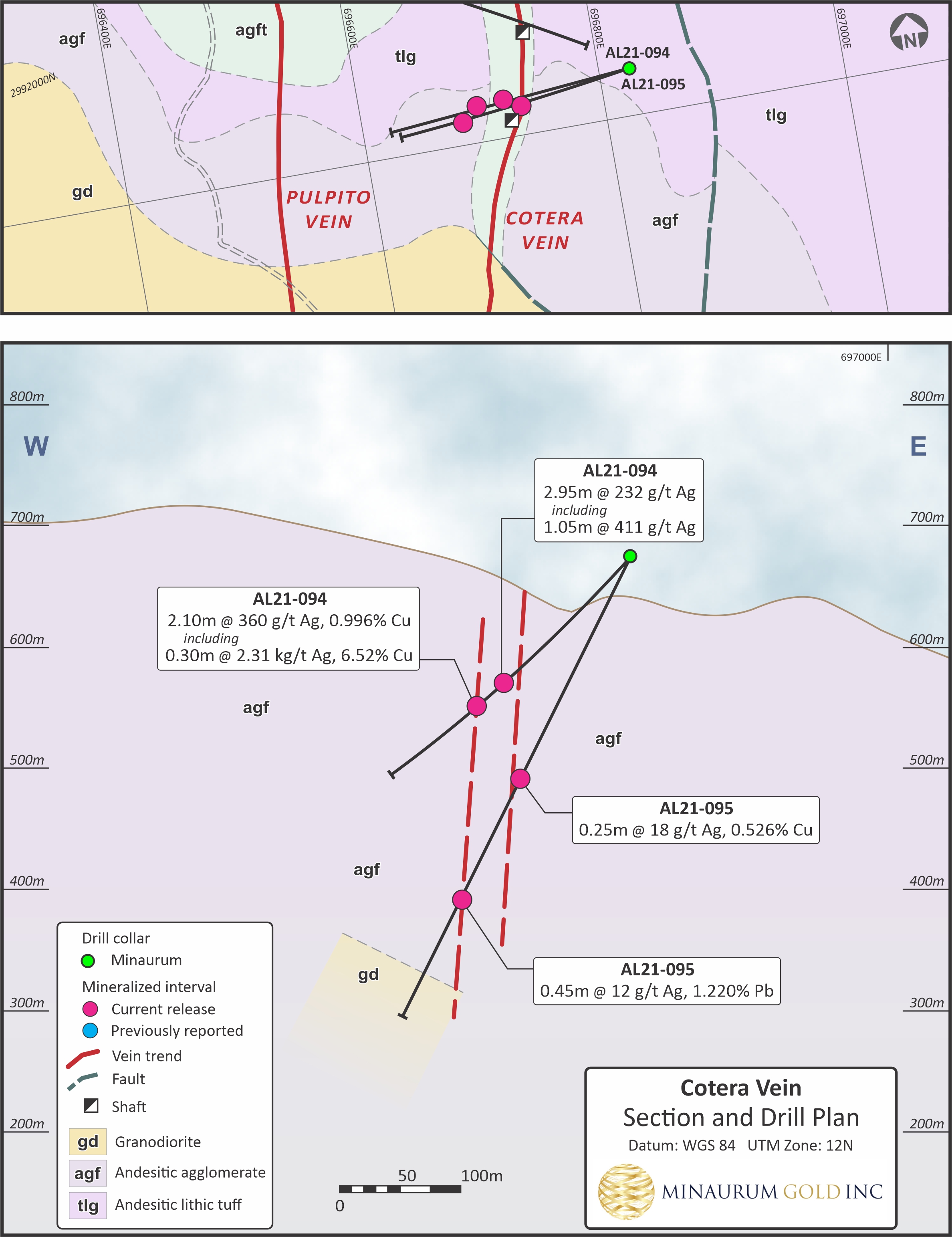
Cotera
800
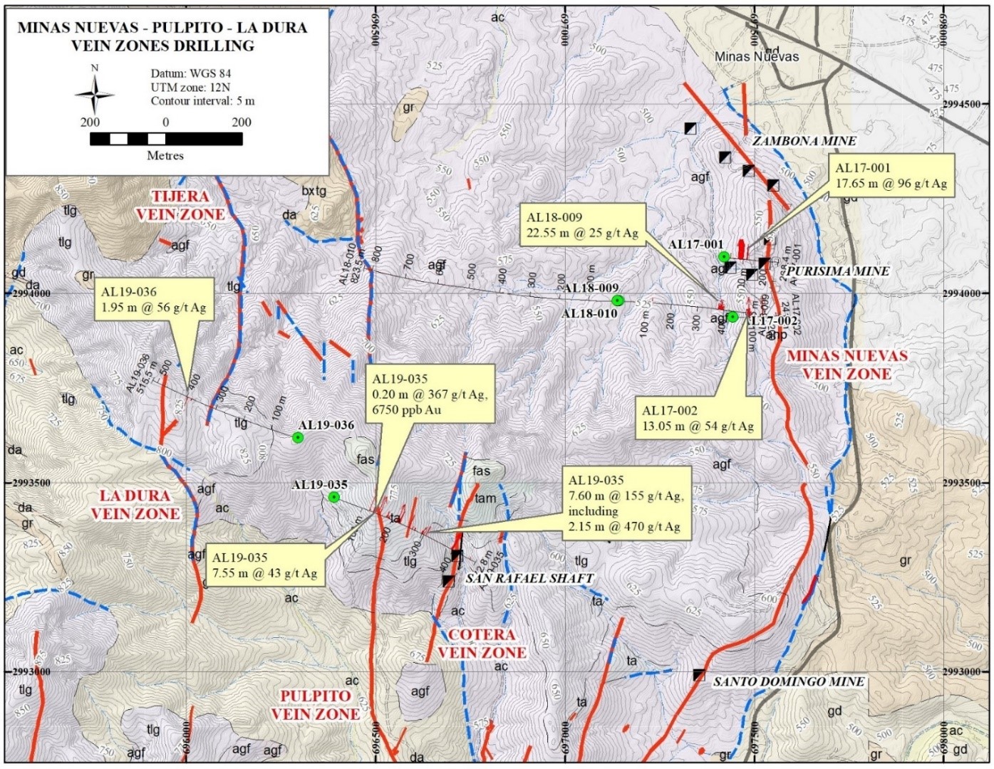
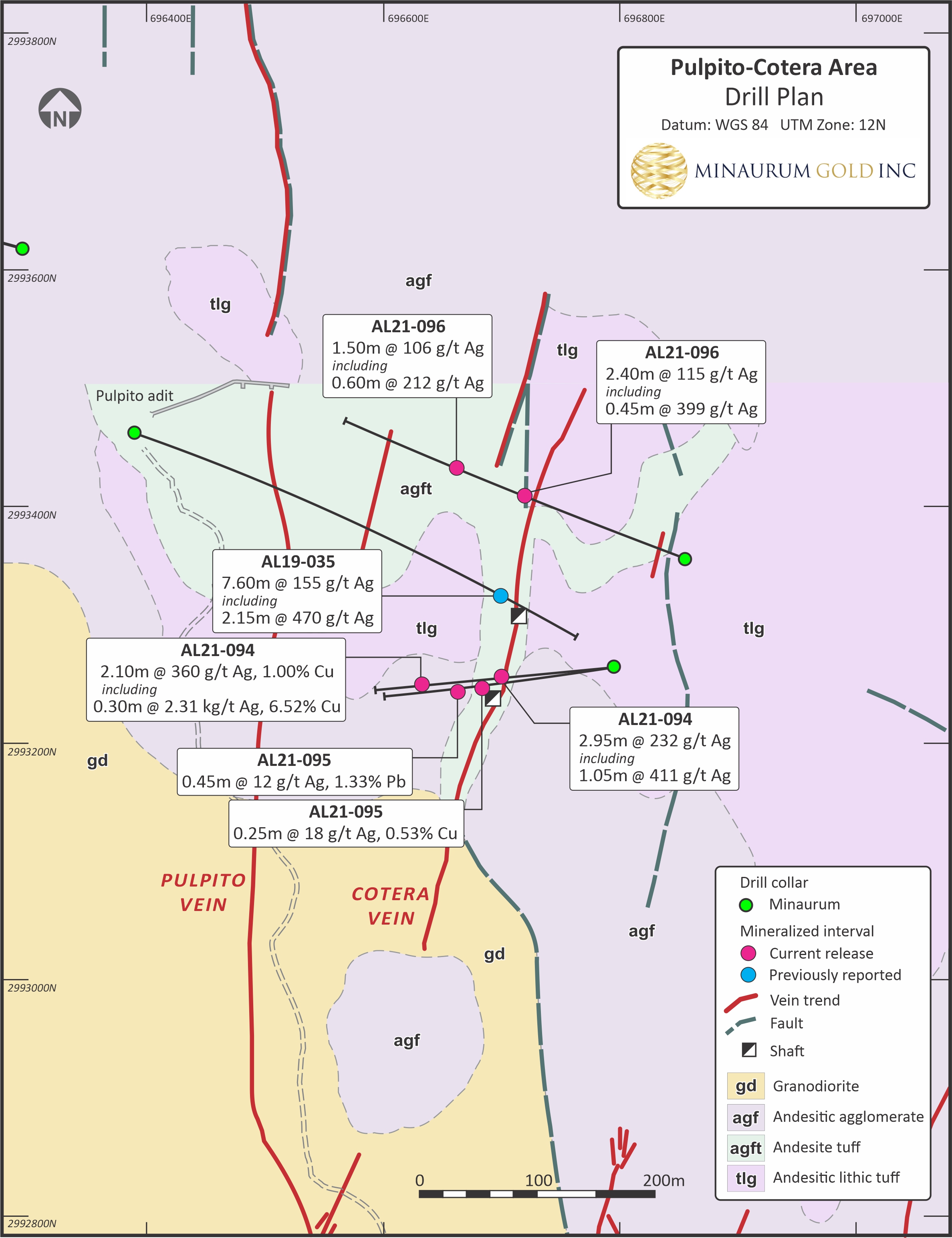
7.60 m @ 155 g/t Ag incl. 2.15 m @ 451 g/t Ag (AL19-035)
Alessandra
1100
6.60 m @ 3.89% combined Cu, Pb, and Zn (AL19-038)
Pulpito
1000
0.20 m @ 367 g/t Ag, 6.75 g/t Au, 1.35% Cu, 0.59% Pb, 0.56% Zn (AL 19-035)
Robust Preliminary Metallurgical Testing Results
-
Confirms high-grade silver and gold recoveries, even with low-grade material exhibiting impressive recoveries from flotation
-
Six separate composites from Europa and Promontorio vein zones were tested
-
Silver recoveries ranged from 83.5% to 94.3% for 5 of the 6 core composites
-
Gold recoveries ranged from 68.9% to 96.5% in 5 composites with detectable gold
-
Two separate independent labs conducted the tests
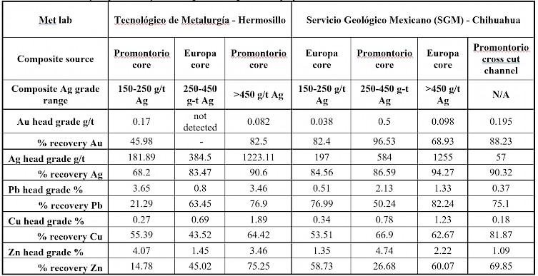
See April 9, 2024 news release.
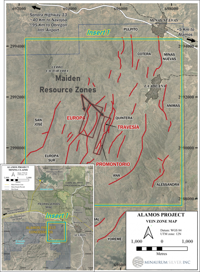
Maiden Resource
Alamos hosts an initial inferred resource estimate of 55 million ounces AgEq grading 320 g/t AgEq (see Minaurum news release dated January 28, 2026 and Resource section above) from just 3 of the 26 vein zones namely: Promontorio, Europa, and Travesia vein targets.
Resource Expansion Drill Program Results
Promontorio
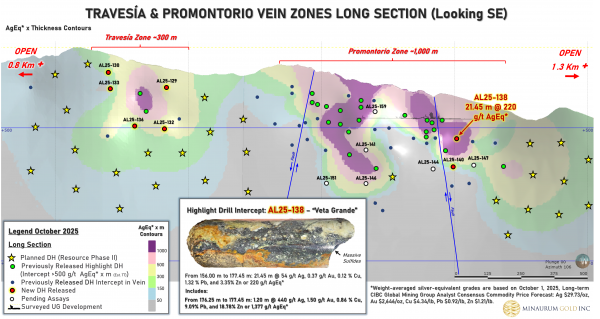
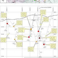
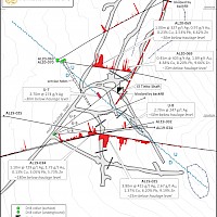
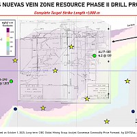
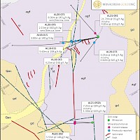
Promontorio Vein Zone averages a width of mineralization of 5.4 m (weighted average), average grade of 170 g/t Ag, 0.4% Cu, 1% Pb, and 2% Zn, or 338 g/t AgEq. The most significant results include: AL24-105 that intersected 0.70 m of 2,976 g/t AgEq, AL24-107 that returned 5.60 m of 368 g/t AgEq and 2.55 m of 621 g/t AgEq and AL24-108 that returned 8.45 m of 336 g/t AgEq (See Minaurum news release dated September 19, 2024). Exceptional intercepts including: 3.00 m of 4,173 g/t AgEq (AL24-111); 6.35 m of 380 g/t AgEq (AL24-110); and 5.75 m of 189 g/t AgEq (AL24-112). Hole AL24-111 intersected a significant high-grade sub interval returning 1.55 m of 7,780 AgEq*, which includes 0.50 m of 13,995 g/t AgEq and 1.05 m of 4,839 g/t AgEq (See Minaurum news release dated February 13, 2025). A significantly wide intercept of 36.65 m of 328 g/t AgEq including 3.85 m of 1,022 g/t AgEq (AL24-117), 4.40 m of 241 g/t AgEq including 0.90 m of 385 g/t AgEq (AL24-115), and 4.95 m of 272 g/t AgEq including 0.90 m of 513 g/t AgEq (AL24-116), and further demonstrate the high-grade continuity (See Minaurum news release dated Febrary 27, 2025).
Hole AL25-138 intersected a significant wide zone of skarn/CRD lead- and zinc-sulfide mineralization including silver and gold values: 21.45 m of 220 g/t AgEq including 1.00 m of 497 g/t AgEq and 1.20 m of 1,377 g/t AgEq (440 g/t Ag, 1.499 g/t Au, 9.089% Pb, 18.783% Zn)
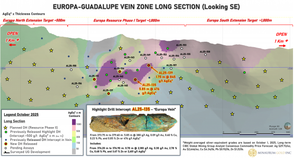
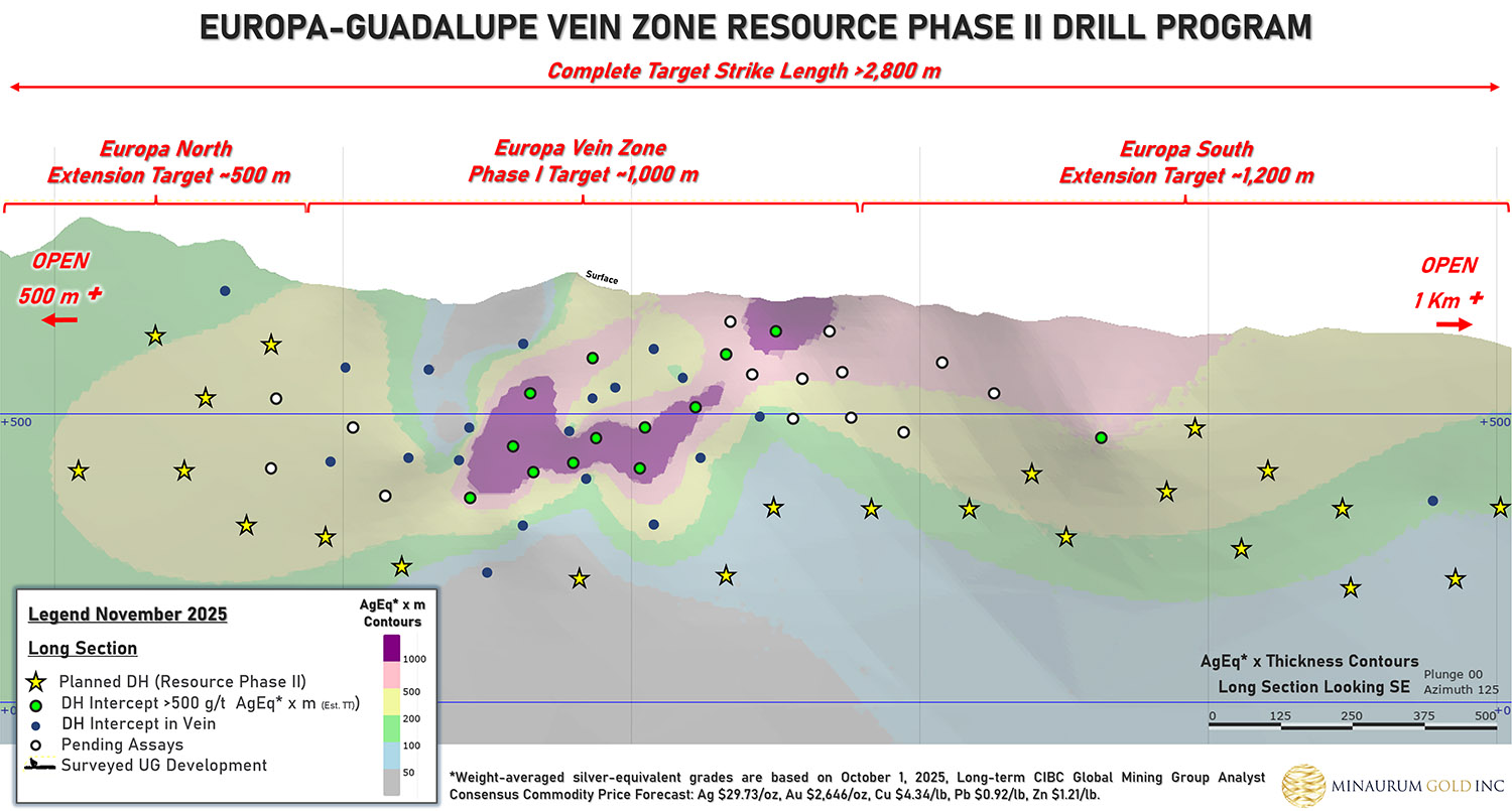
Europa
The Europa Vein Zone has an average width of mineralization at 3.1 m, and average grade of 358 g/t Ag, 0.5% Cu, 0.6% Pb, and 1.2% Zn, or 454 g/t AgEq. Significant mineralization was intersected in Hole AL25-135 which returned 5.85 m of 476 g/t AgEq including 0.70 m of 2,601 g/t AgEq (2,180 g/t Ag); and hole AL25-139 returned 2.40 m of 499 g/t AgEq including 0.50 m of 1,366 g/t AgEq (851 g/t Ag).
(Weight-averaged silver-equivalent grades are based on October 1, 2025 Long-term CIBC Global Mining Group Analyst Consensus Commodity Price Forecast: Ag $29.73/tr oz, Au $2,646/tr oz, Cu $4.34/lb, Pb $0.92/lb, Zn $1.21/lb).
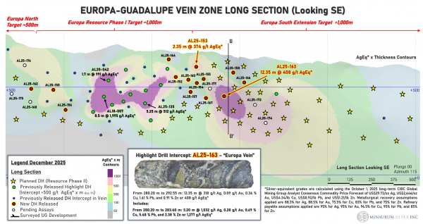
Minaurum extended the Europa vein zone by 250 meters in step-out hole that intersected a significant wide interval of 12.35 m zone averaging 408 g/t AgEq, including 3.20 m of 1,277 g/t AgEq (1,032 g/t Ag, 0.278 g/t Au, 0.692% Cu, 5.477% Pb, 2.379% Zn). Hole AL25-154 returned 1.05 m of 231 g/t AgEq, including 0.25 m of 700 g/t AgEq (355 g/t Ag, 1.86 g/t Au, 1.45% Cu, 0.77% Pb, 1.89% Zn). These holes confirms the continuity of high-grade silver mineralization well beyond the current inferred resource in the Europa Vein Zone.
Surface-Access Agreements
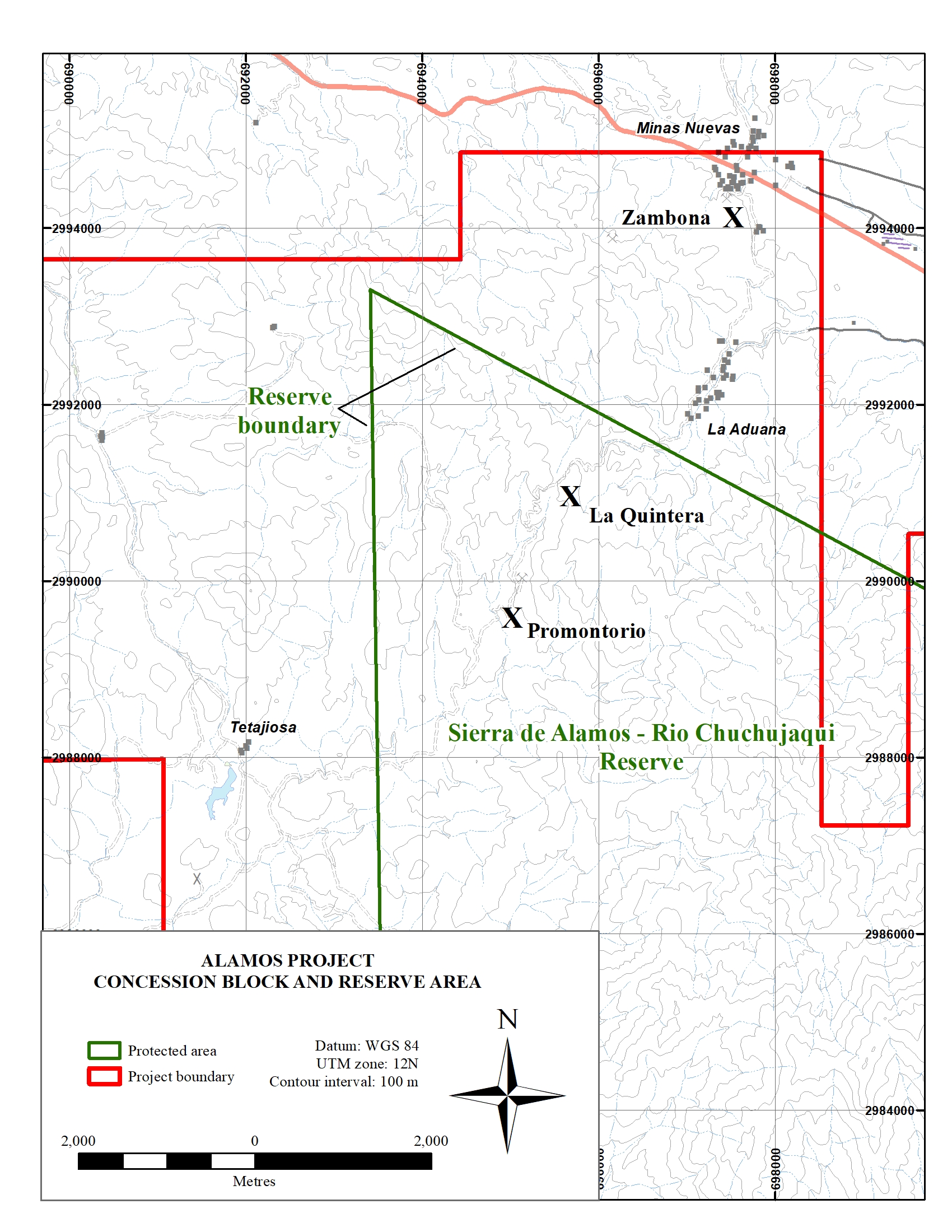
The Alamos project is situated on land belonging to the ejidos of La Aduana and Tetajiosa and the community of Minas Nuevas. Surface-access agreements are in place with all three along with annual rental payments to maintain the agreements.
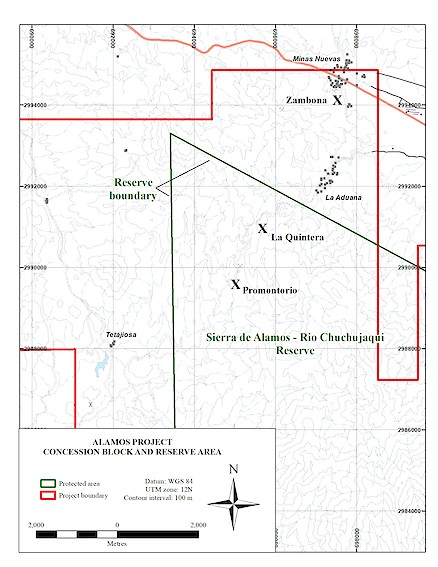
Part of the Alamos project lies within the Sierra de Alamos – Río Cuchujaqui Reserve, which overlaps ejido lands. Authorization was received from the National Commission of Natural Protected Areas (CONANP) to explore in the Reserve Area. The reserve area land inside the project area is categorized as an “area of sustainable exploitation of natural resources”, which is defined in the reserve area management plan as use that does not negatively affect future generations. A coordination agreement between the Protected Area authorities and SEMARNAT was established in July of 2013 and is valid for the life of the project.
Please refer to the 43-101 Technical Report Alamos Project - June 8, 2021 and 43-101 Technical Report Mineral Resource Estimate February 17, 2026 on SEDAR
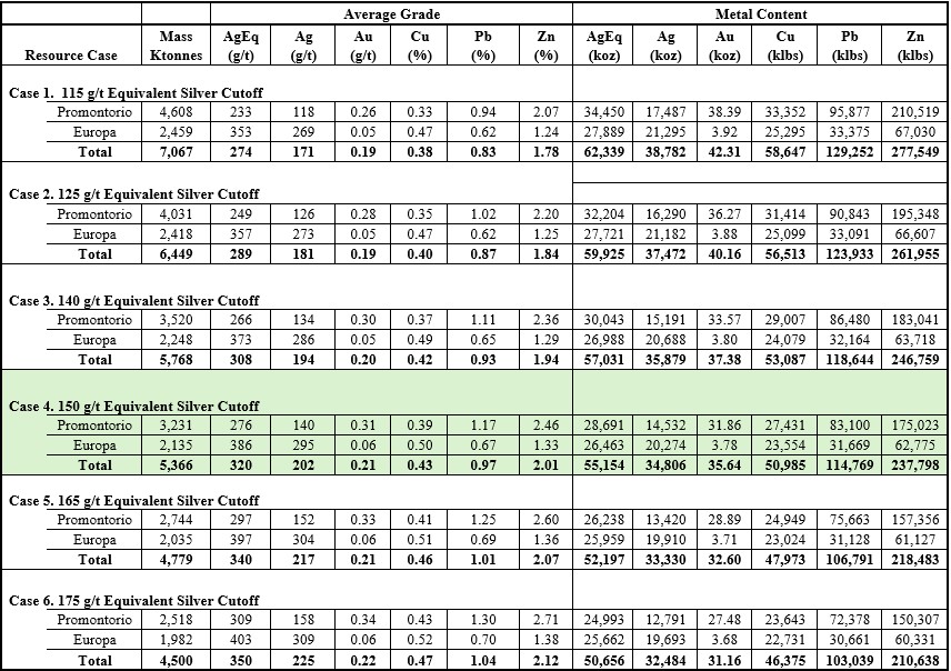
Alamos Silver Project – Inferred Mineral Resource Estimate Summary (150 g/t AgEq cut-off)
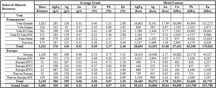
Notes:
- The Mineral Resource estimate conforms to the requirements of NI 43-101 – Standards of Disclosure for Mineral Projects and the CIM Definition Standards for Mineral Resources and Mineral Reserves (2014). The Mineral Resource estimate is entirely classified as Inferred Mineral Resources. Inferred Mineral Resources have been estimated from geological evidence and limited sampling and have a lower level of confidence than Measured and Indicated Mineral Resources and must not be converted to Mineral Reserves. There is no certainty that Inferred Mineral Resources will be converted to Measured or Indicated Mineral Resources.
- Weight-averaged silver-equivalent (“AgEq”) grades are based on the October 1, 2025 long-term CIBC Global Mining Group Analyst Consensus Commodity Price Forecast, using metal prices of US$29.73/oz Ag, US$2,646/oz Au, US$4.34/lb Cu, US$0.92/lb Pb, and US$1.21/lb Zn. Metal recovery assumptions, based on comparable projects, are 88.3% Ag, 75.0% Au, 75.5% Cu, 83.1% Pb, and 75.5% Zn. Assumed refinery payables are 95% Ag, 95% Au, 96.5% Cu, 95% Pb, and 85% Zn.
- The Mineral Resource is reported at a cut-off grade of 150 g/t AgEq.
- Bulk density values applied are 2.72 t/m³ for the Promontorio and Travesía zone veins and 2.65 t/m³ for the Europa zone veins.
- The Mineral Resource estimate is reported on a 100% project basis and reflects reasonable prospects for eventual economic extraction.
- The effective date of the Mineral Resource estimate is January 8, 2026.
- There are no known legal, political, environmental, or other risks that, to the knowledge of the Qualified Persons, could materially affect the potential development of the Mineral Resources.
- All figures are rounded to reflect the relative accuracy of the estimate. Totals may not sum exactly due to rounding.
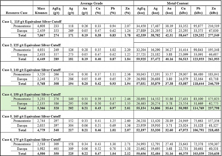
Alamos Silver Project – Inferred Mineral Resource Estimate Sensitivity Table
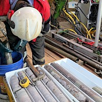
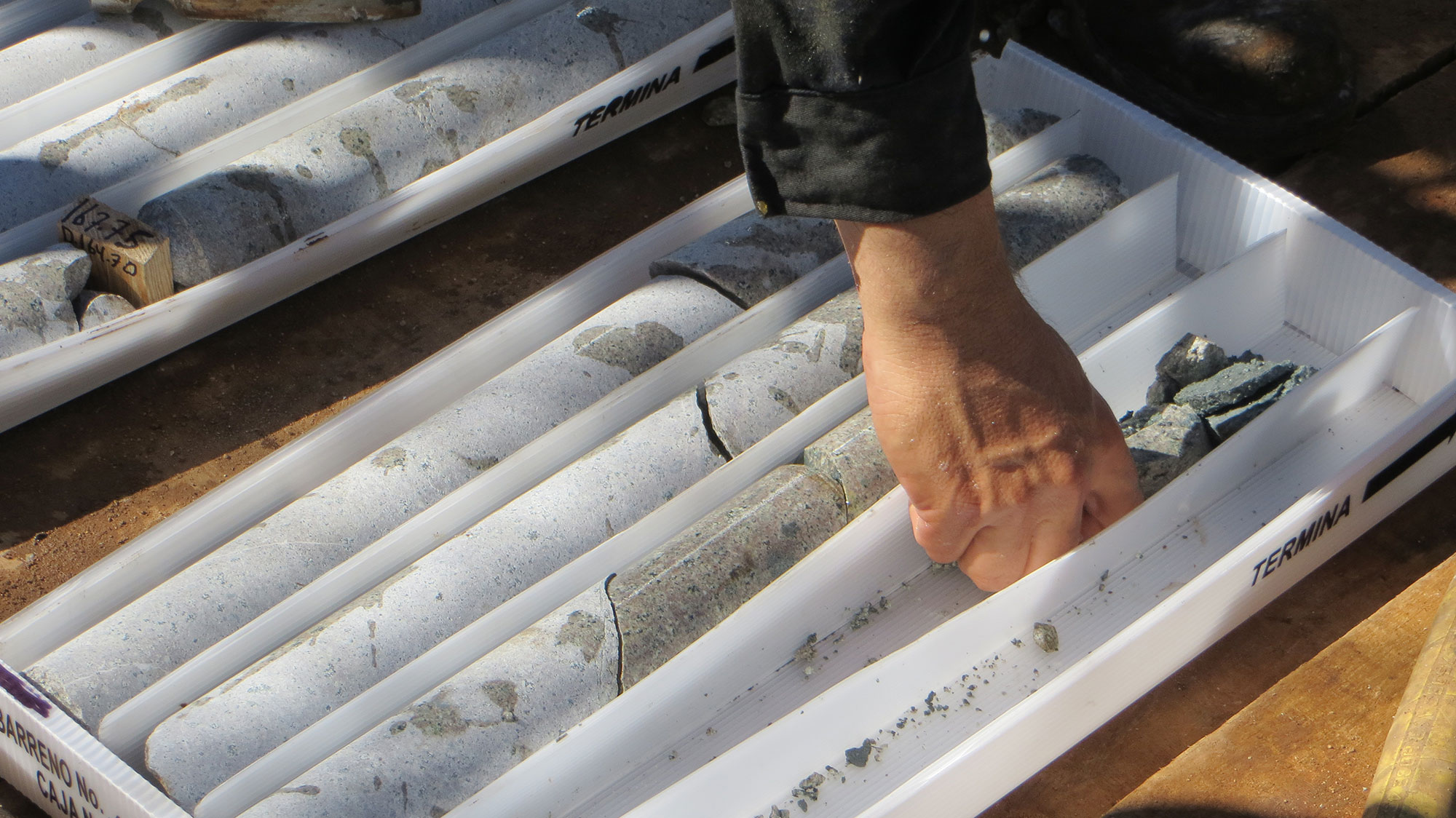
The Resource Estimate, completed by Independent Mining Consultants, Inc., is based on a total database of 104 drill holes, totaling 35,888.15 metres and 10,194 samples. The Resource Estimate is classified as an Inferred Mineral Resource in accordance with CIM Definition Standards, with an effective date of January 8, 2026.
Drill hole spacing within the modeled vein domains averages approximately 80 metres, with locally tighter spacing in higher-grade portions of the Promontorio vein zone. Most of the resource occurs in unmined zones, with partially mined-out areas in the Promontorio vein zone. Interpreted void volumes associated with historical mining have been deducted from the Resource Estimate based on interpretations of historical longitudinal sections, mine maps, and drill hole data. The resource remains open in along strike and down dip on both the Promontorio and Europa vein zones. Multiple other veins in the district have high-grade intercepts that await potential resource definition.
The Alamos Project Resource Estimate is based on the following key assumptions and parameters: specific gravity values of 2.72 for the Promontorio and Travesia veins and 2.63 for the Europa vein, derived from Minaurum’s test work based on 151 wax-coated density measurements; vein domains were modelled to reflect the interpreted vein geology, including vein continuity, thickness, and structural controls; all assays were composited to 1 metre, and grade capping was applied on a vein-by-vein basis, with silver grades capped at up to 3,000 g/t; a 5 m along strike × 1 m across strike × 2.5 m high block size was selected based on geological constraints and potential future mining methods; and block grades for gold, silver, copper, lead, and zinc were estimated using inverse distance squared interpolation; mineral resources were classified as Inferred in accordance with CIM Definition Standards, based on geological confidence, drill hole spacing, sample support, and search criteria. Additional details of the estimation methodology and classification criteria will be provided in the supporting technical report to be filed on the Company’s profile on SEDAR+. A technical report prepared by IMC in accordance with NI 43-101 will be filed on the Company’s profile at www.sedarplus.ca within 45 days of the date of this press release.

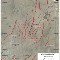
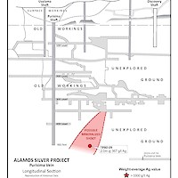
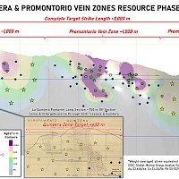
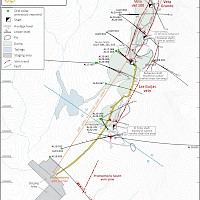
Figure 1. Alamos Silver Project Vein Zones – 55.2 Moz AgEq grading 320 g/t AgEq lies on Promontorio, Travesia, and Europa vein zones located within the black boxed outlines.
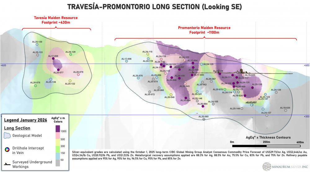
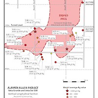
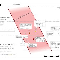
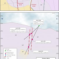
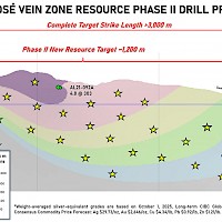
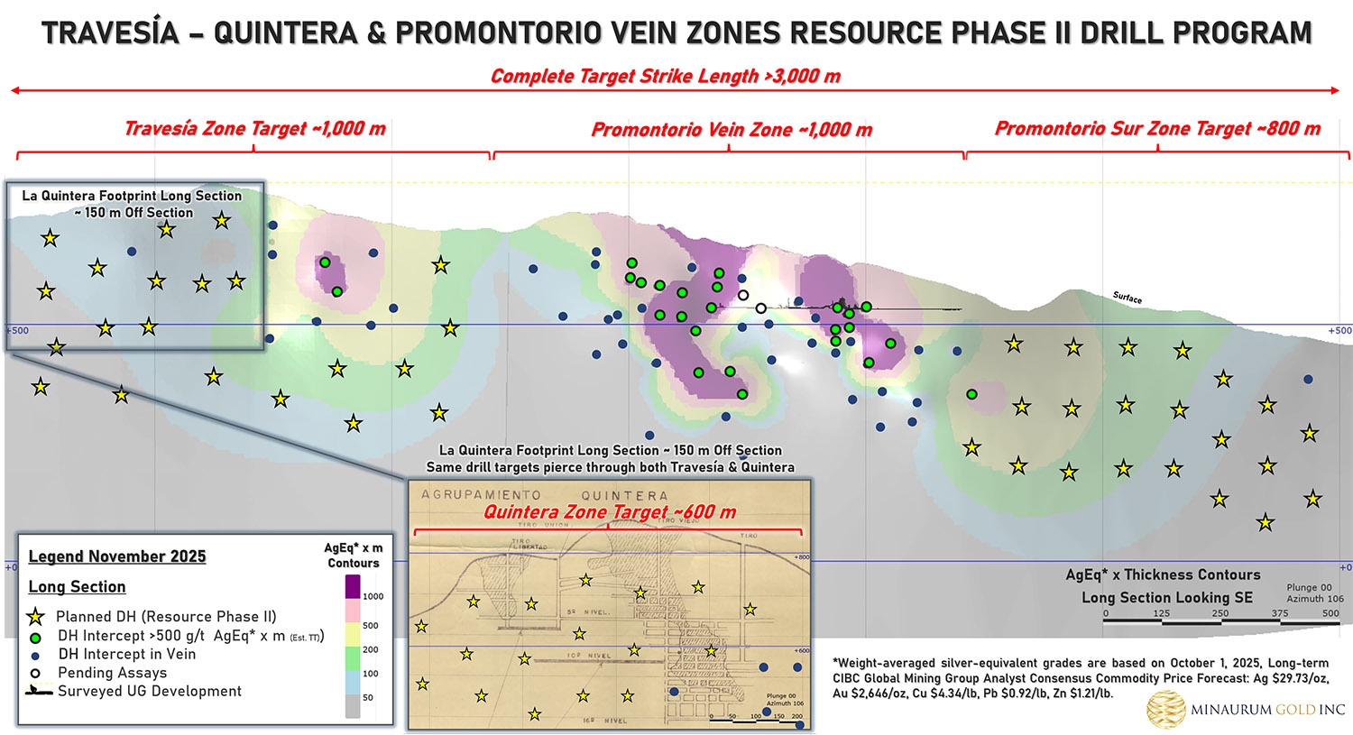
Figure 2. Travesia-Promontorio vein zone longitudinal section. Dotted line indicates the outline of the geological model used in calculating resources. This vein zone comprises 28.7 Moz AgEq grading 276 g/t AgEq.
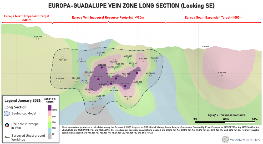
Figure 3. Europa vein zone longitudinal section. Dotted line indicates the outline of the geological model used in calculating resources. This vein zone comprises 26.5 Moz AgEq grading 386 g/t AgEq.
A technical report prepared by IMC in accordance with National Instrument 43-101 — Standards of Disclosure for Mineral Projects ("NI 43-101") will be filed on SEDAR at www.sedar.com within 45 days.
Qualified Assurance Program and Quality Control Measures ("QA/QC"): Minaurum has implemented QA/QC protocols including insertion of duplicate, blank and standard samples in all drill holes and underground sampling. Ninety-two percent of drill samples were submitted directly to the ALS Chemex in Hermosillo, Mexico, for preparation and sent to ALS Chemex in North Vancouver, BC, Canada, for analysis. During 2024, the Company sent drill samples to ActLabs’ facility in Zacatecas, Mexico, for preparation and analysis there, amounting to 8% of the total drill samples. Additional duplicate test work has been conducted on mineralized samples to assess variability of coarse reject and pulp samples. An IMC independent qualified person visited the Alamos project on 2 occasions, the 3-5th of September 2024, and the 18th of November 2025. IMC has reviewed the QA/QC work completed by Minaurum and believes the database is reliable for estimating Mineral Resources.
Qualified Person: The Mineral Resources for the Alamos Project disclosed in this news release have been estimated by Michael G. Hester, FAusIMMVice President of Independent Mining Consultants, Inc. and independent of Minaurum. Mr. Hester is a Qualified Person as defined in NI 43-101. The Mineral Resources have been classified in accordance with CIM Definition Standards for Mineral Resources and Mineral Reserves, adopted by CIM council, as amended. Mr. Hester has read and approved the contents of this press release as it pertains to the disclosed mineral resource estimate.
-
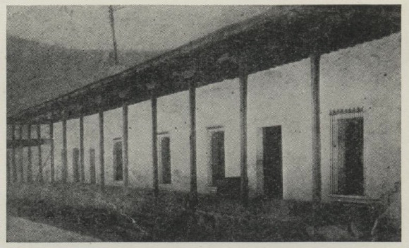
General & Historic
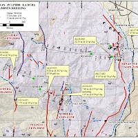
Europa Guadalupe Vein Zone
Promontorio, Quintera, Travesia Vein Zones
Minas Nuevas Vein Zone
Pulpito, San Jose, and Cotera Vein Zones
-
Historic
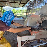
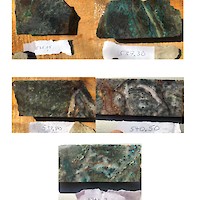
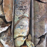
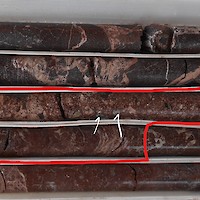
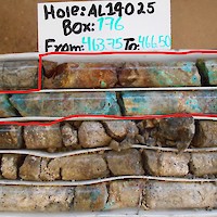
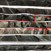
Drilling & Core
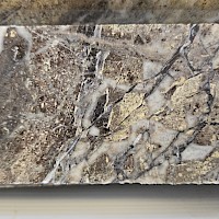
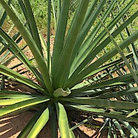
Geology
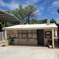
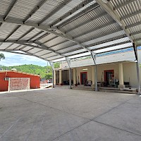
Infrastructure
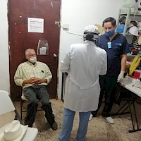
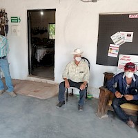
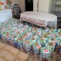
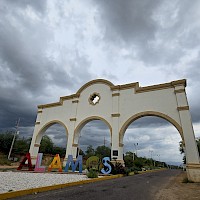
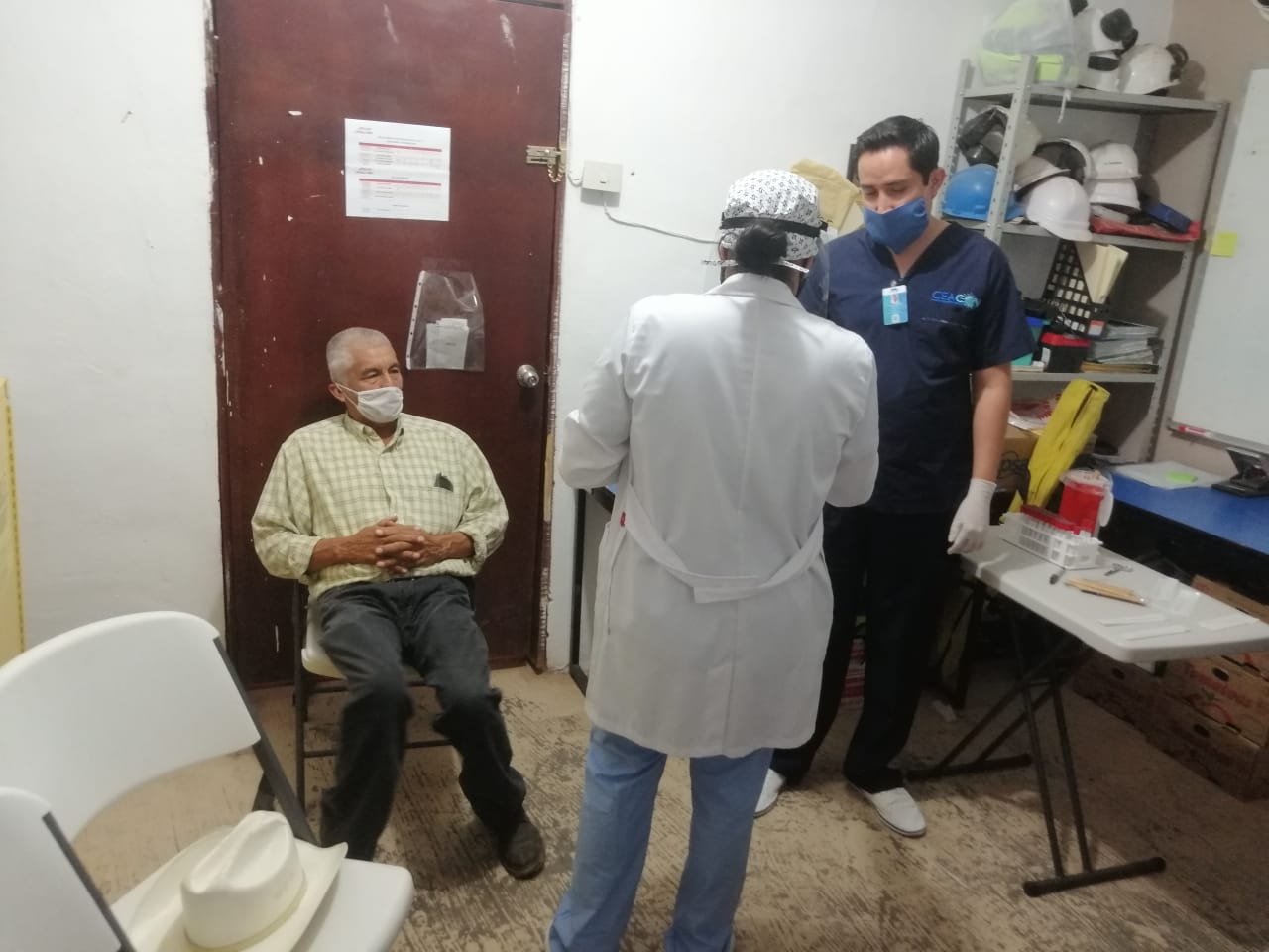
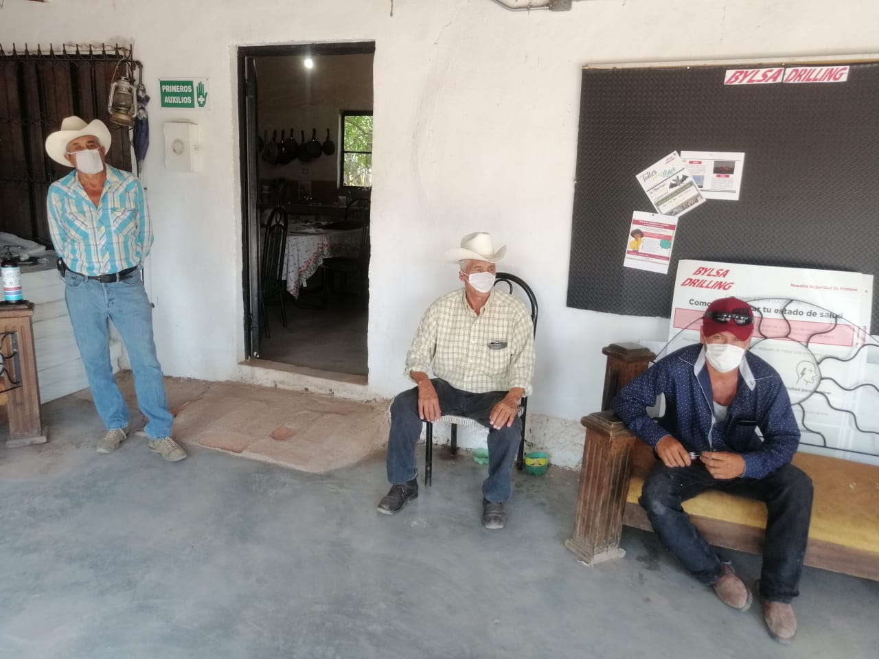
Community & Environmental
-
PDAC 2026 - Minaurum Silver Core Talk with Stephen Maynard, VP Exploration
PDAC 2026 - Minaurum Silver Core Talk with Ruben Molina, Project Manager, Alamos Silver Project
PDAC 2026 - Minaurum Silver Core Talk with Paola Portela, Modelling Geologist
Alamos Silver Project Initial Resource Estimate Webinar
Interview with Ruben Molina, Project Manager for Alamos Silver Project
PDAC 2025 - Minaurum Gold Coreshack Talk - Part I
PDAC 2025 - Minaurum Gold Coreshack Talk - Part II
PDAC 2025 - Minaurum Gold Coreshack Talk - Part III
Alamos Silver Project - Infrastructure
Promontorio Mine Rehabilitation Program, Alamos Silver Project, Sonora, Mexico
Alamos Phase II Drill Program Presentation with Steve Maynard, VP Exploration
PDAC 2020 Core Shack with Stephen Maynard, VP Exploration, Minaurum Gold Inc.
PDAC 2020 Core Shack with Dr. Peter Megaw, Co-founder & Director, Minaurum Gold Inc.
Webcast on Historical Data and Exploration Update at the Alamos Silver Project
Dr. Peter Megaw, Minaurum Gold Inc. - "Proof of Concept at the Alamos Silver Project"
Stephen Maynard, Minaurum Gold Inc. - "More Drill Core from the Alamos Silver Project"
Dr. Peter Megaw, Co-founder & Director of Minaurum Gold Inc. - "The Alamos Silver Project"
Dr. Peter Megaw, Minaurum Gold Inc. - "Drill Core from the Alamos Silver Project"
ESG Focus Series - Bat Colony Education
| Project | Alamos |
| Commodity | Primary: Silver Secondary: Gold, Copper, Lead, Zinc |
| Location | Southern Sonora |
| Nearest City | 8 km west of city of Alamos |
| Nearest Major Mining Projects | 45 km northwest of Pan American's Alamo Dorado silver mine 15 km south of Cobre Del Mayo's Piedras Verdes copper mine |
| Drilling |
Initial Inferred Resource Estimate: 55 Moz AgEq grading 320 g/t AgEq Phase II - 50,000 m resource expansion drill program planned for updated resource in second half of 2026 |
| Geology | Epithermal vein system |
| Land Package | 37,928 has |
| Exploration Highlights |
Hole AL 17-007 Hole AL 24-117 Hole AL 17-004 5.60 m of 368 g/t AqEq, 200 g/t Ag, 0.48 g/t Au, 0.35% Cu, 1.46% Pb, 1.64% Zn Hole AL24-111 Hole AL 20-042 Hole AL 20-046 Hole AL 20-047 Hole AL21-099 |
| Access & Infrastructure | Paved and gravel roads, mining labour force, power and water. Permitted through to construction allowing surface exploration and mining production activities. |
| Project Interest | 100% Owned |
Project
The 100% owned Alamos silver project has a unique advantage as the only recent permitted silver discovery in Mexico an Environmental Impact Statement ("MIA”) for the development allowing for surface exploration and mining production activities, including the construction of drill pads, clean-up of preexisting roads, and the rehabilitation and reactivation of historical underground mine workings. Alamos hosts excellent infrastructure with the central area (Quintera-Promontorio vein zones) permitted from exploration through to production. The project lies 8 km west of the city of Alamos, 45km northwest of Pan American's Alamo Dorado silver mine, and 15 km south of Cobre Del Mayo's Piedras Verdes copper mine. The project is 37,928 hectares.
Alamos hosts an initial inferred resource estimate of 55 million ounces silver equivalent grading 320 g/t silver equivalent (see Minaurum news release dated January 28, 2026 and Resource section above).
Minaurum has drilled 149 diamond core holes totaling 55,000 m on 19 of the 26 vein zones discovered at the Alamos silver project from 2017 - 2025.
A Phase II - 50,000 m resource expansion drill program is currently underway and targeting an updated resource in second half of 2026.
Opportunity
The 100% owned Alamos Silver Project controlling over 37,000 hectares is located in Sonora, Mexico and presents a unique opportunity in that it is permitted for production with an initial inferred resource estimate of 55 million ounces AgEq grading 320 g/t AgEq (see Minaurum news release dated January 28, 2026 and Resource section above). Cobre del Mayo’s Piedras Verdes porphyry copper mine lies about 16 km to the NNE of the central part of the Alamos district, along the projection of the main fault trend.
The project is permitted for production with an Environmental Impact Statement ("MIA”) permit granted by the Mexican Federal Environmental Authority ("SEMARNAT"). The permit allows for surface exploration and mining production activities, including the construction of drill pads, clean-up of preexisting roads, and the rehabilitation and reactivation of historical underground mine workings. Please see news release dated June, 26, 2023. Alamos’ mining permit was granted on December 13, 2013 and is valid for a period of 30 years starting on the date of the notice of commencement of Minaurum’s exploration activities to SEMARNAT, the National Commission for Protection of Natural Areas (CONANP), and the Federal Attorney for Environmental Protection (PROFEPA), which occurred on October 18, 2016.
Geology & History
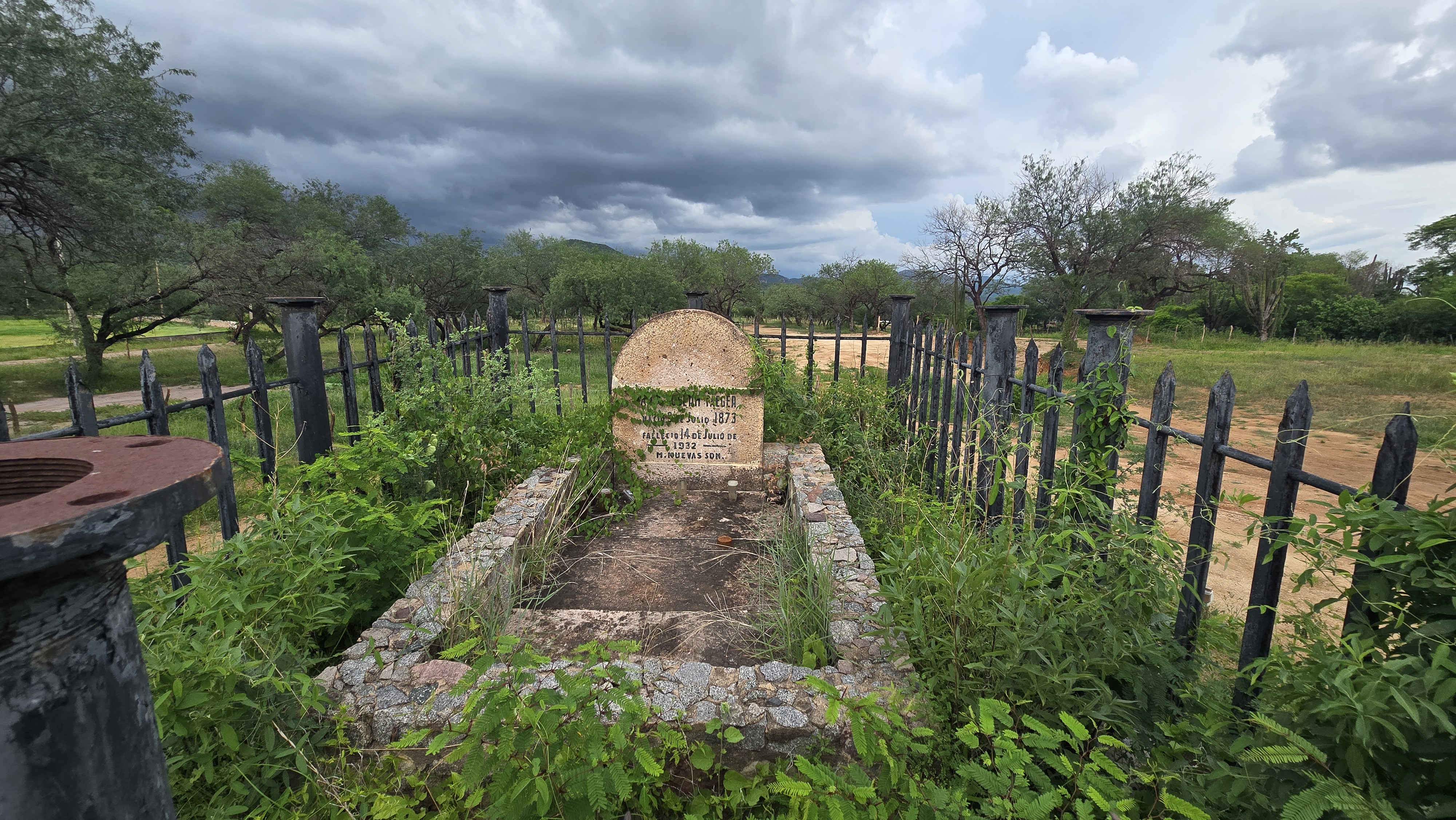
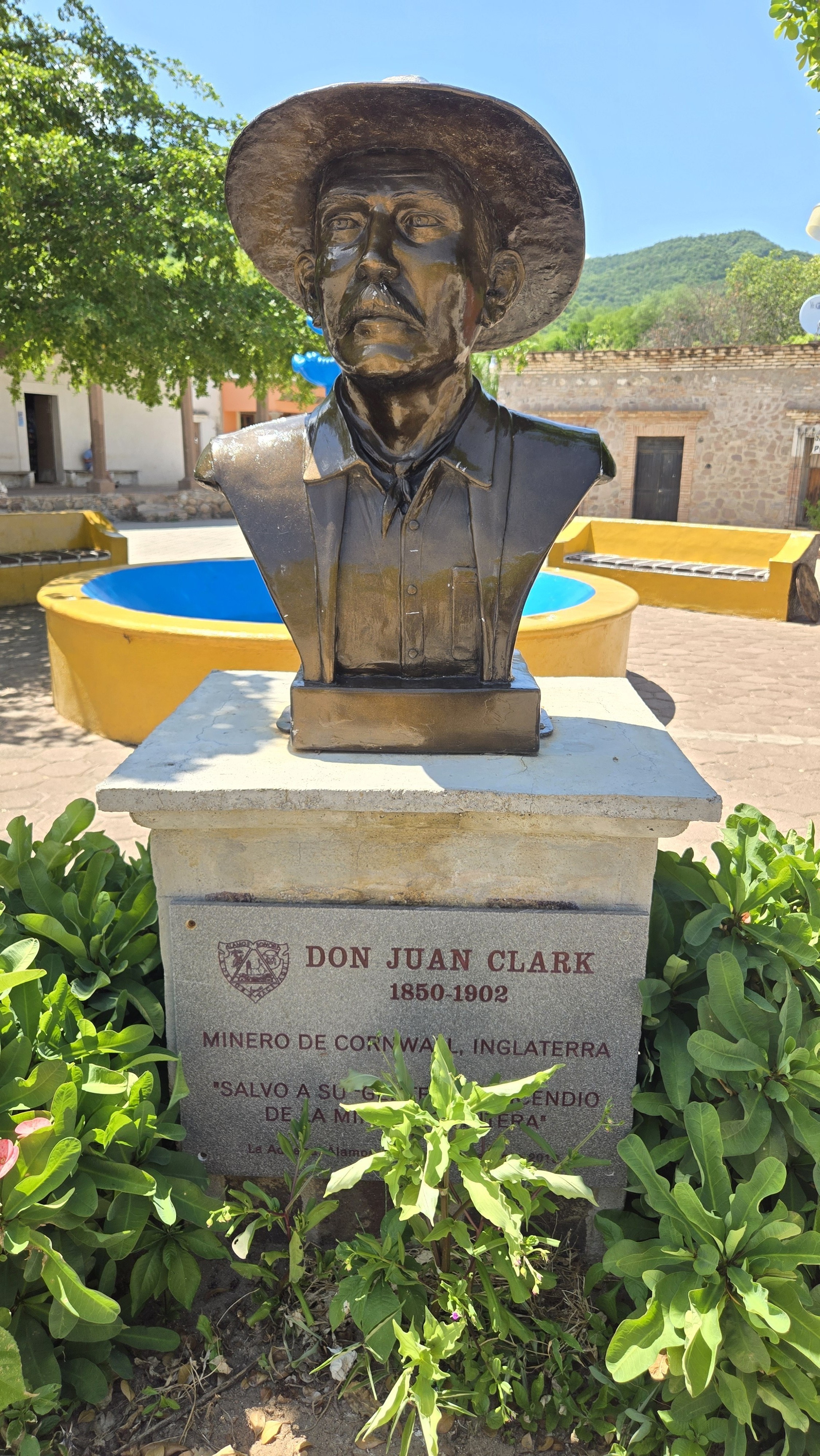
It contains a wide, high-grade epithermal vein system that produced approximately 200 Moz of silver from the time of the first Spanish discovery around 1682 to the 1910-1920 Mexican Revolution from three separate mines. Historical reports indicate mine widths of up to 20m grading in excess of 2,000 g/t silver and 3-4% copper. In the latter part of the 19th century, silver production from the district supported a mint in the nearby town of Alamos. Mining activities diminished just before and during the 1910-1920 Mexican Revolution, with the Zambona mine shutting down by 1925. Various operators attempted to revive the mines during the 20th century, but with only minor production, mostly from the re-working of mine dumps (see 43-101 Technical Report titled Alamos Project - June 8, 2021 on SEDAR).
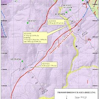
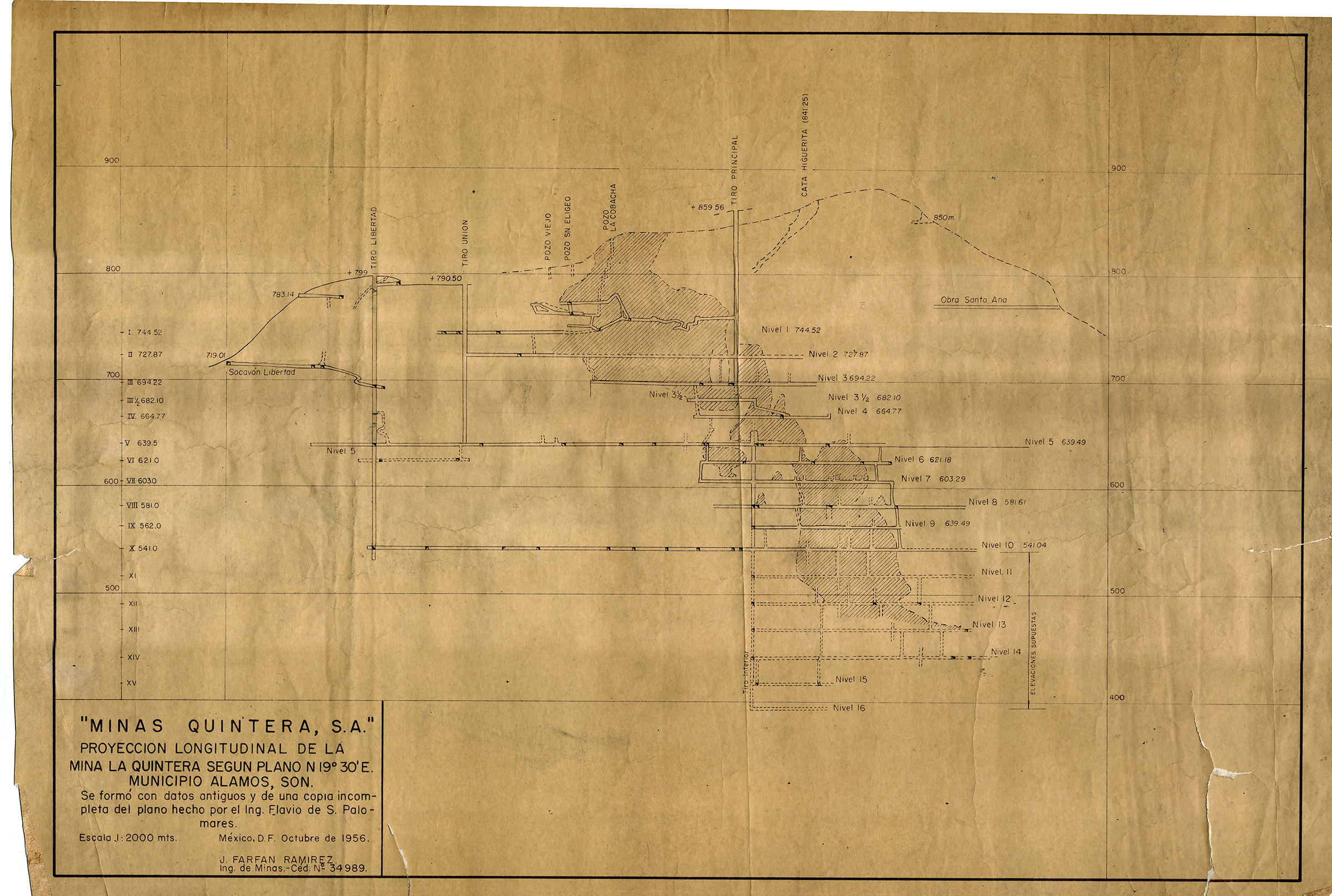
Minaurum acquired historical data including mine maps, sections and assay results of 40 holes (6,099 m) drilled in multiple surface and underground exploration campaigns that occurred from the 1960s through the early 1980s. The exploration programs were focused on the historic Promontorio and Minas Nuevas underground mines that closed in 1898 and 1912, respectively. The majority of these historical holes cut broad widths of high-grade silver, the best include: Hole U-3 that cut 4.6 m grading 2,838 g/t silver and Hole U-5 that cut 11.3 m of 785 g/t silver. The drill results indicate that the historically mined deposits included multiple veins that continue both down plunge and along-strike. At Promontorio, drill holes intersected mineralization over 50 m below the historic mining level and indicate an aggregate 735 m strike length of mineralization. (please see News Release February 6, 2020).
Drill highlights from the Historical Drilling Data at the Promontorio mine include: (only silver and gold were assayed – widths are reported drill thickness)
- 1.2 m of 5,588 g/t Ag (Hole U-1)
- 1.2 m of 1,008 g/t Ag (Hole U -1)
- 4.6 m of 2,838 g/t Ag (Hole U-3)
- 4.6 m of 305 g/t Ag (Hole U-4)
- 1.4 m of 377 g/t Ag (Hole U-4)
- 12.2 m of 710 g/t Ag (Hole U-4)
- 7.6 m of 747 g/t Ag (Hole U-5)
- 11.3 m of 785 g/t Ag (Hole U-5)
- 1 m of 2,177 g/t Ag (Hole U-12)
- 1.2 m of 854 g/t Ag (Hole U-15)
Drill highlights from the historical drilling data at the Minas Nuevas mine include: (only silver was assayed – widths are reported drill thickness)
- 1.7 m of 452 g/t Ag (Hole TP-80-08)
- 2 m of 367 g/t Ag (Hole TP-80-09)
- 1.8 m of 839 g/t Ag (Hole TZ-80-01)
Exploration
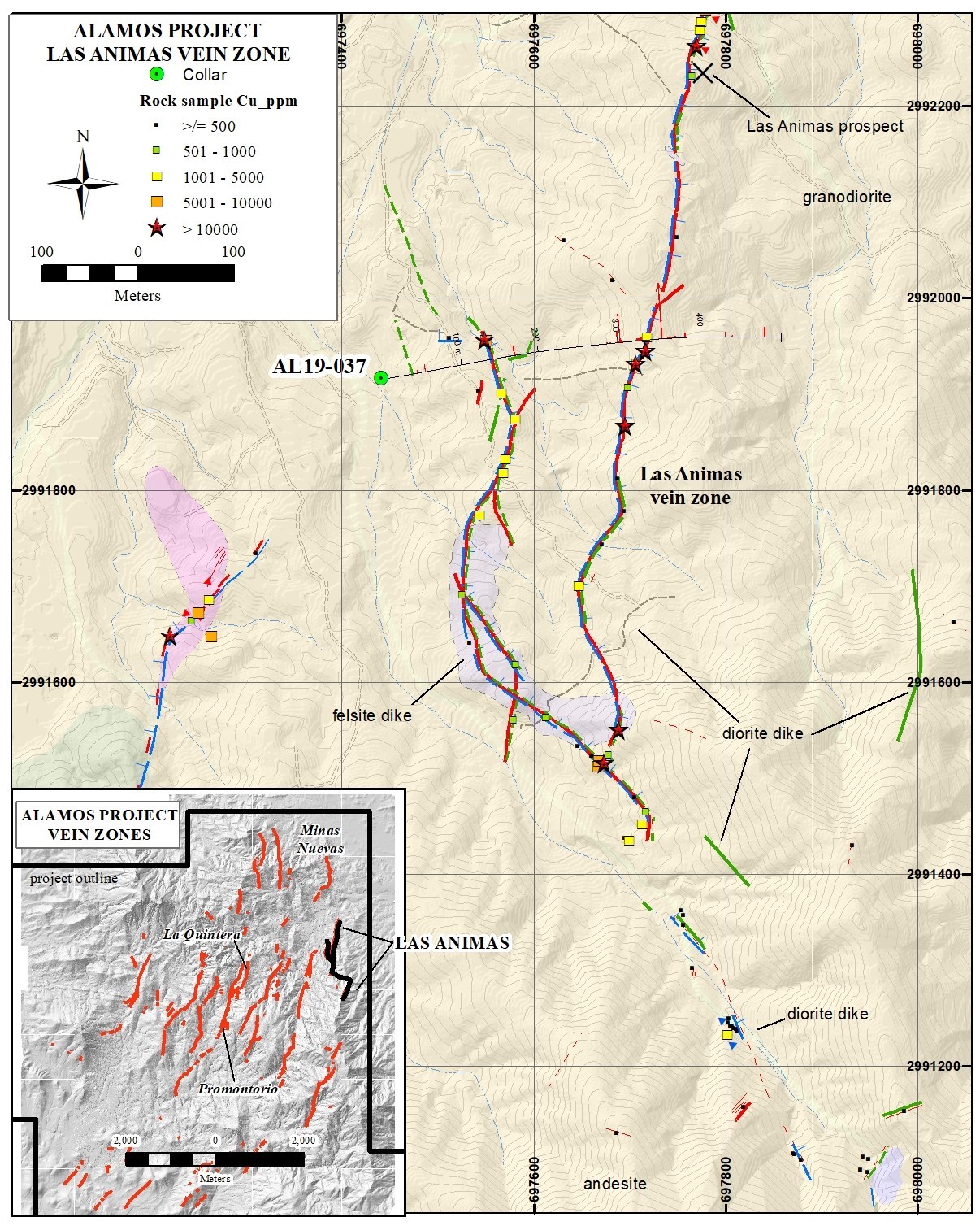
Minaurum geologists have covered more than 75 sq km with detailed geological mapping, and the geochemical database has more than 1500 rock samples with over 60,000 m of core drilling in 178 holes resulting in the identification of 26 vein zones in the Alamos district.
The 26 vein zones are spread across a mineral footprint measuring 11 km by 6 km with drilling so far testing 19 of the vein zones. Thirteen of the nineteen vein zones drilled returned high-grade silver intercepts demonstrating that mineralization occurs throughout the vein system. Only 15% of the total concession package has been explored so far with 85% with signficiant potential.
Minaurum currently has a 50,000 m resource expansion drill program to expand the initial inferred resource estimate.
August 2016: 3 Vein Zones Now: 26+ Vein Zones
Drill Results Highlights
| Drill Results | ||
|---|---|---|
| Vein System | Known Strike Length (m) | Best Drill Intercept |
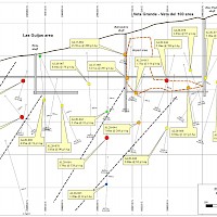
| Minas Nuevas | 1500 | 9.90 m @ 609 g/t Ag; incl. 0.90 m @ 1,145 g/t Ag, 0.50 m @ 2,260 g/t Ag, and 0.50 m @ 2,360 g/t Ag (Hole AL21-099) |
| Europa-Guadalupe | 2500 |
6.35 m of 356 g/t Ag, 0.39% Cu, 0.42% Pb, 0.57% Zn incl. 0.70 m of 2090 g/t Ag, 1.98% Cu, 2.51% Pb, 2.43% Zn (AL20-047) 3.50 m of 404 g/t Ag, 0.54% Cu, 1.30% Pb, 1.81% Zn incl. 1.15 m of 999 g/t Ag, 1.29% Cu, 2.98% Pb, 4.15% Zn (AL20-042) 3.85 m @ 342 g/t Ag, 0.76% Cu, 1.03% Zn; including 0.80 m @ 1,185 g/t Ag, 2.19% Cu, 1.2% Zn (AL20-054) 3.25 m @ 196 g/t Ag, 178 ppb Au, 0.26% Cu, 0.35% Pb, 1.10% Zn including 0.55 m @ 784 g/t Ag, 552 ppb Au, 1.05% Cu, and 2.49% Zn (AL20-050) |
| Promontorio | 1200 |
5.1 m of 769 g/t Ag, 0.76% Cu; incl. 3.1 m of 1,197 g/t Ag, 1.04% Cu (AL20-046) 3.70 m @ 528 g/t Ag, 819 ppb Au, 0.83% Cu, 2.43% Pb, 1.47% Zn, including 1.05 m @ 1,203 g/t Ag, 2.45 g/t Au, 1.42% Cu, 5.08% Pb, 2.80% Zn (AL20-064) 4.00 m @ 161 g/t Ag, 0.5 g/t Au, 0.24% Cu, 2.15% Pb, 5.92% Zn, including 1.00 m @ 327 g/t Ag, 0.9 g/t Au, 0.23% Cu, 2.53% Pb, 6.62% Zn (AL20-069) |
| Nueva Europa | 2100 | 1.20 m @ 542 g/t Ag, 0.28% Cu, 0.44% Pb, 0.88% Zn (AL17-007) |
| Amalia | 980 |
1.30 m @ 1.73% Pb, 1.99% Zn (AL18-012)
|
| San Jose | 2500 |
9.60 m @ 198 g/t Ag, 0.22% Pb, 0.88 % Zn (AL18-015) 4.45 m @ 314 g/t Ag, 0.27% Cu, 0.19% Pb, 0.20% Zn (AL20-066) 2.15 m @ 460 g/t Ag, 0.15% Cu, 0.47% Pb, 0.85% Zn (AL20-075) |
| Tigre | 1000 | 0.90 m @ 391 g/t Ag, 0.42% Pb, 0.29% Zn (AL18-012) |
| Ana | 3400 | 2.85 m @ 25 g/t Ag, 2.29% Pb, 10.58% Zn (AL18-011) |
| Travesia | 880 | 9.60 m @ 88 g/t Ag, 0.24% Cu, 0.37% Pb, 0.33% Zn (AL17-008) |
| El Creston | 1900 | 0.20 m @ 20 g/t Ag, 0.85% Cu (AL18-014) |
| Europa Sur | 1000 | 0.95 m @ 425 g/t Ag, 0.32% Cu, 3.17% Pb 1.31% Zn, including 0.50-m @ 719 g/t Ag, 172 ppb Au, 0.57% Cu, 5.91% Pb, and 2.37% Zn (AL19-018) |
| Promontorio Sur | 1300 | 31.70 m mineralized zone containing 0.20m interval assaying 304 g/t Ag, 352 ppb Au, 1.41% Cu, 2.5% Pb, 3.36% Zn (AL19-020) |
| Azulacas | 400 | 12.25 m averaging 122 g/t Ag, 0.21% Cu and 1.37% Zn (AL19-023) |
| La Quintera | 1400 | 0.50 m of 124 g/t Ag, 0.26% Cu (AL19-017) |
| Cotera | 800 | 7.60 m @ 155 g/t Ag incl. 2.15 m @ 451 g/t Ag (AL19-035) |
| Alessandra | 1100 | 6.60 m @ 3.89% combined Cu, Pb, and Zn (AL19-038) |
| Pulpito | 1000 | 0.20 m @ 367 g/t Ag, 6.75 g/t Au, 1.35% Cu, 0.59% Pb, 0.56% Zn (AL 19-035) |
Robust Preliminary Metallurgical Testing Results
-
Confirms high-grade silver and gold recoveries, even with low-grade material exhibiting impressive recoveries from flotation
-
Six separate composites from Europa and Promontorio vein zones were tested
-
Silver recoveries ranged from 83.5% to 94.3% for 5 of the 6 core composites
-
Gold recoveries ranged from 68.9% to 96.5% in 5 composites with detectable gold
-
Two separate independent labs conducted the tests
See April 9, 2024 news release.
Maiden Resource
Alamos hosts an initial inferred resource estimate of 55 million ounces AgEq grading 320 g/t AgEq (see Minaurum news release dated January 28, 2026 and Resource section above) from just 3 of the 26 vein zones namely: Promontorio, Europa, and Travesia vein targets.
Resource Expansion Drill Program Results
Promontorio
Promontorio Vein Zone averages a width of mineralization of 5.4 m (weighted average), average grade of 170 g/t Ag, 0.4% Cu, 1% Pb, and 2% Zn, or 338 g/t AgEq. The most significant results include: AL24-105 that intersected 0.70 m of 2,976 g/t AgEq, AL24-107 that returned 5.60 m of 368 g/t AgEq and 2.55 m of 621 g/t AgEq and AL24-108 that returned 8.45 m of 336 g/t AgEq (See Minaurum news release dated September 19, 2024). Exceptional intercepts including: 3.00 m of 4,173 g/t AgEq (AL24-111); 6.35 m of 380 g/t AgEq (AL24-110); and 5.75 m of 189 g/t AgEq (AL24-112). Hole AL24-111 intersected a significant high-grade sub interval returning 1.55 m of 7,780 AgEq*, which includes 0.50 m of 13,995 g/t AgEq and 1.05 m of 4,839 g/t AgEq (See Minaurum news release dated February 13, 2025). A significantly wide intercept of 36.65 m of 328 g/t AgEq including 3.85 m of 1,022 g/t AgEq (AL24-117), 4.40 m of 241 g/t AgEq including 0.90 m of 385 g/t AgEq (AL24-115), and 4.95 m of 272 g/t AgEq including 0.90 m of 513 g/t AgEq (AL24-116), and further demonstrate the high-grade continuity (See Minaurum news release dated Febrary 27, 2025).
Hole AL25-138 intersected a significant wide zone of skarn/CRD lead- and zinc-sulfide mineralization including silver and gold values: 21.45 m of 220 g/t AgEq including 1.00 m of 497 g/t AgEq and 1.20 m of 1,377 g/t AgEq (440 g/t Ag, 1.499 g/t Au, 9.089% Pb, 18.783% Zn)

Europa
The Europa Vein Zone has an average width of mineralization at 3.1 m, and average grade of 358 g/t Ag, 0.5% Cu, 0.6% Pb, and 1.2% Zn, or 454 g/t AgEq. Significant mineralization was intersected in Hole AL25-135 which returned 5.85 m of 476 g/t AgEq including 0.70 m of 2,601 g/t AgEq (2,180 g/t Ag); and hole AL25-139 returned 2.40 m of 499 g/t AgEq including 0.50 m of 1,366 g/t AgEq (851 g/t Ag).

(Weight-averaged silver-equivalent grades are based on October 1, 2025 Long-term CIBC Global Mining Group Analyst Consensus Commodity Price Forecast: Ag $29.73/tr oz, Au $2,646/tr oz, Cu $4.34/lb, Pb $0.92/lb, Zn $1.21/lb).
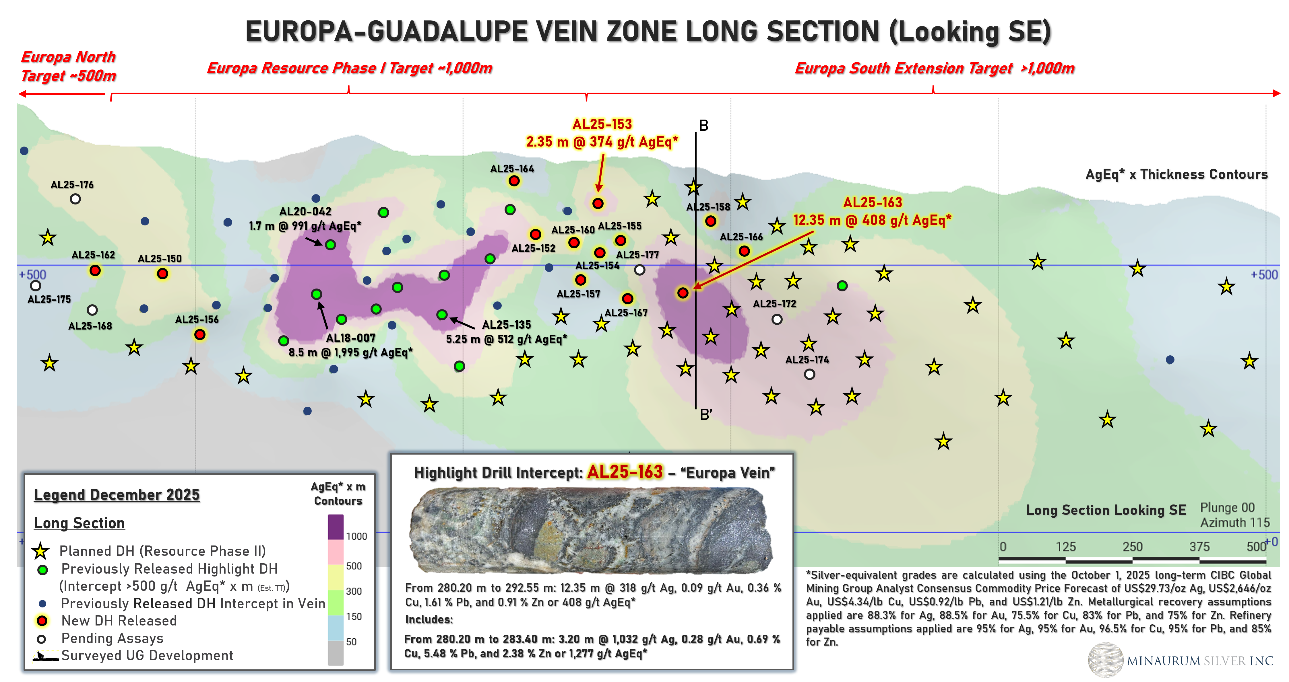
Minaurum extended the Europa vein zone by 250 meters in step-out hole that intersected a significant wide interval of 12.35 m zone averaging 408 g/t AgEq, including 3.20 m of 1,277 g/t AgEq (1,032 g/t Ag, 0.278 g/t Au, 0.692% Cu, 5.477% Pb, 2.379% Zn). Hole AL25-154 returned 1.05 m of 231 g/t AgEq, including 0.25 m of 700 g/t AgEq (355 g/t Ag, 1.86 g/t Au, 1.45% Cu, 0.77% Pb, 1.89% Zn). These holes confirms the continuity of high-grade silver mineralization well beyond the current inferred resource in the Europa Vein Zone.
Surface-Access Agreements
The Alamos project is situated on land belonging to the ejidos of La Aduana and Tetajiosa and the community of Minas Nuevas. Surface-access agreements are in place with all three along with annual rental payments to maintain the agreements.
Part of the Alamos project lies within the Sierra de Alamos – Río Cuchujaqui Reserve, which overlaps ejido lands. Authorization was received from the National Commission of Natural Protected Areas (CONANP) to explore in the Reserve Area. The reserve area land inside the project area is categorized as an “area of sustainable exploitation of natural resources”, which is defined in the reserve area management plan as use that does not negatively affect future generations. A coordination agreement between the Protected Area authorities and SEMARNAT was established in July of 2013 and is valid for the life of the project.
Please refer to the 43-101 Technical Report Alamos Project - June 8, 2021 and 43-101 Technical Report Mineral Resource Estimate February 17, 2026 on SEDAR
Alamos Silver Project – Inferred Mineral Resource Estimate Summary (150 g/t AgEq cut-off)
Notes:
- The Mineral Resource estimate conforms to the requirements of NI 43-101 – Standards of Disclosure for Mineral Projects and the CIM Definition Standards for Mineral Resources and Mineral Reserves (2014). The Mineral Resource estimate is entirely classified as Inferred Mineral Resources. Inferred Mineral Resources have been estimated from geological evidence and limited sampling and have a lower level of confidence than Measured and Indicated Mineral Resources and must not be converted to Mineral Reserves. There is no certainty that Inferred Mineral Resources will be converted to Measured or Indicated Mineral Resources.
- Weight-averaged silver-equivalent (“AgEq”) grades are based on the October 1, 2025 long-term CIBC Global Mining Group Analyst Consensus Commodity Price Forecast, using metal prices of US$29.73/oz Ag, US$2,646/oz Au, US$4.34/lb Cu, US$0.92/lb Pb, and US$1.21/lb Zn. Metal recovery assumptions, based on comparable projects, are 88.3% Ag, 75.0% Au, 75.5% Cu, 83.1% Pb, and 75.5% Zn. Assumed refinery payables are 95% Ag, 95% Au, 96.5% Cu, 95% Pb, and 85% Zn.
- The Mineral Resource is reported at a cut-off grade of 150 g/t AgEq.
- Bulk density values applied are 2.72 t/m³ for the Promontorio and Travesía zone veins and 2.65 t/m³ for the Europa zone veins.
- The Mineral Resource estimate is reported on a 100% project basis and reflects reasonable prospects for eventual economic extraction.
- The effective date of the Mineral Resource estimate is January 8, 2026.
- There are no known legal, political, environmental, or other risks that, to the knowledge of the Qualified Persons, could materially affect the potential development of the Mineral Resources.
- All figures are rounded to reflect the relative accuracy of the estimate. Totals may not sum exactly due to rounding.
Alamos Silver Project – Inferred Mineral Resource Estimate Sensitivity Table
The Resource Estimate, completed by Independent Mining Consultants, Inc., is based on a total database of 104 drill holes, totaling 35,888.15 metres and 10,194 samples. The Resource Estimate is classified as an Inferred Mineral Resource in accordance with CIM Definition Standards, with an effective date of January 8, 2026.
Drill hole spacing within the modeled vein domains averages approximately 80 metres, with locally tighter spacing in higher-grade portions of the Promontorio vein zone. Most of the resource occurs in unmined zones, with partially mined-out areas in the Promontorio vein zone. Interpreted void volumes associated with historical mining have been deducted from the Resource Estimate based on interpretations of historical longitudinal sections, mine maps, and drill hole data. The resource remains open in along strike and down dip on both the Promontorio and Europa vein zones. Multiple other veins in the district have high-grade intercepts that await potential resource definition.
The Alamos Project Resource Estimate is based on the following key assumptions and parameters: specific gravity values of 2.72 for the Promontorio and Travesia veins and 2.63 for the Europa vein, derived from Minaurum’s test work based on 151 wax-coated density measurements; vein domains were modelled to reflect the interpreted vein geology, including vein continuity, thickness, and structural controls; all assays were composited to 1 metre, and grade capping was applied on a vein-by-vein basis, with silver grades capped at up to 3,000 g/t; a 5 m along strike × 1 m across strike × 2.5 m high block size was selected based on geological constraints and potential future mining methods; and block grades for gold, silver, copper, lead, and zinc were estimated using inverse distance squared interpolation; mineral resources were classified as Inferred in accordance with CIM Definition Standards, based on geological confidence, drill hole spacing, sample support, and search criteria. Additional details of the estimation methodology and classification criteria will be provided in the supporting technical report to be filed on the Company’s profile on SEDAR+. A technical report prepared by IMC in accordance with NI 43-101 will be filed on the Company’s profile at www.sedarplus.ca within 45 days of the date of this press release.
Figure 1. Alamos Silver Project Vein Zones – 55.2 Moz AgEq grading 320 g/t AgEq lies on Promontorio, Travesia, and Europa vein zones located within the black boxed outlines.
Figure 2. Travesia-Promontorio vein zone longitudinal section. Dotted line indicates the outline of the geological model used in calculating resources. This vein zone comprises 28.7 Moz AgEq grading 276 g/t AgEq.
Figure 3. Europa vein zone longitudinal section. Dotted line indicates the outline of the geological model used in calculating resources. This vein zone comprises 26.5 Moz AgEq grading 386 g/t AgEq.


