Aurifero
Project
Aurifero
Commodity
Gold, Silver
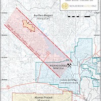
Location
Navajoa, Sonora
Nearest City
35 km Northwest of the Alamos Silver Project
Nearest Major Mining Projects
15 km Northwest of Cobre Del Mayo's Piedras Verdes copper mine
Drilling
Drill permits submitted
Geology
Epithermal vein system
Land Package
1,348 has
Exploration Highlights
Hole DMDDH-01
3.1 m of 18.37 g/t Au
Hole 07-MN-10
24.5 m of 3.12 g/t Au
Hole CI-35
48 m of 1.47 g/t Au
Hole CI-09
58 m of 3.65 g/t Au
Hole CI-34
24 m of 2.42 g/t Au
Access & Infrastructure
Paved and gravel roads, mining labour force, power and water
Project Interest
Under option to acquire 100% interest
Project
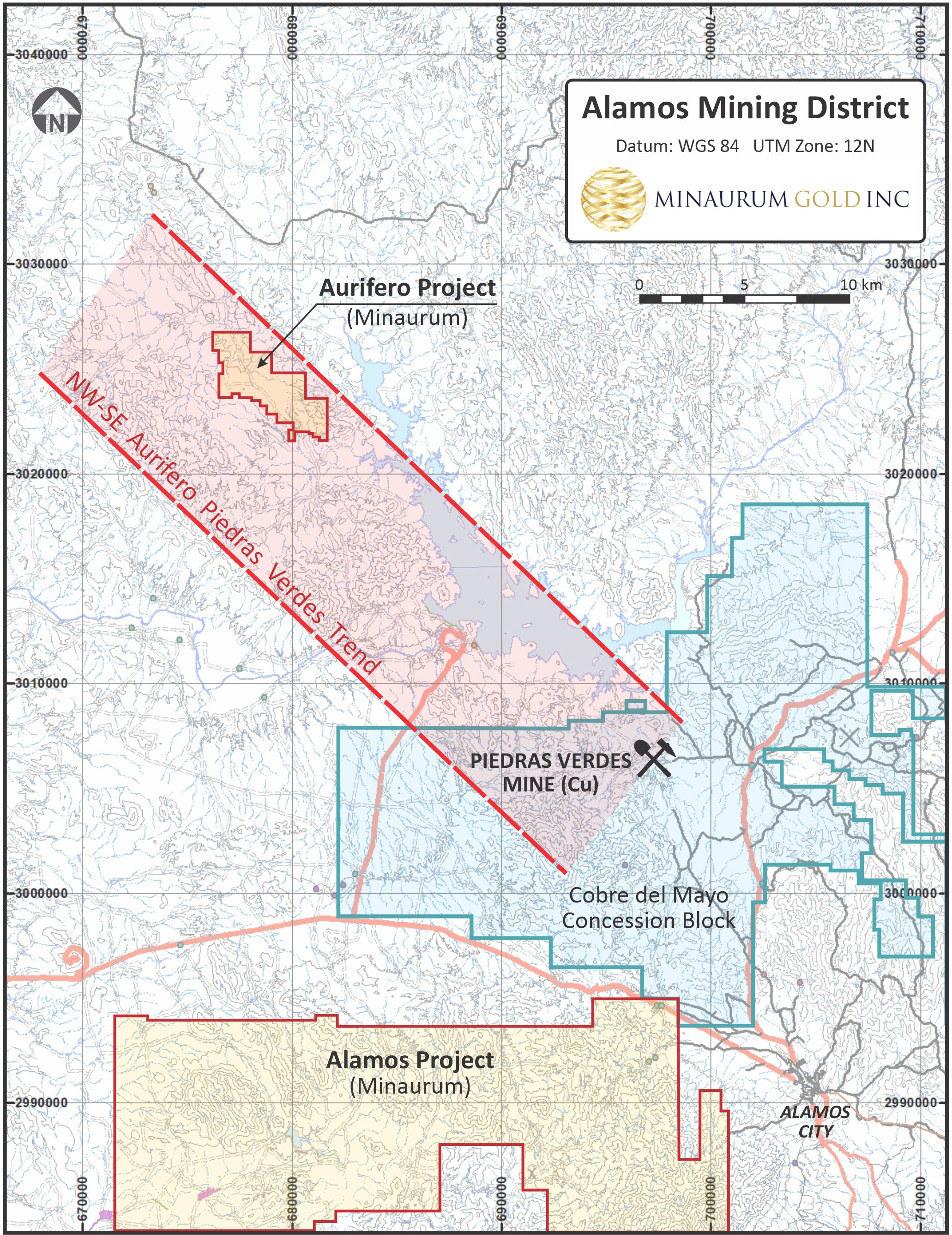
The Aurifero gold project contains a swarm of gold- and silver-bearing epithermal veins within a NW/SE-trending zone measuring 3 km long and more than 400 m wide.
A NW-SE trend of structurally controlled ridges and valleys extending from northwest of Aurifero project to the east-southeast of the Piedras Verdes porphyry copper deposit. Gold mineralization in the Aurífero project area is associated with NW-SE fracture zones, veins, and rhyolite dikes, cutting intermediate to felsic tuffs. Quartz-eye rhyolite dikes and strong argillic alteration in a number of the shallow underground workings suggest that mining has been limited to the uppermost levels of a mineralized epithermal system. Aurifero mineralization appears to be spatially and temporally related to the emplacement of fine-grained felsic intrusions (dikes and small stocks), the nature and extent of which were not clearly identified in historical work.
The project has seen numerous campaigns of shallow reverse circulation and core drilling since the 1980s totaling over 8,000 metres. Holes were on average less than 100 m deep; the deepest reaching a vertical depth of 135 m from surface.
The project is 35 km northwest of the Alamos silver project, and 15 km northwest of Cobre Del Mayo's Piedras Verdes copper mine. The total size of the project is 1,229 hectares.
Project terms include completing cash payments of CDN $2,686,000 over 96 months.
The project has seen numerous campaigns of shallow reverse circulation and core drilling since the 1980s totaling over 8,000 metres. Holes were on average less than 100 m deep; the deepest reaching a vertical depth of 135 m from surface. Please see Minaurum news release dated January 29, 2020. Stephen R. Maynard, Vice President of Exploration of Minaurum and a Qualified Person as defined by National Instrument 43-101, acuracy of the historical drilling data reported has not been verified.
Drill program to test at depth targets has been designed and drill permits have been submitted. Work continues to consolidate the district.
Historical drilling highlights, Aurífero project. Minera Terrazas and Pershimco performed diamond (core) drilling; Peñoles used a reverse-circulation drill.
Company
Hole
From (m)
To (m)
Interval (m)
Ag (g/t)
Au (g/t)
Peñoles
CI-09
40.00
98.00
58.00
3.65
CI-22
6.00
48.00
42.00
1.7
CI-34
54.00
78.00
24.00
2.42
CI-35
36.00
84.00
48.00
1.47
Minera Terrazas
DMDDH-01
85.65
93.25
7.60
5
7.97
including
90.15
93.25
3.10
8
18.37
NDDH-02
3.35
6.50
3.15
28
1.25
8.50
23.65
15.15
14
0.92
32.55
35.55
3.00
2
0.99
NDDH-07
17.90
22.25
4.35
57
2.56
70.15
94.55
24.40
5
0.67
SFDDH-01
54.00
62.00
8.00
1
1.79
76.70
82.70
6.00
2
2.48
Pershimco
07-MN-02
82.00
93.80
11.80
3.7
2.9
98.00
101.00
3.00
11.4
3.68
140.00
143.00
3.00
39
1.86
151.90
159.00
7.10
3.3
2.15
07-MN-03
146.00
149.00
3.00
10.15
2.94
07-MN-04
141.90
143.40
1.50
2.8
2.35
07-MN-07
42.20
44.80
2.60
158
trace
07-MN-09
47.70
53.90
6.20
26.2
2.24
61.00
63.40
2.40
86.3
3.7
07-MN-10
51.70
76.20
24.50
43.8
3.12
including
52.50
53.50
1.00
273.5
26.07
and
60.00
61.20
1.20
63.6
9.56
and
69.80
70.80
1.00
189.5
6.98
Drill Results Hole Data
Hole
Company
Year
Method
zone
WGS 84, Zone 12N
elev
Az
inc
m
UTM_E
UTM_N
CI-09
Peñoles
1986
RVC
San Francisco
679989
3022569
206
30
-60
100
CI-34
Peñoles
1986
RVC
San Francisco
679966
3022573
210
30
-60
100
CI-35
Peñoles
1986
RVC
San Francisco
680062
3022604
195
210
-60
100
DMDDH-01
Terrazas
2014
DDH
Dios Mediante
680481
3022363
219
230
-50
128.2
-
| Project | Aurifero |
| Commodity | Gold, Silver |
| Location | Navajoa, Sonora |
| Nearest City | 35 km Northwest of the Alamos Silver Project |
| Nearest Major Mining Projects | 15 km Northwest of Cobre Del Mayo's Piedras Verdes copper mine |
| Drilling | Drill permits submitted |
| Geology | Epithermal vein system |
| Land Package | 1,348 has |
| Exploration Highlights |
Hole DMDDH-01 48 m of 1.47 g/t Au Hole CI-09 Hole CI-34 |
| Access & Infrastructure | Paved and gravel roads, mining labour force, power and water |
| Project Interest | Under option to acquire 100% interest |
Project
The Aurifero gold project contains a swarm of gold- and silver-bearing epithermal veins within a NW/SE-trending zone measuring 3 km long and more than 400 m wide.
A NW-SE trend of structurally controlled ridges and valleys extending from northwest of Aurifero project to the east-southeast of the Piedras Verdes porphyry copper deposit. Gold mineralization in the Aurífero project area is associated with NW-SE fracture zones, veins, and rhyolite dikes, cutting intermediate to felsic tuffs. Quartz-eye rhyolite dikes and strong argillic alteration in a number of the shallow underground workings suggest that mining has been limited to the uppermost levels of a mineralized epithermal system. Aurifero mineralization appears to be spatially and temporally related to the emplacement of fine-grained felsic intrusions (dikes and small stocks), the nature and extent of which were not clearly identified in historical work.
The project has seen numerous campaigns of shallow reverse circulation and core drilling since the 1980s totaling over 8,000 metres. Holes were on average less than 100 m deep; the deepest reaching a vertical depth of 135 m from surface.
The project is 35 km northwest of the Alamos silver project, and 15 km northwest of Cobre Del Mayo's Piedras Verdes copper mine. The total size of the project is 1,229 hectares.
Project terms include completing cash payments of CDN $2,686,000 over 96 months.
The project has seen numerous campaigns of shallow reverse circulation and core drilling since the 1980s totaling over 8,000 metres. Holes were on average less than 100 m deep; the deepest reaching a vertical depth of 135 m from surface. Please see Minaurum news release dated January 29, 2020. Stephen R. Maynard, Vice President of Exploration of Minaurum and a Qualified Person as defined by National Instrument 43-101, acuracy of the historical drilling data reported has not been verified.
Drill program to test at depth targets has been designed and drill permits have been submitted. Work continues to consolidate the district.
Historical drilling highlights, Aurífero project. Minera Terrazas and Pershimco performed diamond (core) drilling; Peñoles used a reverse-circulation drill.
| Company | Hole | From (m) | To (m) | Interval (m) | Ag (g/t) | Au (g/t) |
|---|---|---|---|---|---|---|
|
Peñoles |
CI-09 |
40.00 |
98.00 |
58.00 |
|
3.65 |
|
CI-22 |
6.00 |
48.00 |
42.00 |
|
1.7 |
|
|
CI-34 |
54.00 |
78.00 |
24.00 |
|
2.42 |
|
|
CI-35 |
36.00 |
84.00 |
48.00 |
|
1.47 |
|
|
Minera Terrazas |
DMDDH-01 |
85.65 |
93.25 |
7.60 |
5 |
7.97 |
|
including |
||||||
|
90.15 |
93.25 |
3.10 |
8 |
18.37 |
||
|
NDDH-02 |
3.35 |
6.50 |
3.15 |
28 |
1.25 |
|
|
8.50 |
23.65 |
15.15 |
14 |
0.92 |
||
|
32.55 |
35.55 |
3.00 |
2 |
0.99 |
||
|
NDDH-07 |
17.90 |
22.25 |
4.35 |
57 |
2.56 |
|
|
70.15 |
94.55 |
24.40 |
5 |
0.67 |
||
|
SFDDH-01 |
54.00 |
62.00 |
8.00 |
1 |
1.79 |
|
|
76.70 |
82.70 |
6.00 |
2 |
2.48 |
||
|
Pershimco |
07-MN-02 |
82.00 |
93.80 |
11.80 |
3.7 |
2.9 |
|
98.00 |
101.00 |
3.00 |
11.4 |
3.68 |
||
|
140.00 |
143.00 |
3.00 |
39 |
1.86 |
||
|
151.90 |
159.00 |
7.10 |
3.3 |
2.15 |
||
|
07-MN-03 |
146.00 |
149.00 |
3.00 |
10.15 |
2.94 |
|
|
07-MN-04 |
141.90 |
143.40 |
1.50 |
2.8 |
2.35 |
|
|
07-MN-07 |
42.20 |
44.80 |
2.60 |
158 |
trace |
|
|
07-MN-09 |
47.70 |
53.90 |
6.20 |
26.2 |
2.24 |
|
|
61.00 |
63.40 |
2.40 |
86.3 |
3.7 |
||
|
07-MN-10 |
51.70 |
76.20 |
24.50 |
43.8 |
3.12 |
|
|
including |
||||||
|
52.50 |
53.50 |
1.00 |
273.5 |
26.07 |
||
|
and |
||||||
|
60.00 |
61.20 |
1.20 |
63.6 |
9.56 |
||
|
and |
||||||
|
69.80 |
70.80 |
1.00 |
189.5 |
6.98 |
||
Drill Results Hole Data
| Hole | Company | Year | Method | zone | WGS 84, Zone 12N | elev | Az | inc | m | |
|---|---|---|---|---|---|---|---|---|---|---|
| UTM_E | UTM_N | |||||||||
| CI-09 | Peñoles | 1986 | RVC | San Francisco | 679989 | 3022569 | 206 | 30 | -60 | 100 |
| CI-34 | Peñoles | 1986 | RVC | San Francisco | 679966 | 3022573 | 210 | 30 | -60 | 100 |
| CI-35 | Peñoles | 1986 | RVC | San Francisco | 680062 | 3022604 | 195 | 210 | -60 | 100 |
| DMDDH-01 | Terrazas | 2014 | DDH | Dios Mediante | 680481 | 3022363 | 219 | 230 | -50 | 128.2 |